Aunque ya había subido al Castro Valnera cuatro veces, llevaba varios años con la intención de llegar desde Pandillo, más de 1000 metros por debajo de la cumbre. El problema estribaba en encontrar el día adecuado. Prefería una época del año con bastantes horas de luz, pero el calor me quita todas las ganas de caminar por montaña. Junto con estos dos condicionantes, no me apetecía coincidir con un día de niebla, como el que tuvimos la semana anterior por la Sierra de Sel. Total, que la incompatibilidad de un día propicio con mis días de asueto estaba convirtiendo la subida en un tema un poco obsesivo. Por añadidura, el desenterramiento del plan absurdo de construir un teleférico en la zona significaba que me quedaba menos tiempo para disfrutar de estos paisajes en su estado actual. Pero felizmente se alinearon los astros, además a las dos semanas de celebrar el kilómetro vertical por la misma zona, que me venía bien para ver fácilmente el camino que mejor convenía. Un día festivo en Santander, me levanté temprano para evitar las temperaturas más incómodas en la subida, y por fin, me puse en camino. Lo primero, cruzar este puente y seguir el sendero balizado hacia Praderas de Ruyemas. Even though I'd been up to Castro Valnera four times already, I'd been intent on walking up from Pandillo, almost 4000 feet below the summit, for several years. Finding a suitable day was not easy - I wanted there to be ample hours of daylight, but it tends to be too warm for my liking from late spring onwards. It was also important not to go on a foggy day, like last week's excursion. The incompatibility of finding a day with the right forecast that coincided with my days off was beginning to make this an obsessive walk on my "to-do" list. In addition, the resurrection of the absurd project to build a cable-car in the area meant I didn't have much time to enjoy the landscape in its present state. Ironically, Santander's local holiday "The Virgin of the Sea" gave me the opportunity to head for the mountains. It was also not long after the yearly Vertical Kilometre race so I'd have no problems choosing the path to take. I got up very early to avoid the higher temperatures while ascending, and off I set. The walk (I wasn't planning on running!) began by crossing this bridge.
Dejé el sendero y empecé a subir por una senda que apenas se veía entre la hierba. El rocío me dejó los pantalones y botas empapados.
I left the main path and began walking up through a meadow, with the dew on the tall grass meaning my trousers and boots were soon soaked.
Una mirada atrás hacia el valle. Arriba a la derecha se ve la arista por donde bajaría más tarde.
Looking back down into the valley - meanwhile, the top of the photo shows the ridge I would come down later in the day.


Conecté con el trazado del km vertical y comenzaba una serie de miradas hacia atrás, viendo como Pandillo quedaba cada vez más lejos.
I joined up with the Vertical km trail and each time I looked back Pandillo was farther away
 |
| Helguerón |
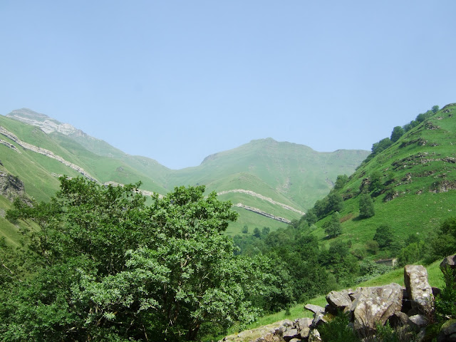
Una cosa que me ha gustado de esta ruta es que hasta llegar a las cabañas de Colina no ves la cima, así que ¡no te agobias al contemplar la distancia que te falta todavía!
One thing I liked about this walk is that until you get to the Colina stone huts you don't see the summit, so you don't get that feeling of literally "having a mountain to climb"!
Y ya se ha hecho la mitad de la subida así que cuando se me presentaron las montañas del macizo lo que sentía era admiración por la belleza del paisaje
And I'd already got half-way up, so when the second half came into view my feelings were of admiration for the beauty of the landscape
Dentro de unos tres horas estaría rodeando esta montaña
I'd be walking round the other side of this mountain in a couple of hours
 |
| La Capía |
Uno de los tramos más pindios de la subida
One of the steepest sections of the walk
Y una mirada hacia atrás, las cabañas de La Colina todavía visibles
Looking back, I can still see La Colina and the huts
Llego a la zona donde supongo estaba la meta del KV y veo delante de mí un viejo conocido
I come out onto where I guess the VKm finishing line would have been and see an old acquaintance in front of me |
| La Cubada Grande |
Ya estoy a la altura de la Capía. Se ve Peña del Cuervo detrás que sobresale algo más baja
I'm now level with the top of La Capía; you can see Peña del Cuervo jutting out behind it at a lower elevation
Continúo subiendo hasta la base de Los Dojos, y aparece Castro Valnera un poco más adelante, con ese aspecto de barco atracado en el muelle - bueno a mí me lo recuerda.
I carry on up to the foot of los Dojos, and Castro Valnera comes into view a bit further on, looking like a ship moored at the quayside - well that's what comes to my mind.
Desde la cima se ve La Colina delante, y más abajo Helguerón y se intuye Pandillo. La estribación más hacia la izquierda es por la que pretendo regresar
From the summit you can see la Colina in front of you, and further down Helguerón and way down to the right you can vaguely make out Pandillo. The ridge further to the left is the one I plan to return by.
Bajo en dirección a La Cubada Grande
I now descend to the south, towards La Cubada Grande
 |
| Los Dojos y Castro Valnera |
 |
| La Cubada Grande |
y voy bordeando la Capía
and skirt La Capía
 |
| Los Dojos y La Capía |
Hacia el oeste están las cabañas de El Rostro, que atravesaré para comenzar la siguiente parte del descenso
Below me to the west is a place called El Rostro, which I will cross in order to get onto the next part of the descent
Ya en El Rostro miro hacia donde saqué la foto anterior, Peña del Cuervo
Now in El Rostro I look back to where the last photo was taken, near Peña de Cuervo
Estoy ahora al lado del comienzo de la arista que lleva al caminante hacia el noroeste
And next comes the start of the ridge that leads north-west
Un mapa de la zona que tengo propone una travesía que arranca en las Estacas de Trueba (muy cerca) y prosigue por esta arista hasta Vega de Pas. Pienso seguirla un rato hasta pasar al valle de la derecha y volver a Pandillo
My plan was now to follow the ridge part of the way before crossing over to the valley on the right-hand side and returning to Pandillo
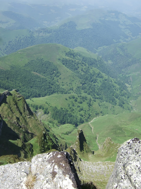
Abajo a la izquierda está la estación de Yera, donde supuestamente se instalará el teleférico. Creo que la idea es que millares de turistas acudan a la zona dispuestos a que les lleven al lugar donde ahora me encuentro (Muro de Peñallana).
Y así el turismo nos librará de los problemas económicos que padecemos. No soy adepto de esta secta que no ve más posibilidades que convertir el territorio en destino turístico de masas, convirtiendo Cantabria en un parque temático.
Down on the left-hand side is where the cable-car station is supposedly going to be built. I think the idea is that thousands of tourists will come to the area eager to be transported to where I'm now standing.
And so tourism will deliver us from our economic woes.
I don't subscribe to this trend in Spain that sees promoting mass tourism as the solution to our problems, turning Cantabria into a theme park along the way.
Pero vuelvo a la excursión... hay zonas en que hay que buscar una forma de bajar a la siguiente parte de la arista, al principio más al lado E y después al O
But back to the walk.... there are some spots where you have to make your way down to the right and later on to the left so avoid a sheer drop
Decido que es un buen momento para buscar un sendero que lleve a Pandillo y al bajar al collado de la siguiente imagen dejo la arista. Tendría que haber cogido directamente a la derecha pero me parecía tan atractiva la canal que sube paralela a la arista que la subí. Por desgracia la continuación, si hubiera existido alguna vez ya ha sido engullida por la vegetación. Tuve que rodear la peña a la derecha con sumo cuidado entre rocas y maleza.
When I reach the point that I've decided will enable me to get onto a path back to Pandillo I mistakenly follow the space between two ridges instead of heading down directly from the col. Unfortunately there's no clear way to continue with all the vegetation, so I have to carefully make my way round the rock-face on the right |
| Portillo de la Tajá |
Tardé un rato en localizar el sendero, pero la alegría de haberlo encontrado era doble, puesto que me encontraba en un hayedo precioso que además me proporcionaba una sombra muy de agradecer
It took a while to find the path, but the relief I felt when I did so was double because of the shade the lovely beech wood I was in gave me |
| Hayedo Las Garmas |
Al salir del bosque veo las alturas que pisaba hace pocas horas
When I came out of the wood I had a view of the high ground I was on earlier
se cruza un riachuelo
I cross a brook
y siguiendo el sendero enlazo con mis pisadas de la mañana y llego a meta.
and carrying on along the path, caught up with my footsteps from the morning and so to the finish line.
Luego una parada en una tienda de la zona para comprar unos sobaos y para casa...
And importantly, before going home I stopped off at a shop to buy some of the area's culinary delicacies...


