Not enough time for a long walk, what with bad weather on the way, so off to San Vicente de la Barquera we went, to explore the coastline. This is the mouth of the estuary:
Sin tiempo para una caminata larga, con mal tiempo previsto, salimos para el oeste de la provincia para recorrer la costa. Empezamos desde la Ría de San Vicente de La Barquera:
Heading west
Nos dirigimos hacia el oeste
The Picos behind the village of Prellezo and the Sierra de Jerra, where the outing was to finishSe ven los Picos detrás del pueblo de Prellezo, con La Sierra Plana de Jerra, donde acabaría la excursión, a su derecha
Fuentes beach, with Peña Sagra in the background
La playa de Fuentes, con Peña Sagra al fondo
Walking back into San Vicente, a close-up of Peña Sagra again, behind the church, with the estuary in the foreground
Volviendo a San Vicente, otra vez Peña Sagra - esta vez sacada con el zoom - detrás de la iglesia, con la Ría en primer plano
Next stop Prellezo, stopping off to visit Berellín beach
De allí nos trasladamos a Prellezo, con una visita a la playa de Berellín
and then a walk up to the Sierra de Jerra which affords views of the coastline (Berellín far right)
y luego la subida a la Sierra de Jerra que permite vistas de la costa (Berellín a la derecha)
and the Picos (in close-up) as you change direction
y de los Picos (con zoom) a medida que cambias de dirección
Below is the Tina Menor estuary with the village of Pesués the other side and the Picos in the background
Debajo está la Ria de Tina Menor con el pueblo de Pesués en la orilla de enfrente y los Picos al fondo
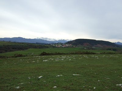
and finally the Sierra de Peña Sagra as you make your way back round the flat-topped summit
y por último la Sierra de Peña Sagra al acabar el paseo alrededor de la cima


Veo que no te retiene en casa ni el mal tiempo
ResponderEliminar