sábado, 1 de febrero de 2020

El Alto Asón


Aparcamos a la entrada de Valdició y subimos por una carretera al este hacia el Barranco del Sendero. Los tornos en el camino que cogimos se ven en la foto. Más adelante a la derecha se ve el Porrón, que luego subiríamos
We set off from the first house you get to in Valdició (near San Roque de Riomiera) and headed east. The bends in the road can be seen in this photo. Over to the right is the Porrón, which we would go up shortly

El Porrón
Al fondo a la izq. está Porracolina
Porracolina is on the left
El Romeral

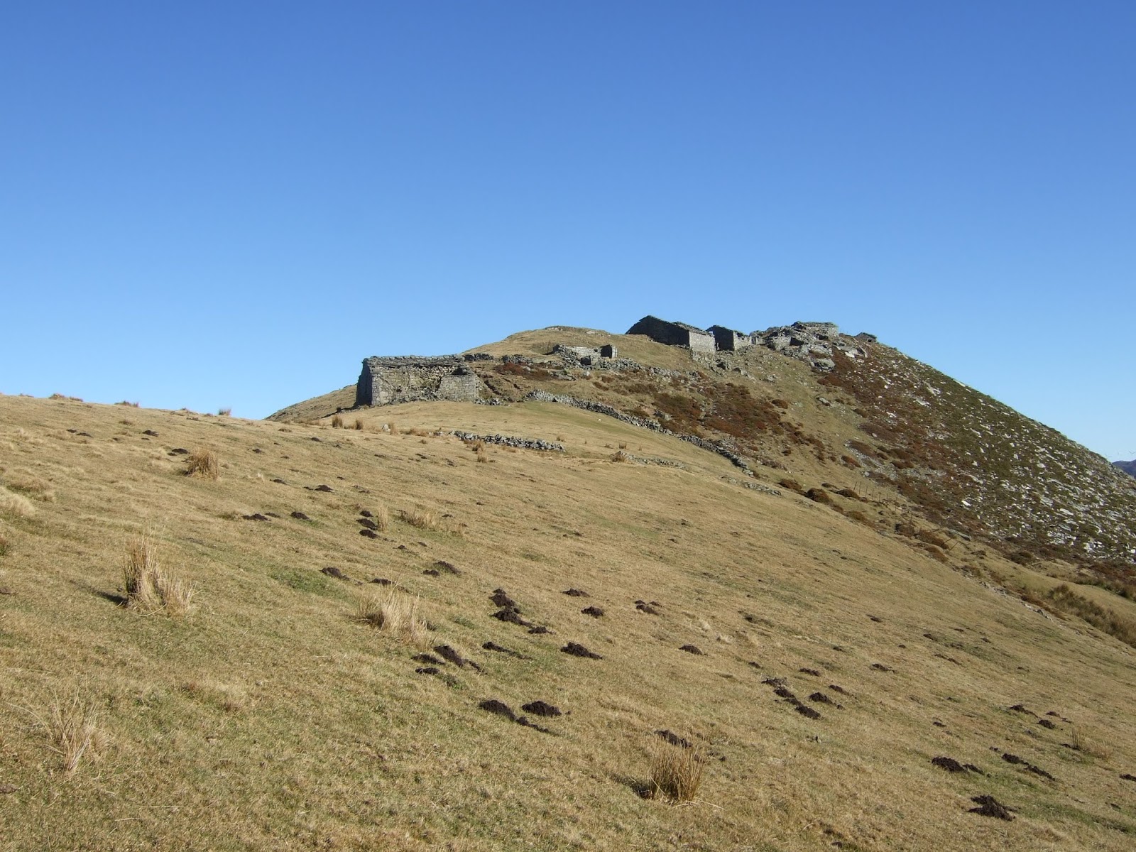
Cuando estábamos enfrente del Porrón, dejamos el camino y fuimos a la derecha (NO), bordeando un camino a nuestra derecha antes de subir una ladera directamente para llegar a las ruinas de una cabaña al pie del antecima del Porrón. Subimos hacia la derecha pero luego la subida se puso extremadamente pindia así que habríamos hecho mejor en atacar la cuesta directamente hacia arriba. Ya que hay que llegar al pico que se ve detrás a la izq. quizás se podría rodear el antecima por el lado este
When we were opposite El Porrón we left the track and turned right, keeping to the left of a path and then going straight up the hillside, coming out by the ruins of a stone hut. The next stage is a steep climb up to the left

A medida que vas subiendo las vistas empezaban a ponerse espectaculares. Los Picones de Sopeña, delante, con los Picos detrás
As you get higher, the views get better and better. 


Ahora hay que bajar un poco antes de llegar al Porrón. Luego iremos hacia Pizarras, más allá de la nieve que se ve arriba a la derecha
Straight ahead is the summit of the Porrón. After that we'll head up to Pizarras, above the snowline to the right

Luego andaremos por el cordal de enfrente
We'll be walking along the ridge later on


Bajamos del Porrón y acometemos la subida de Peña Blanca enfrente. Hay un sendero débil, que después de pasar el primer obstáculo rocoso, va en diagonal hacia la izquierda. Hacia la derecha se ve Castro Valnera. 
We carry on in the same direction, coming down from the Porrón before going up the other side. There is a faint path, which veers to the left once you get past the first rocks. Over to the right is Castro Valnera

La subida herbosa que se ve entre las rocas parecía prometedor, pero hay una subida más fácil justo detrás del resalte rocoso, por lo que bajamos un poco para rodearlo
The grassy strip between the rocks looked promising, but there's an easier way up just the other side of the outcrop that juts out.

En el siguiente escalón encontramos nieve y ¡también tres jabalíes! Fuimos hacia arriba, trepando donde era necesario y con tendencia a la izquierda para evitar la nieve. Este fue el último paso, visto desde arriba
On the level above the rocks we were surprised to see three wild boar, who kept their distance from us, moving up to the right through the snow. We went in the same direction for a while and then, after  clambering up the next rocks we encountered, headed to the left. This is the last pass we negotiated, as seen from above


Y ya nos encontrábamos arriba. Hacia la izquierda Carrío y a la derecha El Esquinazo del Carrío
Now we were onto the uplands. Towards the left lies Carrío and on the right is the rockface we'll go up later on our way there


Subimos Peña la Llusa antes de seguir en suave ascensión a la derecha para llegar a Pizarras. El Picón del Fraile se ve al fondo a la izquierda
We make our way up Peña la Llusa before continuing to the right up the gentle incline to Pizarras. Picón del Fraile is away to the left

Desde Pizarras mirando hacia Castro Valnera
From Pizarras, looking towards Castro Valnera

Dimos la vuelta y fuimos en dirección NE por el cordal. Mirando al lado derecho se ve el Mortillano al fondo a la izquierda
We turned round and headed northeastwards along the ridge. On the righthand side lies Mortillano (in the distance on the left of shot)

Vamos hacia el escarpe que se ve en el centro
Next towards the scarp in the centre of the photo

A la izquierda está Porracolina pero solo vamos a ir hasta Carrío (der) antes de bajar otra vez a Valdició
On the left is Porracolina, but we only plan to go as far as Carrío (right) before going back down to Valdició

Por aquí se sube
Threre's a pathway up through these rocks

Abajo a la derecha se ven un par de cabañas
Down to the right lie a couple of huts

Seguimos de frente hacia Carrío. A la derecha está Porra la Colina 
We carry straight on to Carrío. Behind it and to the right is Porra la Colina

Al fondo la costa y Santander
In the distance is the coastline and Santander

Peña Lusa en el centro
Peña Lusa (centre)

Una mirada hacia atrás; Pizarras en el centro
Looking back; Pizarras in the middle

Al fondo, el Mazo Grande
Mazo Grande in the distance

Desde Carrío tenemos esta vista de Porracolina, Peñas Gordas, el Mosquiteru y Peña Lavalle, con la costa detrás
From Carrío we are treated to this view of Porracolina (left) Peñas Gordas and Peña Lavalle (right)

Ahora bajamos la ladera pindia hacia el norte. Hay un paso entre estas rocas que nos permite llegar al collado: el Alto de las Hazas Bravas
We now go down the steep slope to the north. There's a passageway through these rocks that enables you to get down to the col

Luego cogeremos un sendero a nuestra izquierda para bajar hacia el oeste. Una mirada atrás hacia Carrío
We'll then take a path down to the west. A look back at Carrío

El sendero no está muy definido al principio, si tenemos en cuenta que ya estamos en la GR-74
The path isn't particularly well-defined to begin with, bearing in mind that this is part of the GR-74

Después de un rato llegamos al camino por donde habíamos subido y así completamos el círculo
After a while we come onto the track we'd walked up earlier on and so we complete the circle


jueves, 9 de enero de 2020

Los Montes Pasiegos / a shortish walk


Hace más de 20 años hice una ruta circular saliendo de San Pedro del Romeral, justo cuando estaban construyendo una pista que (acabo de descubrir) iba destinada a facilitar la colocación de unos aerogeneradores en la divisoria entre Cantabria y Burgos. La ruta que hice aquel día con Yuri, mi perro de entonces, me quedó grabada en la memoria. Quería revivirla, pero al consultar el mapa vi los símbolos del parque eólico, que aunque positivo porque posibilita energía renovable, degrada en cuanto a lo paisajístico, y me iba a impedir experimentar las mismas sensaciones. Una solución era comenzar a andar en la zona del puerto de Estacas de Trueba para llegar a los montes de Samo.
My first walk of the New Year, like the last one of the Old was to revisit a walk in the east of Cantabria that I first did over twenty years ago. In this case, a wind farm has changed the landscape, so I altered my route to avoid it.
En la curva (1120m) antes de la última recta hacia el puerto sale una pista hacia la derecha (O). La seguí hasta que dobla la esquina y cambia de dirección (SSO). Mirando hacia el este veía montañas muy conocidas.
At the last bend before getting to the Estacas de Trueba pass, up the road from Vega de Pas, a track leads off to the right (W). I parked by the bend and set off up the track. Where it changes direction to go SSW I took this photo of the familiar mountains to my right.
Castro Valnera, La Cubada Grande
Acaba la pista y seguí por este camino que lleva a un grupo de cabañas
The track fizzles out and I carried on up this path to a group of stone huts.
La Hormaza
Después de salir del cabañal continué hacia el sur por una senda más o menos clara entre los      escajos, contorneando la ladera 
After leaving most of the huts behind I carried on along a path through the gorse making my way southwards round the hillside

Delante se ven los objetivos de mi paseo:
Ahead of me lay the day's objectives
La Maruya (der/right); Coteru la Brena (detrás/behind)
  Ya en el cordal que separa las provincias, hacia el sur veo La Merindad de Valdeporres con Peña Dulla a la izquierda
Looking southwards from the ridge

Ahora mirando hacia el norte desde el Colladillo de la Hormaza. Justo debajo de este sitio está el Túnel de la Engaña
And now to the north:

Subo la cuesta y llego a la Maruya, los cabañas más altas de los valles pasiegos
I walk up the hill and get to La Maruya, the highest elevation Pas Valley huts can be found at

La Maruya, que parece totalmente abandonada, me transmite sensaciones parecidas a las que me dan las ruinas de civilizaciones de siglos pasados
La Maruya seems to be totally abandoned, and gave me similar feelings to the ones I get when looking at ruins from centuries past


Aumenta el viento mientras sigo hacia el sur, y subo la cuesta más empinada del día antes de llegar a la cima de Coteru la Brena. La Maruya se ve en el centro-izq.;  Porracolina al fondo un poco a la der. y Castro Valnera más a la der.
The wind increases as I continue southwards and walk up the steep hill to the top of Coteru de Brena. La Maruya can be seen centre-left; Porracolina in the distance a bit to the right and Castro Valnera further over to the right

La vista hacia Burgos
Looking towards the province of Burgos

Bajando de la cima me acerco al oeste para disfrutar de la vista
A few metres to the left of the summit there's a good view of one of the emblematic villages in the area
San Pedro del Romeral
Vuelvo hacia el norte, y me acerco otra vez a la Maruya, donde paro a almorzar
I walk back the way I came and decide to have my lunch at la Maruya

Abajo hacia el norte veo unas cabañas donde recuerdo haber tenido que abrigarme con Yuri mientras esperaba a que escampara
Below to the north I spy a group of huts I remember taking shelter from the rain in years ago

Me quedo un rato viendo como un buitre da vueltas alrededor
I spend some time gazing at a vulture circling around me

Sigo el camino por el cordal. Abajo a mi derecha está el río del Horno, y al fondo el Somo de Guzmántara
Heading back along the ridge; the view to the south-east

Paso otra vez por la Hormaza, con sus pilas de piedra.
No aconsejo intentar llegar directamente por arriba ya que la bajada por el lado este está extremadamente pindia. Sin embargo, recuerdo una vez haber seguido desde el colladillo de la Hormaza hasta las Estacas de Trueba, y ese tramo resulta más tendido y es un paseo cómodo
I go through La Hormaza, with its piles of stones, again. 
I wouldn't recommend the direct route over the top as the slope on the other side is exceedingly steep. I do though remember having once continued eastwards from the ridge to Estacas de Trueba, which is a lot less abrupt and comfortable for walking

Ya bajando el puerto en el coche paro en una curva para disfrutar de esta cascada.
Driving back down the road I stopped at a bend to take in this waterfall


miércoles, 18 de diciembre de 2019

Calseca años después / Calseca years later


Una de las primeras rutas que hice en Cantabria, hace más de 20 años, fue la subida a Porracolina desde Calseca. Volví al pueblo para hacer una variación sobre el mismo camino, y vi que el croquis que manejaba ya no servía: la carretera ya no acababa donde yo recordaba - seguía hasta un repetidor, y donde antes existía un sendero que significaba el comienzo de la ruta, ahora había otra carretera que acaba en Bustablado. 
Total, que perdí bastante tiempo buscando dónde empezar a andar, hasta que di con la opción de hacer la ruta al revés - un aliciente adicional sería descubrir donde acababa.
Pues a menos de un kilómetro desde el cruce con la carretera que sube a Valdició está el camino que cogí (ver foto). Un poco antes hay un lugar donde se puede dejar el coche, en frente de una bifurcación que baja a un albergue.
Returning to Calseca, a village which served as starting point to one of the first hikes I did in Cantabria, I found that new roads made it difficult for me to work out where I'd set off from before. So I decided to do the walk the other way round. The photo shows the starting point about half a mile from the turnoff from the road that goes up to Valdició near San Roque de Riomiera.
Porracolina

Pronto se deja el camino para coger un sendero que sube al lado del Arroyo de Calseca
You soon leave the track to take a path that follows a stream up the valley

Un poco más adelante cogí este ramal a la derecha en lugar de seguir de frente. Pasa por delante de una cabaña donde reanuda la dirección ESE de antes
A bit further on I took this fork to the right instead of carrying straight on. It leads to a hut then takes up the ESE direction again


La vista hacia una roca con forma llamativa y Porracolina detrás
To the left a striking outcrop, with today's destination, Porracolina, behind


Después de salir del valle fui subiendo por restos de sendero y praos. Una mirada hacia atrás
After coming out of the valley I carried on up using the odd path through the meadows

Un poco más arriba enlacé con un sendero que sube cómodamente en zigzags. Al fondo se ven los Picos de Sopeña
A little higher up I found a path that ascended in zigzags.

Llego al Alto de la Mina. Porracolina está a mi izquierda
The top of the hill. Porracolina on my left

Hacia el este está Mortillano y el Mazo Grande detrás a la derecha
To the east lies Mortillano, with Mazo Grande behind to the right.

Continúo hacia el NE. El viento está muy fuerte pero empiezo la última parte de la subida a la cima
I continue in a north-westerly direction. The wind is very strong as I begin the last part of the climb


Se ve Santander bastante bien desde la cumbre
You can see Santander from the summit

Y Santoña más al este. Luego bajaré por el sendero que va hacia la izquierda donde hay un collado. A la izquierda de este collado hay una pequeña subida a un alto donde experimentaré un viento huracanado
and Santoña further along the coast to the east. The next part of the walk will be to take the path that heads left towards a col. To the left of that is a slight incline where I'll feel the wind at even higher speeds

Empiezo a bajar casi en seguida de Porracolina debido a la fuerza del viento. Abajo se ve un grupo de cabañas con sus praos, por donde habrá que pasar
But it's already too strong for me to want to stay longer on the summit. Below there's a group of huts surrounded by meadows, which I'll be passing through later
El Mortero
Primero llego al pequeño Alto de la Porra de Hormigas. Aquí me cuesta mantenerme de pie por las rachas tan fuertes. Mi idea de seguir por las Peñas Gordas hasta el Mosquiteru no tiene sentido en estas condiciones
But first I follow the path to the col and then it's a real battle to get up the nearby hill - I can hardly stand upright due to the intense gusts. My original idea of following the Peñas Gordas as far as Mosquiteru is just not an option in these conditions
Peñas Gordas y Mosquiteru
Ahora estoy enfrente de Porracolina
I'm now opposite Porracolina

Bajo hacia el Mortero. En enclave me resulta muy atractivo
I make my way down to the meadows (el Mortero)

Miro atrás desde un sendero que continúa hacia el NO
Looking back from a path that heads to the NW

A medida que voy bajando veo que vamos a salir a la carretera que sube a Bustablado. Primero paso cerca de una cabaña rodeada de fresnos delante de un prao que se aprecia en la parte baja de esta foto
As I make my way down I realise I'm going to come out on a new road that leads to Bustablado. First I go past a hut surrounded by ash trees set at the edge of a meadow you can see at the bottom of this photo

Una vez en la carretera miro atrás a la cabaña y la senda que sube al Mortero.  Hasta aquí llegaba un sendero que venía de Calseca la última vez que andaba por aquí. Ahora solo hay que bajar la carretera, atajando una curva por un camino a la izq. antes de llegar al punto de salida.
Once on the road I look back at the hut and the path that goes up to the Mortero. I remember this place from the last time I was here. all that's left now is to follow the road down, taking a short cut down a path on the left and coming out on the road again just above the starting point.