1) Una lesión me ha impedido hacer ninguna ruta este mes, así que he aprovechado para investigar un par de sitios que desde hace tiempo me resultan sugerentes. Muchas veces al pasar cerca de Torrelavega me he preguntado dónde se juntan los ríos Saja y Besaya. Me acerqué una tarde a la "capital del Besaya" para descubrir el punto exacto. Se encuentra fácilmente detrás de la Lechera. Aquí se ven los últimos metros del Besaya antes de juntarse con el Saja.
Unable to go hiking this month owing to an injury, I've taken the opportunity to explore a couple of places I've driven past many times. The first is in the industrial town of Torrelavega, where two rivers converge: the Saja and the Besaya.

Dos ánades reales levantan el vuelo al percibir la turbulencia causado por la confluencia del Besaya (izquierda) con el Saja (que viene de frente).
Two mallards take fight as they come into contact with the turbulence caused by the confluence of the rivers.

The Besaya is the tributary of the Saja, and having joined forces, they head to the coast not far away.

Además de ver el lugar de la confluencia, he descubierto un par de datos que me han llamado la atención. 1º: que el nombre "Besaya" viene de "bis salia" en latín, o sea "segundo Saja"; 2º: que aunque el Saja es el río que impone su nombre tanto etimológicamente como en importancia real - el Besaya se considera afluente del Saja - es el Besaya que tiene un caudal medio ligeramente superior.
The mountain that overlooks the town.

y que se ve también en esta foto sacada desde la orilla izquierda del Saja el 10 /10/21 donde se ve como el Besaya viene desde el otro lado de los árboles
and which can also be seen in this photo taken from the left bank of the Saja on 10/10/21 in which you can see the Besaya coming from behind the trees

Unas fotos más desde la orilla izquierda del Saja, unos metros río abajo, mirando hacia la confluencia
A few more photos from the left bank of the Saja, a few yards downriver, facing the point where the Besaya flows into the Saja


Y la continuación hacia la desembocadura en Suances
And the continuation towards the mouth of the river in Suances

2) La segunda confluencia que quería descubrir es menos accesible. ¿Cuántas veces habré salido del Desfiladero de la Hermida preguntándome por el lugar de unión del Deva con el Cares? Di un paseo agradable desde Panes, siguiendo el río hacia arriba.
The second confluence is of the Deva and the Cares, two rivers that flow through the Picos de Europa. A short walk from Panes took me to the spot where they converge.
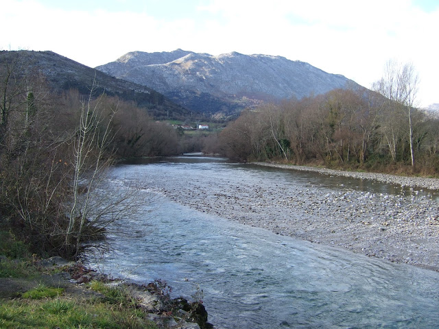
Se asoma el Peñamellera

Cuando se acaba el parque municipal, hay que seguir la carretera durante cinco minutos hasta dejarla donde esta casa abandonada.
After leaving the local park a 5-minute walk along the main road brings you to this abandoned house.

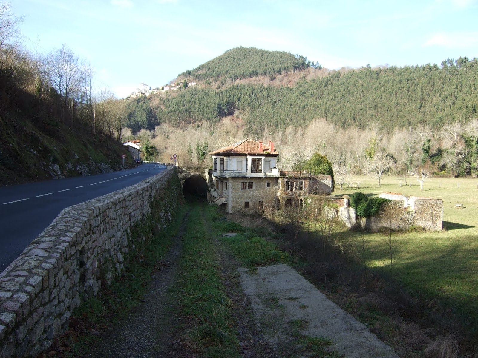
Aquí no hay ninguna indicación, pero veo por un sendero poco pisado que no soy el primero en atravesar una zona de chopos, seguramente conocido por los pescadores en busca de salmones. Aquí viene el Deva, buscando el norte.
Thereafter, making my way through the poplars, I came to the last few metres of the Deva before it is joined by the Cares


para deleite de estas vacas, que se acercan a la ribera para saciar su sed

Una vez más, el río que impone su nombre después de la confluencia - el Deva- es el menos caudaloso. Quizás por eso, en Panes lo denominan Cares-Deva.
Oddly enough, in both cases, the tributary has a greater volume of water than the main river.
3) 26/02/17
Añado una tercera confluencia; la del río Gándara, que me acompañaba durante una parte de mi subida al Pico San Vicente, con el Asón. Aquí se ve la última recta del Gándara en el barrio de Entrepuentes de Ramales.
I'm adding a third confluence at a later date; the river Gándara is the main tributary of the Asón, and accompanied me on part of my walk up to Pico de San Vicente. Here is the last stretch of the river in the town of Ramales (east Cantabria).

y mirando en la dirección opuesta se ve como el Asón viene por la izquierda
Looking in the other direction, you can see the Asón coming from the left

Desde el cercano puente medieval se ven los últimos metros del Asón antes de la confluencia
From the nearby medieval bridge we see the last part of the Asón before it is joined by the Gándara


4) 29/12/17
Ahora en Potes, desde el antiguo Molino de Palacio vemos como baja el Deva. El río Quiviesa se junta desde la derecha
In Potes we see the last stretch of the Deva river before its tributary, the Quiviesa joins it from the right

El Quiviesa nace en Peña Prieta
The Quiviesa has its source on Peña Prieta

La Torre del Infantado y el macizo oriental de los Picos a la derecha
The Torre del Infantado and the Picos de Europa provide the perfect backdrop

El Deva viene de frente
The Deva as it comes to be joined by its tributary

El Deva sigue su camino. Peña Ventosa al fondo
The Deva continues on its way. Peña Ventosa in the distance

5) Semana Santa del 2018.
Un encuentro más tranquilo fuera de Cantabria. En el Parque de Monfragüe (Cáceres) se juntan el Tiétar (izq) y el Tajo (der). La tranquilidad se debe a que estos tramos de los ríos son embalses. Los ríos siguen caminos cercanos y en 1965 durante la construcción de un túnel entre ellos en Torrejón cedió una compuerta, que causó la muerte de hasta un centenar de los trabajadores en la obra. Nunca se ha sabido exactamente cuántos fallecieron.
Easter 2018.
A placid confluence outside Cantabria. In Monfragüe National Park in Extremadura, the river Tiétar (left) flows into the Tagus - the longest river in the Iberian peninsula. This part of the river is a reservoir. The rivers run closely together, and in 1965, during the construction of a tunnel between them in Torrejón, a floodgate failed and up to 100 of those working on the project were killed. The exact number of the victims of this tragedy has never been known.

6) Marzo del 2021
The second confluence is of the Deva and the Cares, two rivers that flow through the Picos de Europa. A short walk from Panes took me to the spot where they converge.

Se asoma el Peñamellera

Cuando se acaba el parque municipal, hay que seguir la carretera durante cinco minutos hasta dejarla donde esta casa abandonada.
After leaving the local park a 5-minute walk along the main road brings you to this abandoned house.
Aquí no hay ninguna indicación, pero veo por un sendero poco pisado que no soy el primero en atravesar una zona de chopos, seguramente conocido por los pescadores en busca de salmones. Aquí viene el Deva, buscando el norte.
Thereafter, making my way through the poplars, I came to the last few metres of the Deva before it is joined by the Cares

Confluye desde su izquierda el Cares


Y siguen camino conjuntamente hacia el este (dirección que ya llevaba el Cares)
The Deva continues eastwards, taking the direction of its tributary

para deleite de estas vacas, que se acercan a la ribera para saciar su sed

Una vez más, el río que impone su nombre después de la confluencia - el Deva- es el menos caudaloso. Quizás por eso, en Panes lo denominan Cares-Deva.
Oddly enough, in both cases, the tributary has a greater volume of water than the main river.
3) 26/02/17
Añado una tercera confluencia; la del río Gándara, que me acompañaba durante una parte de mi subida al Pico San Vicente, con el Asón. Aquí se ve la última recta del Gándara en el barrio de Entrepuentes de Ramales.
I'm adding a third confluence at a later date; the river Gándara is the main tributary of the Asón, and accompanied me on part of my walk up to Pico de San Vicente. Here is the last stretch of the river in the town of Ramales (east Cantabria).

y mirando en la dirección opuesta se ve como el Asón viene por la izquierda
Looking in the other direction, you can see the Asón coming from the left

Desde el cercano puente medieval se ven los últimos metros del Asón antes de la confluencia
From the nearby medieval bridge we see the last part of the Asón before it is joined by the Gándara

Y por último desde un pocos metros río abajo: el Gándara viene por la izquierda y el Asón por la derecha. Se ve el puente medieval y el Pico San Vicente al fondo
And finally from a few metres downriver: the Gándara on the left and the Asón on the right. You can see the medieval bridge and Pico San Vicente in the background

4) 29/12/17
Ahora en Potes, desde el antiguo Molino de Palacio vemos como baja el Deva. El río Quiviesa se junta desde la derecha
In Potes we see the last stretch of the Deva river before its tributary, the Quiviesa joins it from the right

El Quiviesa nace en Peña Prieta
The Quiviesa has its source on Peña Prieta

La Torre del Infantado y el macizo oriental de los Picos a la derecha
The Torre del Infantado and the Picos de Europa provide the perfect backdrop

El Deva viene de frente
The Deva as it comes to be joined by its tributary

El Deva sigue su camino. Peña Ventosa al fondo
The Deva continues on its way. Peña Ventosa in the distance

5) Semana Santa del 2018.
Un encuentro más tranquilo fuera de Cantabria. En el Parque de Monfragüe (Cáceres) se juntan el Tiétar (izq) y el Tajo (der). La tranquilidad se debe a que estos tramos de los ríos son embalses. Los ríos siguen caminos cercanos y en 1965 durante la construcción de un túnel entre ellos en Torrejón cedió una compuerta, que causó la muerte de hasta un centenar de los trabajadores en la obra. Nunca se ha sabido exactamente cuántos fallecieron.
Easter 2018.
A placid confluence outside Cantabria. In Monfragüe National Park in Extremadura, the river Tiétar (left) flows into the Tagus - the longest river in the Iberian peninsula. This part of the river is a reservoir. The rivers run closely together, and in 1965, during the construction of a tunnel between them in Torrejón, a floodgate failed and up to 100 of those working on the project were killed. The exact number of the victims of this tragedy has never been known.

Otra vez en Cantabria. Aquí viene el Pas, a las alturas de Vargas, pasando por debajo del A-8.
March 2021
Once again in Cantabria. Here comes the Pas, near the town of Vargas, with the dual carriageway passing overhead

Mirando río abajo vemos los últimos metros del río antes de que desde la derecha se junta el Pisueña.

Looking downriver we see the last metres of the river before it is joined from the right by the Pisueña

Aquí se ve mejor la confluencia. El Pas que viene desde la derecha y el Pisueña de la izquierda

The confluence is clear to see here. The Pas coming from the right and the Pisueña from the left
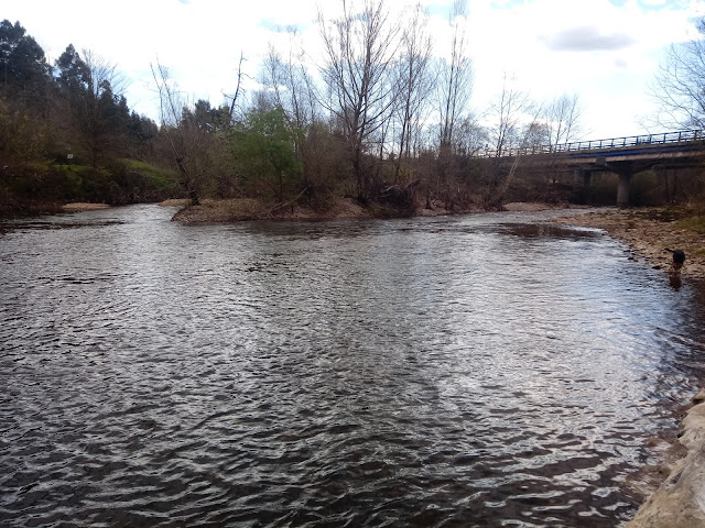
El Pas sigue su camino, ya con más caudal

The Pas continues on its way with increased volume