viernes, 26 de febrero de 2016

Macizo de Arria


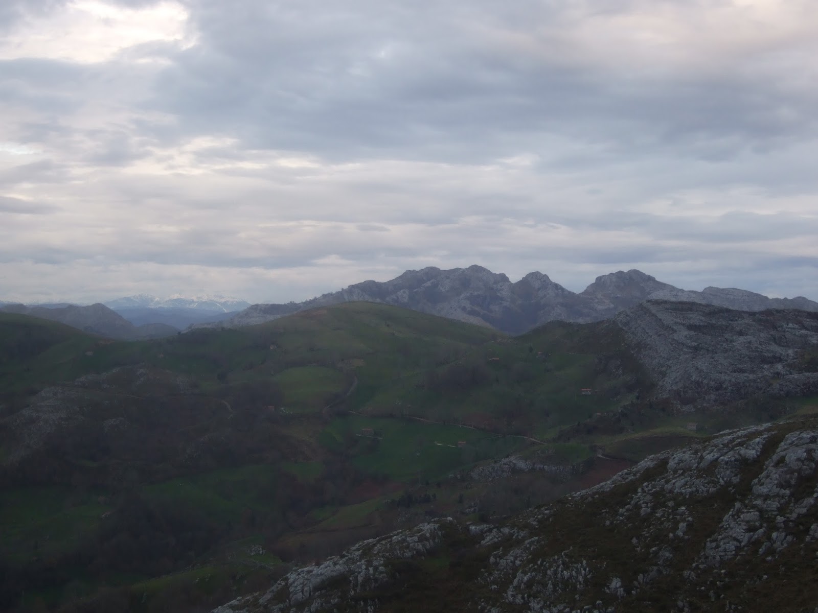
El macizo de Arria visto desde el principio de la carretera que sube a Burió en Lamasón. Las dos cimas más altas miden poco más de 1000 metros, pero subir hacia ellas desde el sur implica una ascensión empinada por terreno escabroso. Una de las dos se distingue claramente a la izquierda, y la otra es el Cuetu el Castillo, que se intuye al fondo entre los dos árboles en primer plano a la derecha de la foto; a ésta pretendía ir. 
Today's hike is in Lamasón in western Cantabria. Not a high altitude, but a steep walk up to the Cueto de Castillo, which can be seen between the two trees in the foreground.


Dejé la carretera donde una entrada a un prao y subí directo hasta la base de la pared. Al acabar el prao empezaba un terreno de helechos y rocas.  Abajo está el pueblo de Lafuente.
I left the road and went straight up through the meadows and bracken-covered hillside towards the foot of the rock face. Looking back down to the village of Lafuente.

Conecté con un sendero poco definido y avanzaba hacia la derecha
When I reached an indistinct path I headed to the right

Se ve la carretera que sube a Burió, y debajo el barrio de Los Pumares, donde la carretera gira al sur.
The view behind me

Llegué a un punto en que el sendero giraba a la izquierda, aunque otro ramal seguía la base de la pared, descendiendo para rodear una roca grande. No me apetecía volver a bajar, y suponiendo que ésta era la Canal de Braña tiré para arriba.
At this point I took a fork upwards to the left, rather than continuing as before and having to lose ground going round a large outcrop. I'd read there was a way up and supposed this was it.

Los buitres nos observaban con atención durante un buen rato
The vultures circled above us throughout this part of the walk

Las marcas del sendero desvanecieron y avanzar se hacía menos fácil
The path disappeared and the going got more challenging

 Salí de este ramal pindio de la canal y crucé hacia la derecha...
 After getting out of the increasingly steep gully I crossed over to the right...


para descubrir el "bueno" que convergía en este punto. Decidí que bajaría luego por aquí
to find an alternative route up the mountain that converged with the one I'd taken. I decided I'd come down this way.


La subida seguía todavía un buen rato hasta que llegamos a una pequeña valla, donde el terreno se ponía mucho más cómodo, y en seguida se veía el objetivo de la excursión al fondo hacia el oeste
There was still quite a stretch left though before we got to the top of the hillside. Thereafter going became much easier, and the summit soon came into view over towards the west.

El Cornón de Peña Sagra a punto de desaparecer detrás de las nubes
Behind us Peña Sagra was just about to be engulfed by clouds

Como siempre, Monty encantado con la presencia de nieve
As usual, Monty was quick to make the most of any snow that we came across


las ruinas de una cabaña
the ruins of a stone hut

Ya desde la cima, mirando hacia el este
From the summit, looking back eastwards

La costa, con Tina Mayor y Menor
the coastline to the north

El puerto de Arria
Pasturelands

La continuación del macizo, que enlaza con el de Peñarrubia
The mountains continue to the west

Los Picos de Europa

Peña Ventosa y la Sierra de las Cuerres

Abajo, el pueblo de Lafuente y la carretera que se dirge a la Hermida
Down below, the village of Lafuente and the road that makes its way to the Hermida Gorge


Otra cabaña en ruinas, camino de la bajada
Another hut in ruins on the way back down

No parece gran cosa ¿verdad?
Doesn't seem like much, does it?

Pues tardó lo suyo. Al llegar a la base de la canal me di cuenta de la boca de esta cueva que había dejado a mi izquierda sin percatarme. Me vino a la cabeza la portada del album "In the Court of the Crimson King"
Well it took a bit of time to get down. When I was almost at the foot of the cliffs I saw this cave entrance I'd gone past without noticing. It reminded me of the album cover of "In the Court of the Crimson King"

Algo más abajo se ve mejor la subida.  Más cómoda que la que cogí yo, pero también más larga.
A bit lower down and the descent is easier to appreciate. Less tricky than the way I went up but somewhat longer.
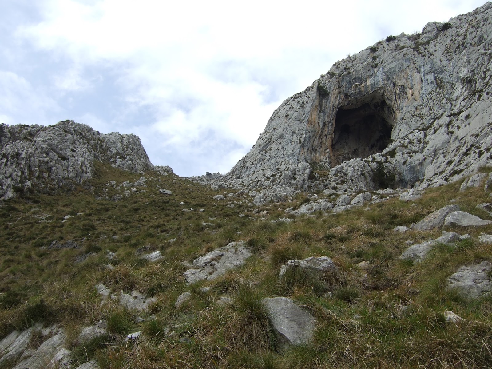
 Bajé directamente por la ladera, por terreno que no se ponía cómodo en ningún momento. Una última mirada hacia atrás, con la cueva hacia la derecha, y la subida que cogí hacia la izquierda.
I headed directly down the slope, over terrain that was never straightforward. One last look back, with the cave over to the right and the gully to the left.

martes, 2 de febrero de 2016

Clouds over Ordunte / Ordunte entre nubes


The weather was forecast to get better as the morning wore on, so I took Monty to the Carranza Valley, just over into the province of Biscay. The walk started off at a village with a strange sounding name:"Lanzas Agudas", which means "Sharp Spears". I imagine the early inhabitants defending themselves from attacks from the valley below - no aggro today though ;-)  and Monty even had a 
friendly welcome from one of his kind, in what was his first outing to the Basque Country. I followed the signposted route for the first part of the way up to Valjerri (with a slightly different spelling in Basque), which is one of the Ordunte mountains.

En las laderas del Valle de Carranza está el pueblo de donde salí para acercarme a los Montes de Ordunte. Tiene un nombre singular: "Lanzas Agudas", y me imaginaba a los primeros habitantes defendiéndose de ataques que procedían de valle abajo. Nosotros veníamos en son de paz ;-)  y de hecho Monty hizo buenas migas con uno de su género, en este, su primera visita al Pais Vasco.

Seguí la indicación a Valjerri (así se escribe en castellano). A los pocos minutos de salir del pueblo la pista empieza a bajar. Hay que girar a la izquierda bruscamente en una curva, dejando dos pistas que siguen hace la derecha y que se ven en la foto anterior.

The beginning was a gentle ascent with views of the village below
La pista sube suavemente y vemos el pueblo abajo

I then took the first track that branched off to the right through the wood
En el primer cruce giré  a la derecha para seguir una pista que atraviesa un bosque. La alternativa habría sido seguir 5 minutos más y coger un sendero balizado.

After going through a meadow, the track skirts some pine trees. That's where I left it to head uphill towards the low-lying clouds.
Se pasa por un prao y la pista bordea una pequeña plantación de pinos. En la base del monte que se ve al fondo de la siguiente foto volvimos a encontrar el camino balizado y dejamos la pista para seguir por una senda que sube diagonalmente hace la derecha. Como se ve, seguían las nubes bajas.

At the foot of Valjerri it was touch and go whether I'd be enveloped in cloud when I got to the top.
Cuando llegué a la base del Valjerri todavía dudaba si iba a ver algo arriba

However, my timing was spot on /  I was lucky (take your pick) and the cloud had moved on. I followed the advice above the survey marker and stepped onto the "podium of health"
Sin embargo, había calculado bien / por suerte (como quieras) y no me encontraba dentro de la nube cuando llegué a la cima y pude "Subir al podium de la salud"

I still had to wait about half an hour before it was worth taking any more photos. To the south lies the Mena Valley and the Peña ridge (province of Burgos)
Todavía hubo que esperar por lo menos media hora para poder sacar alguna foto que dejara ver algo. Hacia el sur el Valle de Mena y  la cresta de la Peña  (Burgos

The Carranza Valley to the west. On the horizon to the right, the Pico Las Nieves can be seen just below the cloud line.
El Valle de Carranza. El Pico Las Nieves se ve en el horizonte hacia la dcha. justo debajo de la nube


Looking towards the N-E
Hacia el NE

The Ordunte mountains, of which Valjerri is one, continue round to Zalama, which is shared by three provinces (Cantabria, Biscay and Burgos). As I came down to the small pool at the bottom of the summit, the cloud that had shrouded Zalama all morning finally lifted.
El Zalama (donde se juntan tres provincias (Cantabria, Vizcaya y Burgos) forma parte de los Montes de Ordunte, igual que el Valjerri. Llevaba toda la mañana cubierto por las nubes, pero cuando llegué al charco que hay en la base del Valjerri se dejó ver por fin.

As I descended, the cloud ascended
A medida que yo bajaba, la nube subía...

Valjerri from the Portillo de Brena
El Valjerri visto desde el Portillo de Brena

I returned the same way I'd come, crossing the burnt hillside and going down to the pine plantation
Regresé por el mismo camino, atravesando la ladera quemada del monte y bajando a la plantación de pinos

In the foreground you can see the tracks that have been uncovered (or perhaps "freshly made") as the pine trees are cut down
El Picón del Fraile se asoma por encima de la nube al fondo a la izq. En el monte de enfrente se observa el trazo de las pistas que quedan al descubierto (o que se abren) a medida que talan los pinos.

I couldn't find the other path that leads down to the village so I went down the track again. From here you can see the Portillo de Brena  (to the right) but Valjerri is hidden by the hill centre-left of shot.
Cuando llegué a este punto busqué el sendero por el bosque pero no lo encontré, así que bajé otra vez por la pista. Delante está el monte que se sube para llegar al Portillo de Brena. La cumbre queda escondida detrás.

The path I couldn't find comes out onto the track just before this gully.
Al bajar, decidí descubrir por donde iba el camino balizado. El cruce está justo antes de este barranco.

jueves, 28 de enero de 2016

A depression worth experiencing / Hoyo Masayo


Looking westwards from the Alisas vantage point on the way to Ruesga
Camino de Ruesga, paramos un momento en el puerto de Alisas: la vista hacia el oeste

The first walk of 2016 was the PR-S 13. The route is pretty well signposted, and begins at the village of Riba, with a steep incline
Elegimos como primera ruta del 16 el PR-S 13, que se adentra en la Sierra de Hornijo. Está balizado, y da comienzo en el pueblo de Riba. La primera parte es la de mayor pendiente

Riba literally means "on the (river)bank". The mist hovered above the river Asón all morning
La neblina indicaba el curso del Asón hasta bien avanzado el día

Peña Rocías overlooks the village and the first part of the walk
Peña Rocías domina el pueblo y la primera parte de la ruta


We turned towards the left to avoid the mountain following alongside an old pathway, which was mostly impassable due to fallen trees or the vegetation that has grown due to lack of use. It leads up to an area called La Cerroja, where there are several abandoned stone huts.
Giramos hacia la izquierda para evitar la montaña, bordeando un camino antiguo lleno de troncos caídos y maleza que indicaban su falta de uso. Lleva a una zona que se llama La Cerroja, donde hay varias cabañas abandonadas.


Looking back at the Mosquiteru, and Porracolina away to the left, with a little snow still on the slopes
Detrás de nosotros el Mosquiteru y Porracolina a la izq. con un poco de nieve todavía 

The second part of the walk took us into a chaotic karst landscape. Eastern Cantabria is carboniferous limestone country.
La segunda parte del recorrido entra en el mundo caótico del karst. 

The Enguinzas, which I photographed from Alisas on the way to Riba
Las Enguinzas, que había fotografiado desde Alisas

There was the occasional yew tree to be seen.
Hay algún tejo entre las rocas

Eventually we reached the Hoyo Masayo, a doline or depression which contrasts with the countryside surrounding it. There was total silence.
Llegamos al Hoyo Masayo (o Masallo), una dolina que contrasta con el paisaje que lo rodea. Reinaba un silencio total.


Photos from the base of the depression:
Un par de fotos desde el fondo de la depresión:

Looking up from the far side of the Hoyo to the point we arrived at
Desde el lado opuesto a la entrada al Hoyo que habíamos cogido

We returned the way we had come, passing this olive tree on the way.
Volvimos por el mismo camino, pasando delante de este olivo


Remains of huts in La Cerroja
Lo que quedaba de un par de cabañas, ya en La Cerroja

A striking beech tree despite having shed all its leaves
Me llamó la atención esta haya. No necesita hojas para destacar.

On the drive back we stopped once more at Alisas to admire the sunset behind Peña Labra and the Enguinzas.
De vuelta a casa paramos por segunda vez en las Alisas para disfrutar de la puesta de sol detrás de Peña Labra y Las Enguinzas.


5 years later I did the continuation of the walk from Hoyo Masayo southwards. Here is the link:
5 años más tarde hice la continuación del camino desde Hoyo Masayo hacia el sur. Aquí está el enlace:

https://northspainrambler.blogspot.com/2021/06/la-sierra-del-hornijo-spring-in-soba-3.html