miércoles, 21 de diciembre de 2011

¡Felices Fiestas! Season's Greetings!


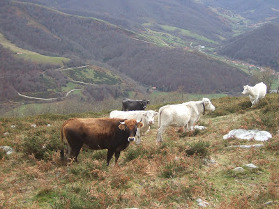
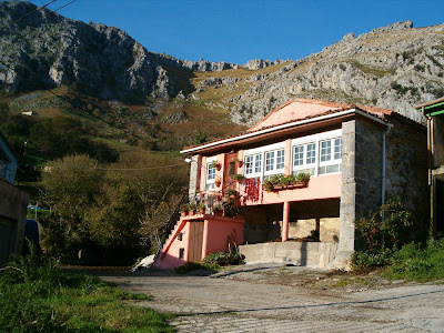
 ¡Felices Fiestas! ¡Que cojamos fuerzas para aguantar lo que nos viene encima...! Por lo menos hay pequeños placeres en la vida que la banca y sus acólitos no nos pueden quitar - como andar por el campo y disfrutar de las cosas que regala a nuestros sentidos.

Enjoy the holidays and brace yourselves for a none-too-rosy-looking future! At least the bankers and their acolytes can't take away from us those little pleasures in life, like rambling in the country and enjoying the sights and sounds in store for us there.

lunes, 12 de diciembre de 2011

The Missing Link


When Carmen and I moved to Cantabria in '95 we did the "Saja Reserve Walk" covering 90 km in four beautiful September days, crossing from the centre to the west of the province. Well not four actually, but three beautiful days, because the other one it rained and the mist prevented us from walking up the hills from La Lastra to Polaciones. Luckily, that was also the only day there was a road providing an alternative way for us to get to our destination.
I'd always meant to explore that "missing link" in the Walk - called the "Camino del Potro", or Colt's Way - and last weekend I used it on my way up to the Pico de las Astillas.
The first part is a gentle ascent up through an oak forest called Monte de Ruistromeo


The Cohilla reservoir lies below the path, with Cueto la Jaya on the other side


Low-lying cloud meant it wasn't a day for good views - here the summit of Cueto Jelgueras opposite became visible for a moment


Just after the Mirador del Potro I decided to head up the steep hillside through gorse and broom
to the top of Las Astillas


Once at the top, there were no views of Cueto Cucón, immediately to the west, as it was enveloped in cloud; happily, there was something to see to the N-W


The coastline away to the north:
The villages of Tudanca and La Lastra down below:
The reservoir below Cueto la Jaya


Pico las Astillas from the nearby hilltop of Hazas

From the col at the base of las Astillas I discovered there was a track that led down to the Camino del Potro, which would have saved me a steep climb earlier on had I bothered to look at a map. Still, it's always good to go back via a different route - here looking back up towards Las Astillas (and Hazas on the right)

The Polaciones valley


Looking towards Piedrasluengas - the border between Cantabria and Castille


A couple of photos taken on the way down:


Las Astillas on the left, the Mirador del Potro on the right


Jelgueras and Cuetu Concilla behind it still finding it hard to shake off the clouds


And so back to the car - a first outing with Carmen's camera.

domingo, 4 de diciembre de 2011

Camera swansong

Four weekends in a row getting out to the country - can't remember when that happened before!
I left the car at Puerto de Braguía, between Selaya and Vega de Pas and headed east along a flat ridge overlooking valleys on either side.
Castro Valnera is the highest mountain in these parts, and looked particularly impressive after a heavy snowfall the day before.


A look back at the first part of the walk, with the snow-capped peaks of Alto Campoo appearing in the distance


To our left lay the Carriedo Valley


The Picos de Sopeña at the end of the ridge, called Llana de Perocapillo, were the day's objective


Castro Valnera soon started to cloud over


To the right, the Pandillo valley


There are incredible contrasts of colour on the hillsides


One of many stone huts


The Picones ever nearer


The last part of the walk is pretty steep, as you make your way up to a gap between the two highest-looking peaks in the centre-left of the picture


And I was a hundred metres or so from the top when my camera decided it had taken its last photo, looking across to the north and Coteru el Teju. No amount of coaxing would change its mind - nor even the most colourful language I could come up with...


At almost 1300 metres there was quite a lot of snow around and on the other side of the Picones a good view of Porracolina and the final part of the road up to the Lunada pass totally white. Unfortunately, I was unable to photograph the view of the walk I'd made from above or the absolutely gorgeous sight of Alto Campoo, Peña Sagra and the Picos beautifully silhouetted away to the west - not that my camera would have done it justice anyway, even if it had been working...

sábado, 26 de noviembre de 2011

The Asón Valley

On my way up the Asón valley I stopped off at the village of Socueva, which is just up the hill from Arredondo at the bottom of the valley.


As you walk up through the village you see this wall of rock in front of you. Barely visible, partially hidden by the trees at the foot of the cliff in the centre of the picture is a small cave containing a chapel.


There's a wooden altarpiece at the entrance


and if you go through the doorway into the rock this is what you see:


A slightly different angle. Apparently it dates from the 9th century!


After the visit, a look up the valley towards my next stop. The skies seemed clear but menacing clouds were approaching from the east


On the way down to the main road, a view of Arredondo, which has the sobriquet of "Capital of the world". I kid you not.


Almost at the top of the valley is a famous waterfall, which marks the source of the Asón river. The lack of rainfall recently explains the modest amount of water flowing down the rockface


Setting off from the Collados de Asón we left the track in Horneo to head towards Saco and the Colina


La Colina stands behind an unusual karst platform formed by glacial action


There are lots of fossils to be seen


The ice that formed the platform came from the Hoyón de Saco cirque seen here. The water that filters through this depression travels underground and ends up 12 km away at the waterfall marking the source of the Asón.


After reaching higher ground I was rewarded with the best views of the day; just across the way is the Porracolina - a mountain that is a landmark when seen from Santander


From a vantage point above the Rolacías gorge you can see the Porros de Mortillano the other side of the Asón valley


and below lies the gorge


The Colina, here seen from the same point but which was already engulfed by clouds when I got there, was the highest point of the walk. I had planned to return by a route along the base of the escarpment the other side, but as visibility was nil I had to go back the way I'd come

That included a descent through this beech wood