At the top of this photo taken from Curavacas (see Sept 2010) is the mountain range that links Cantabria (left) to the province of Palencia (right). It is over 7,000 ft up and I'd intended to explore it when there was snow around. However, when at last a day came along when I could do some walking, it was too hot to go anywhere else, so I decided to walk this range (the Sierra Cebollera).

I was also interested in visiting Brañosera, which is known for being home to most of the remaining bears in Spain. The town of the same name lies just south of Espinilla, on the road that goes up to the Brañavieja ski station and takes you into Palencia. When Monty and I set off down the pathin the next photo it was already pretty warm and we could see our destination up ahead to the right.

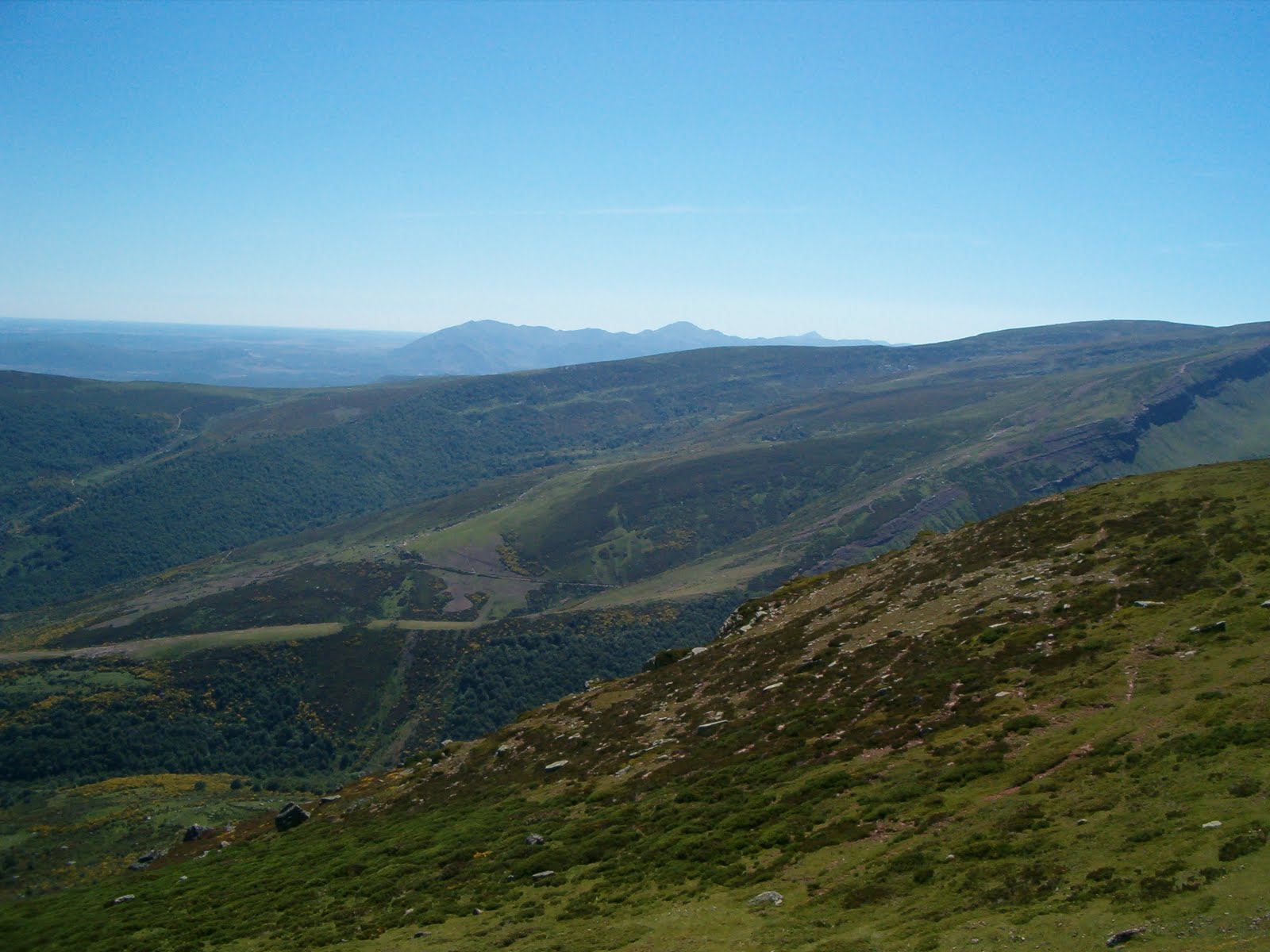
First though, we had to skirt round to the left and walk up a gulley for an hour or so, and this was almost uncomfortably hot at times, with little shade for Monty

The Peña Rubia would be the last of the four peaks we were to visit, and can be seen here over our shoulders as we made our way up


We eventually reached a point where we could feel a breeze, which was extremely welcome, and the town we'd set off from down below came into view beyond the heather


We were rewarded at the first peak (Cueto de Herreruela) with lovely views of the mountains of Palencia to the west


Espigüete, Curavacas and Peña Prieta (the last one's actually in Cantabria)


The horses seem to be standing directly beneath Espigüete (left) and Curavacas (centre), where the first photo on this entry was taken


Nearby, lots of cairns mark the summit of Valdecebollas, which is the highest point in the Sierra.

Peña Labra is the tip of the Alto Campoo range, (which the Sierra Cebollera connects up with) with Peña Sagra behind (though you're advised to click on the photo to see it more clearly)


The Picos de Europa as seen on the way to the next peak


A look back at Valdecebollas (on the right)


The next two photos are taken from Peña Sestil - this one shows the remains of a glacier, the valley takes you down to Golobar

And this one looks eastwards towards Peña Rubia, an hour's walk away


And this one looks eastwards towards Peña Rubia, an hour's walk away

On the way, we passed a large group of horses, and this beautiful stallion came up to make sure we meant them no harm. Cueto Cordel and Pico Ligüardi behind him


From Peña Rubia a view of the final part of the walk, down to Brañosera. Immediately below is a ski station carpark


On the left is the upper part of the gulley we'd walked up earlier and the ascending ridge to the right

Monty on top of Peña Rubia


On the way down, a shot of the route up the valley from Golobar


Peña Rubia from the carpark


A short cut through the fields to get back to Brañosera. I would have to return here later to try to find Monty's lead that I left next to a drinking trough - I couldn't find it, which slightly tarnished a pleasant day's walk


Brañosera town hall, showing the date (824) when the municipality charter was first written, making it the oldest town in Spain (!)


For those of you who can read Spanish, this is a copy of the original charter, attached to a standing stone opposite the town hall (again, you'll have to click on it a couple of times to magnify the text)

