miércoles, 28 de agosto de 2019

Unfinished business / Asignatura pendiente


Back to Liébana. There was too much snow 6 months ago for me to attempt Zamburria, so I chose a coolish summer's day to return. This time I set off from Ledantes. The mountain awaits up ahead as I leave the village.
Volví al Valle de Cereceda para subir el pico de la Zamburria, que no pude hacer hace 6 meses por la cantidad de nieve que había. Esta vez salí de Ledantes. La montaña domina el valle hacia el sur.

Take the track past the cemetery, cross the bridge and keep left at the two forks. The second one goes down to the river and on the other side up into the woods. Thereafter is a long, steep track that, after the initial bend to the right, heads southwards, approaching Zamburria. Eventually the track starts to zigzag a bit more, with Picos occasionally visible through the trees
Hay que coger la pista que pasa al lado del cementerio, cruzar un puente e ir a la izquierda en dos bifurcaciones. La 2ª de estas baja al río y continúa hacia arriba al otro lado entrando en el bosque. A partir de una curva inicial a la drcha, la pista se dirige al sur, acercándose a la montaña. Después de bastante rato la pista empieza a zigzaguear y ofrecer vistas ocasionales de los Picos a través de los árboles.


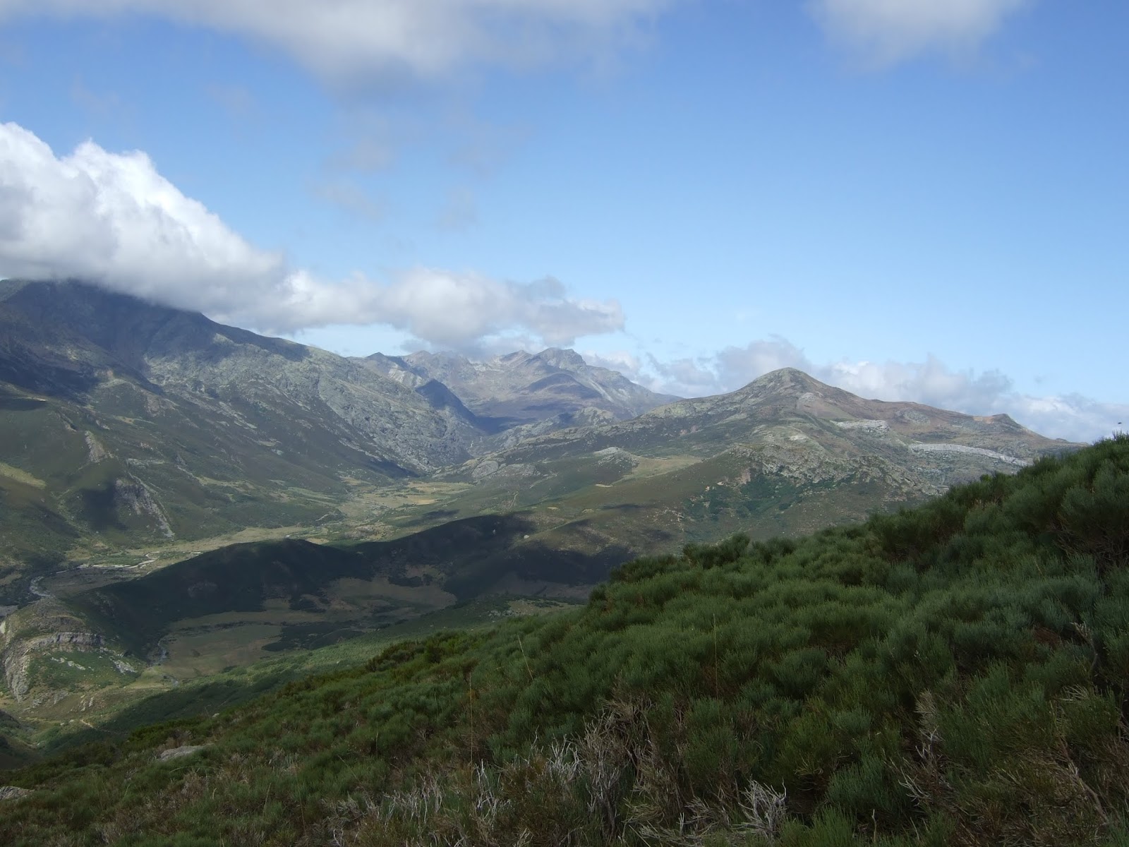
I found it harder going than the walk up from Barrio. At about 1600 metres I'm treated to a view of Peña Sagra in the distance and Casanzo in the foreground
La subida desde Barrio parecía menos empinada que ésta. Salgo del bosque y veo Peña Sagra a lo lejos y Casanzo en primer plano.

Further to the right across to Córcina and Bistruey
Mirando un poco a la derecha vemos Córcina y Bistruey

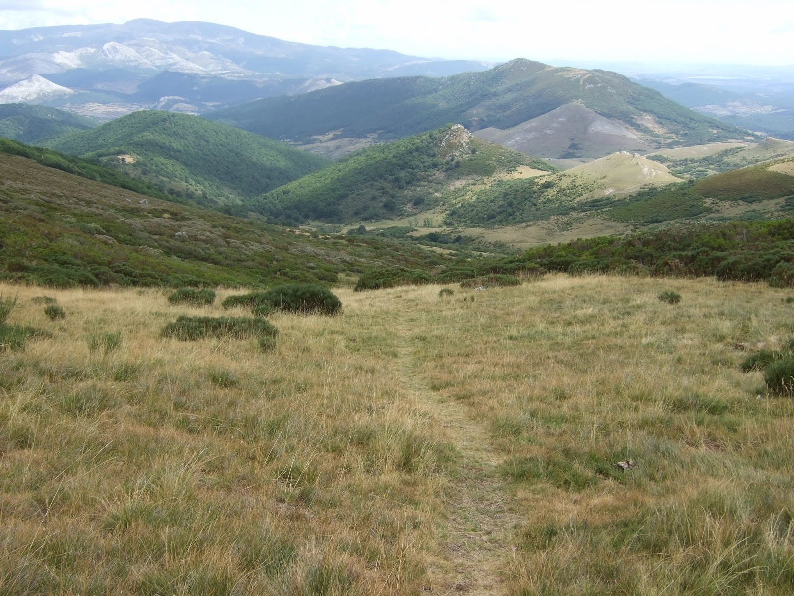
Still a fair bit to do till I get to the top of Zamburria. Peña Prieta peeping up from behind
Todavía queda bastante para llegar arriba. Se ve Peña Prieta, que se asoma detrás de Zamburria

The foot of the mountain. I decide to follow the fence up to begin with, then look for the easiest route straight up through the heather. Later on I'll come down the ridge on the left.
El pie de la montaña. Decido seguir la valla para empezar, luego buscar el camino más fácil por el brezo para subir directamente. A la vuelta bajaré por la arista de la izquierda.

More than halfway up. Just opposite is Cohora and the ridge I went to in March. Beyond is Bistruey.
Después de subir un buen rato veo detrás de mí Cohora y la cumbre del Cordel, donde estuve en marzo. Más allá, el Bistruey.

From the summit the impressive Peña Prieta
Desde la cima, Peña Prieta

Picos de Europa

 Robadorio

Looking down on Ledantes and the woods I walked up through
Abajo está Ledantes y el bosque por el que subí

The summit on the left, with Curavacas on the right
la cima a la izq. y Curavacas a la derecha


I continue a bit down the ridge to the SW. Pumar and Lezna stand out on the left. Behind and just to the right of those is the Peña Carazo ridge, which I was on the week before
Sigo un poco, bajando hacia el SO. Picos Pumar y Lezna están a la izquierda, y desde aquí veo el collado de Hontanillas y parte de Peña Carazo justo detrás de Peña Lezna. Estuve allí una semana antes


I make my way down a path, keeping to the right. Below me to the north is Río Frío (Cold river)
Desciendo siguiendo un sendero que aparece en la arista sur. A mi derecha veo el Río Frío

I come down Cuesta la Rebeca to get back onto the track
Para volver a la pista bajo por la Cuesta la Rebeca (este nombre he visto en un mirador que hay en la carretera que baja a La Vega)


The heather is in full bloom as I retrace my steps towards the woods and Ledantes.
Qué bonito se ve el brezo mientras me acerco de nuevo al bosque para bajar a Ledantes


lunes, 19 de agosto de 2019

Una excursión en la Pernía


Hacía tiempo que no iba al campo, así que escogí una ruta no muy exigente, en la Pernía.
Uno de los atractivos de esta excursión para mí era conocer la CL-627,  que se dirige desde Cervera de Pisuerga hacia Piedrasluengas.  Seguí esta carretera hasta San Salvador de Cantamuda, donde continué a la abadía de Lebanza.
The walk begins at Lebanza abbey in the Pernía part of Palencia. Head north past an abandoned building, through a gate, leaving a swimming pool on the left. (Don't take the track going south). Cross the brook, follow the track sharply round to the left and enter the wood. Peña Carazo comes into view beyond the trees.
La excursión comienza con una pista que va al norte (¡ojo! no la que se dirge hacia el sur al lado de la abadía) al lado de un edificio abandonado. Después de una puerta veo una piscina a la izq. Cruzo un arroyo a la derecha y poco después hay una curva cerrada. Sigo el camino por un bosque de hayas y robles y ahí está el objetivo del día: Peña Carazo. Tendré que dirigirme primero al collado que se ve a su izq.


Cruzo el arroyo y pronto llego a un claro, donde acaba el sendero. Saqué esta foto a la vuelta. Subí por la derecha, volviendo a cruzar el arroyo donde acaba el claro. Más tarde bajé por la izquierda.
After crossing the brook again I got to a clearing, where the path comes to an end. I took this photo on the way back. I walked up to the right, crossing the brook once again where the clearing ends. Later in the day I came down on the left side.


Después de cruzar el arroyo seguí una senda que evidentemente no se usa frecuentemente y que no está nada clara. Entra en zona de escobas (que nunca me hacen gracia) y siguiendo hacia el NO al poco llegué a una zona donde volví a ver el collado. Me dirijo a una roca bastante grande desde la que saco una foto de lo recorrido hasta el momento. Decido que bajaré más tarde por los praos que se ven a la derecha.
Having crossed the brook I followed a path that disappeared into the undergrowth, but came out into a clearing from which I could see the col to the left of Peña Carazo. I carried on to the NW and a rock that stood out, from which I took the next photo, looking back at the first part of the walk.

Cuando alcanzo el nivel del prao más alto a mi izquierda (subiendo), los caminos entre el brezo y escobas se hacen más cómodos.
By the time I came level with the uppermost fields on the left, the paths through the heather and broom were becoming clearer

Llego al collado (de Hontanillas) y subo a la derecha pasando al otro lado de la alambrada.  Mirando atrás hacia el collado, se ve Peña Redonda detrás y la sierra del Brezo a su izquierda.
At the collado de Hontanillas I head up to the right, on the other side of the fence. Looking back towards the col you can see Peña Redonda behind and the Sierra de Brezo to the left.

Hacia el norte se ve Peña Prieta (centro) y a la derecha Picos Lezna y Pumar
To the north is Peña Prieta (centre) and Lezna and Pumar on the right

Se llega fácilmente a la brecha que da paso a la cresta
A gap in the rocks is easily reached

El paisaje hacia el sur
The view to the south

El punto más alto de la cresta, Peña Carazo, está a 2015 m.
The highest point of the ridge, Peña Carazo, is 2015 mts high

Curavacas se queda libre de nubes (casi) por poco tiempo
Curavacas is briefly almost totally free of clouds

Enfrente está Horca de Lores, ligeramente más alta
Opposite Carazo is Horca de Lores, slightly higher

Me acerco para disfrutar de las vistas hacia el norte
I walk across to enjoy the views from the top


Están cubiertos por las nubes Los Picos pero se ven el Bistruey, Córcina, Peña Cigal
The Picos de Europa are obscured by cloud, but nearer familiar peaks are visible to the north


Tampoco están visibles Peña Sagra ni Peña Labra, pero ha merecido la pena subir hasta aquí
Peña Sagra and Peña Labra are also hidden, but it was certainly worth coming up here


Detrás de mi está Peña Carazo
Behind me is Peña Carazo

Abajo a la derecha está la Vega de Santa Marina y el río Carrión
Below to the right is the Vega de Santa Marina and the Carrión river


Curavacas se cubrió definitivamente
Meanwhile Curavacas had disappeared for the rest of the day

No era necesario volver a subir a la cresta; siguiendo los caminos del ganado se llega al collado de Hontanillas. La primera parte de la bajada era igual que la subida.
To get back to the Collado de Hontanillas it isn't necessary to go back up to the ridge. Following the animal tracks leads you round to the col. I then went down the way I'd come up


Cuando me acerco al prao alto al otro lado del arroyo sigo los restos de camino hacia la derecha para cruzar al otro lado
However, when I got near to the highest meadow on the other side of the brook, I veered to the right following open spaces between the broom

Desde el prao miro para atrás. Se intuye el camino seguido.
I crossed over to the other side; looking back you can see how intuition guides you to the crossing point


Dejo atrás Peña Carazo
I leave Peña Carazo behind


Me queda una bajada placentera
and enjoy a pleasant walk down through the meadows


Acabo con un par de imágenes de lo colorido de esta zona
And to finish, a couple of photos taken as I drove away from Lebanza; firstly this striking contrast of colours

y lo románico (la iglesia de San Salvador de Cantamuda)
and secondly, this romanesque church in San Salvador de Cantamuda