domingo, 31 de diciembre de 2017

El Tumbo/Las Segás


El Bistruey, Curavacas y Peña Prieta desde Cahecho al amanecer del 26 de diciembre. Más tarde llegarían las nubes y no se volverían a ver estas cumbres de la cordillera.
Looking towards the southwest from Cahecho at sunrise on Boxing Day. "Red sky in the morning...." Later on the clouds would cover these peaks completely.

Después de desayunar salimos los perros Monty, Otto y yo hacia El Tumbo, en el centro de la imagen.
After breakfast Monty, Otto and I set out for Tumbo, in the centre of the photo.

Cogimos un ramal a la izquierda para acercarnos a lo alto de la ladera enfrente del valle de Bedoya
We took a fork up to the left to gain the top of the hill opposite the Bedoya valley

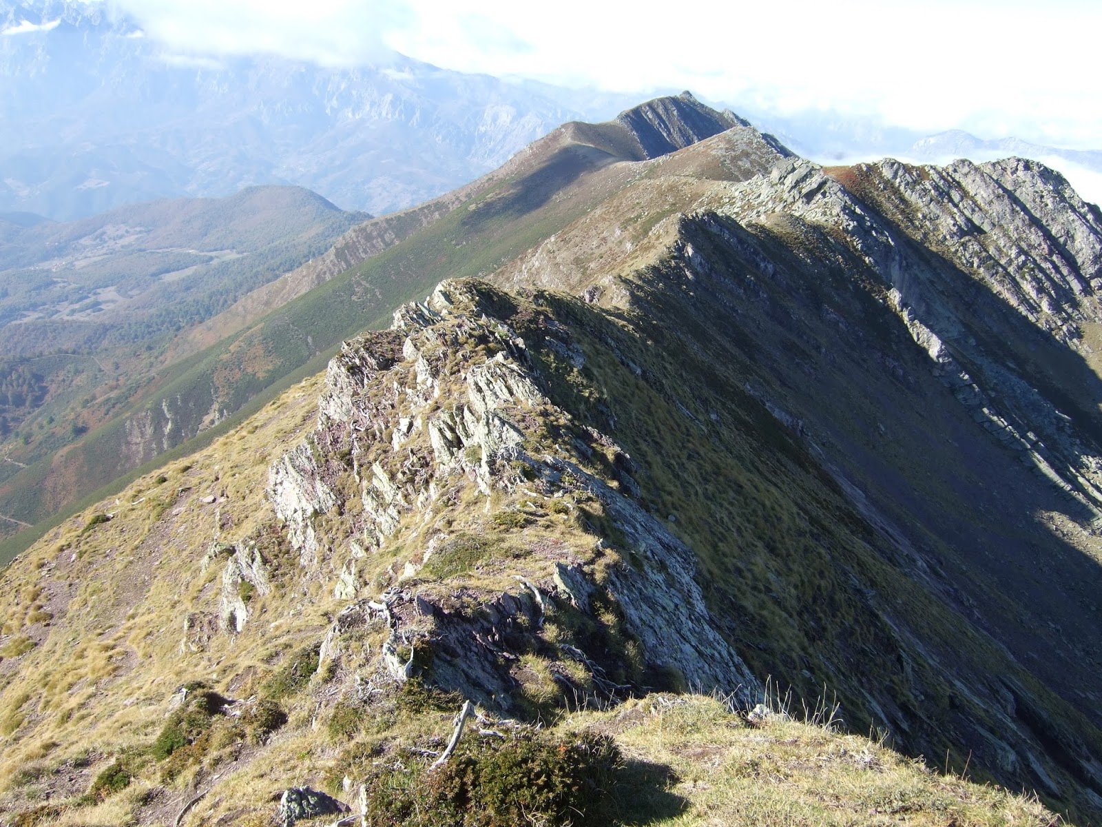
El Tumbo (o Las Segás) tiene dos cotas de la misma elevación (1841 m)
My idea was to start the approach from below the righthand summit and head up diagonally towards the left

El collado donde se juntan la pista que dejamos antes y la que hemos seguido. Al fondo Tresmares y Peña Labra
The point where the track we left joins the one we followed.

Unas huellas que me impresionan. ¿Serán de algún oso? Luego me confirman que se ven bastantes osos por aquí últimamente.
These tracks left me wondering. Could they have made by a bear? Locals confirmed to me later that there have been many bear sightings in this area in recent times.

Hace pocos veranos subí directamente a la cima con Jose Manuel, pero esta vez decidí ir en diagonal hacia la cima septentrional.
A few summers ago Jose Manuel and I went straight uphill to the summit only to find a cloud had got there first, depriving us of views.


El macizo oriental de los Picos poco antes de que las nubes cubrieron las cumbres
The eastern massif of the Picos just before they disappeared from view

Un detalle de la subida hacia la cima
The top seems quite near, but still a lot to do to get there

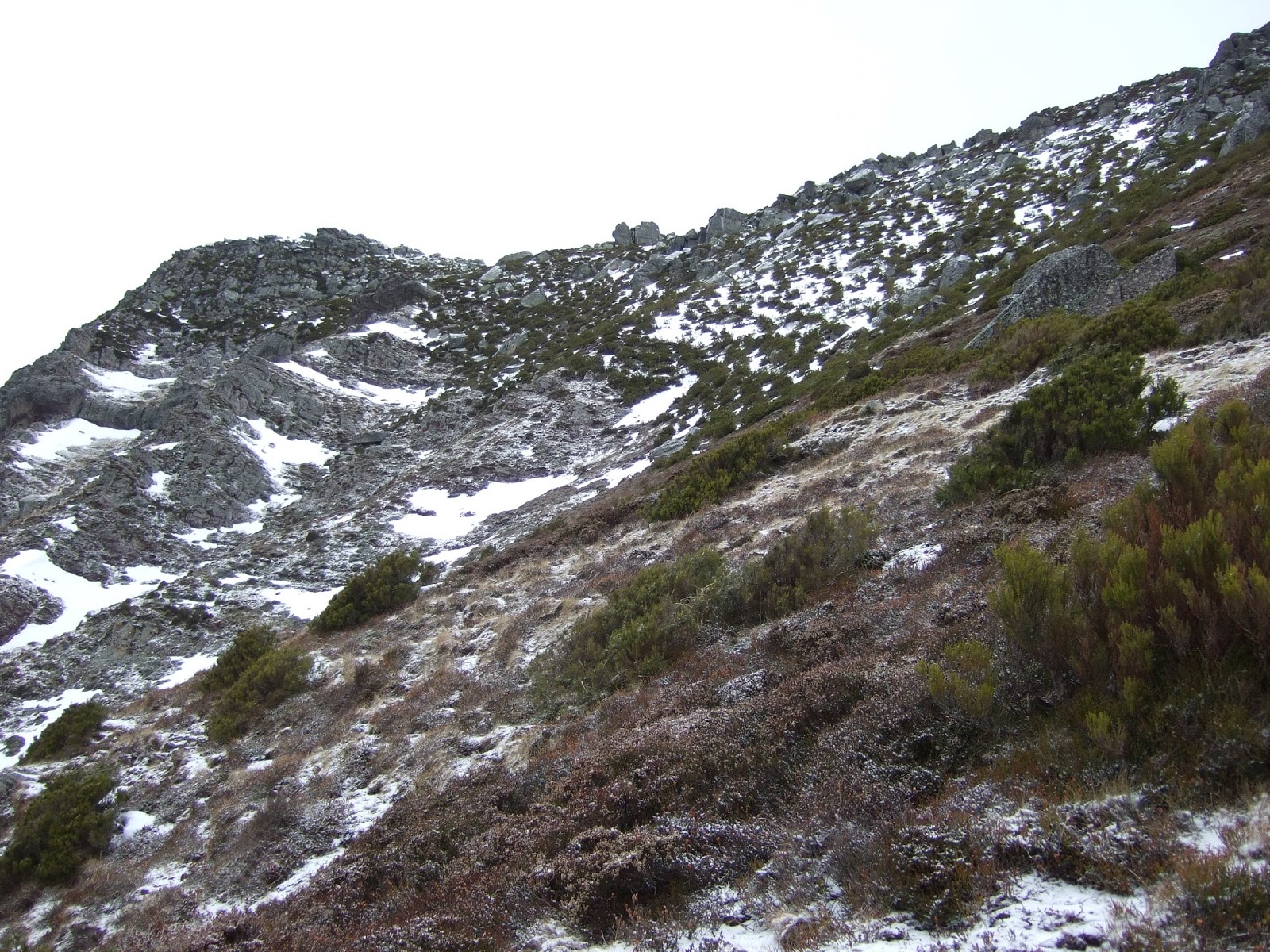
A medida que subía, el progreso se volvía más difícil por la pendiente y la nieve, así que en muchas ocasiones tuve que agarrarme a los arbustos para no resbalarme hacia abajo
The higher I got, progress became tougher due to the incline and the snow, so I was constantly grabbing onto the bushes to make sure I didn't slide down the hillside.

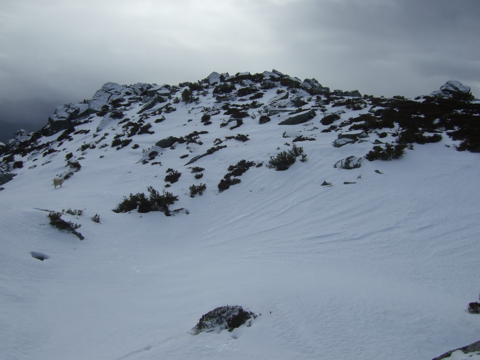
El viento y el frío aumentaban, y superé ese momento tan conocido de pensar "¿Para qué sigo avanzando? ¡Da la vuelta ya!" gracias al pensamiento igualmente conocido: "Hasta aquí he llegado; ¡me arrepentiré si no hago un último esfuerzo!" Así llegué a la cresta, y vi la sierra de las Cuerres al otro lado.
It got windier and colder and pushed me to the limits, but I persisted and got to the ridge. On the other side is the Sierra de las Cuerres

Los perros ya llegaban a la cumbre
Meanwhile, the dogs were already heading up to the summit

Hacia el norte está Peña Ventosa, mientras el Oriental ya empieza a estar escondido detrás de las nubes
To the north is Peña Ventosa, while the Picos are becoming engulfed in cloud

La costa
The coast

La Sierra de Peña Sagra continúa hacia el sureste: en el centro está el Pico Paraes, y detrás, medio tapado por una nube El Cuernón
The Sierra de Peña Sagra continues on to the southeast: in the centre lies Pico Paraes, and behind, half hidden by cloud, Cuernón

Abajo está Cahecho
Cahecho down below

Voy avanzando por la cima del Tumbo hacia la otra cota
I made my way along the top of the mountain towards the right

Otra foto hacia el Cantábrico
Another photo looking towards the sea


Paraes desde la cota meridional
Pico Paraes from the southern summit of Tumbo

Lo que pudo haber sido la última foto de Monty...
What could have been the last photo of Monty...


Bajé por aquí, aprovechándome de la nieve y agarrándome a los arbustos de vez en cuando, en dirección al collado entre el Tumbo y Pico Paraes, suponiendo que seguirían los perros.
I climbed down to the pass between Tumbo and Paraes, assuming the dogs would follow.

La bajada vista desde el collado. Por desgracia los perros no consiguieron bajar por donde lo hice yo, y tuve que dejar que buscaran otro camino. Me alcanzó el samoyedo una hora más tarde, pero no lo acompañaba Monty, lo que aumentó mi preocupación hasta que a eso de las 5 y media, apareció en Cahecho como un campeón.
The descent as seen from the pass. Unfortunately the dogs didn't come after me, and I had to leave them to find another way down. The samoyed caught up with me an hour later, but on his own, which really worried me. Finally, Monty showed up in Cahecho at about half past five, having found his way back using all his canine skills.

Un par de días después saqué esta foto de la sierra de Peña Sagra en Cabariezo. A la izquierda está El Tumbo, seguido de Pico Paraes, y a la derecha se ve la cima del Cuernón.
A couple of days later I took this photo of the Sierra de Peña Sagra in Cabariezo. On the left is Tumbo, followed by Pico Paraes, and on the right you can just make out Cuernón.


miércoles, 1 de noviembre de 2017

El Cuernón de Peña Sagra


El regreso a una sierra que me es especialmente querida, la de Peña Sagra. Salimos del pueblo de San Mamés en Polaciones
One of my favourite mountain ranges in Cantabria is Peña Sagra. As on several previous occasions, we set off from San Mamés in Polaciones

En frente, Peña Labra
Over to the south, Peña Labra

Esta salamandra paseaba por la pista con poco disimulo
Why did the salamander cross the road?

El Cuernón a la izquierda, luego Mesas la Yuncá y Berceju a la derecha
The highest point of Peña Sagra on the left is the Cuernón (the horn), with La Yuncá and Berceju to the right


El Cuernón desde Invernailles
Getting nearer


Al llegar a la base del Cuernón se ve la habitual (en mi experiencia) mar de nubes hacia el norte
At the foot of the Cuernón the other side comes into view, with the clouds hiding the coastline

La ascensión a la cumbre empieza siguiendo los hitos entre las rocas o (la opción más sencilla) cogiendo la senda un poco más abajo en la ladera del norte.
The climb to the summit begins by following the cairns from rock to rock or taking the easier option of walking along a path lower down on the northern side

luego no hay más remedio que cruzar hasta el lado sur
After that you're obliged to continue on the southern side

e ir de hito en hito. Los seguimos primero hacia arriba, luego a la derecha para finalmente ir a la izquierda, lo cual me resultaba un trayecto más largo que lo que recordaba, y al llegar a la parte final vi un hito que parecía indicar el final de otro camino de acercamiento más directo:
going from cairn to cairn. First up northwards, then to the right before finally going to the left, which was much longer than what I remembered from previous visits, and when we found the way up I saw a cairn that appeared to be the culmination of another more direct approach:

De todas formas, hay que subir por una chimenea sencilla, pero de espacio reducido.
In any case to reach the summit you need to climb up a simple but narrow chimney.


Al llegar arriba todavía hace falta trepar un poco por los bloques hacia la izquierda
On reaching the top you still have to clamber over the boulders to the left to get to the summit

y desde la cima se ve como la sierra continua hacia el noroeste, con los Picos medio escondidos detrás de una nube
and from there you can see how the range continues to the NW, with the Picos half hidden behind a cloud


mientras tanto, hacia el sureste, el siguiente punto más alto de la sierra es el Cueto Cucón
meanwhile, to the SE, the next highest point of the range is Cueto Cucón

Después de comer el bocadillo decido ir a explorar la cresta que separa el Cuernón del Canto de la Traspeñuela
After a bite to eat I decided to explore the ridge that leads from the summit to el Canto de la Traspeñuela


Al volver al comienzo del descenso aprovecho para sacar esta foto, donde se aprecian la Mesa la Yuncá y Berceju detrás de esta y un poco a la derecha
When I reach the point where I have to descend I take this photo, which shows la Yuncá, with Berceju a little behind and to the right

mirando hacia el principio de la crestería,
looking towards the start of the ridge,

que resulta ser más fácil recorrer que lo que había imaginado. Al fondo se ve el Pico Paraes.
which turns out to be easier to cross than I'd thought. In the distance is Pico Paraes.

Veo el Pozón abajo al norte
 I spy the pool between the clouds to the north

y detrás de mí el Cuernón
and the Cuernón behind me

Sigo el recorrido, bajando de vez en cuando a la izquierda para evitar las zonas más escarpadas
I continue along the ridge, dropping down to the left occasionally to avoid the trickier bits


Al final de la crestería  Canto de la Traspeñuela
At the end of the ridge is Canto de la Traspeñuela

Me toca volver, y sigo los senderos debajo de la crestería
Time to turn back, and this time I use the paths below the ridge

por fin se ven los Picos sin nubes encima
at last the Picos can be seen without cloud cover

La verdad es que esta manera de volver al collado entre el Cuernón y La Yuncá es mucho menos laborioso
Truth be told, this way of getting to the foot of Mesa la Yuncá is much less complicated

Las montañas de Campoo
The Campoo mountains, culminating in Peña Labra

Hacia Peña Prieta, el Coriscao y los Picos de Europa
Looking towards Peña Prieta, Coriscao and the Picos

Momentos de la bajada:
Moments on the way back down:


Una mirada hacia el Cuernón poco antes de llegar a San Mamés
Looking back at the Cuernón just before reaching San Mamés

Este reportaje no habría sido posible sin la amabilidad de Juan Carlos y Julio, que me hicieron llegar la cámara después de que la dejé encima del banco del pueblo. ¡Gracias de nuevo!
This post would not have been possible without the kindness of the two gents who returned my camera to me safe and sound after I'd left it on the bench in the village. Thanks again Juan Carlos and Julio!