domingo, 23 de febrero de 2020

Montes de Galdames / Mother language day in the Basque Country


Mi fiesta laboral cae en jueves y aprovecho para acercarme a Vizcaya, ya que hoy no habrá tanta afluencia de gente en los montes. Salgo de San Pedro de Galdames y subo por una carretera enfrente del ayuntamiento. Es una mañana preciosa, se oyen muchos pájaros y sensación bucólica total. El camino es empinado y en seguida se ve el Pico la Cruz, donde estaré más tarde.
It's Mother Language Day, so I have a day off work. I head to San Pedro de Galdames in the Basque Country as the countryside there will be rather less crowded today than it tends to get at the weekends.  I take a steep lane up from the town hall, and soon spy Pico la Cruz up above.

Paso cerca de la aldea de Laia
Past Laia

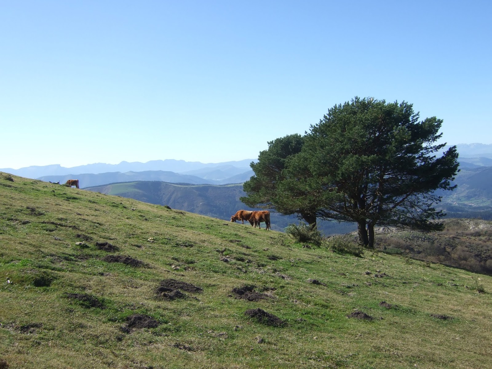
Cerca de una cantera me equivoco de camino, pero me da buenas vistas del oriente de Cantabria además de los nidos de la oruga procesionaria en los coníferos
Near a quarry I take a wrong turning, but it gives me good views of the mountains of Eastern Cantabria and also of pine processionary larvae tents

Vuelvo a la carretera, pero antes de llegar a Ledo la dejo por la izquierda por esta pista de tierra
I return to the lane and before reaching Ledo I take a track off to the left

Después de pasar por un bosque, llego a una zona despejada camino a las antiguas minas de hierro de donde parece que se origina la interjección "alirón". Los mineros ingleses gritaban "All iron!" (¡Todo hierro!) al descubrir las vetas de la zona
After coming through a wood I get to a sparsely vegetated hillside, with the odd juniper tree -  Monty Python's Holy Grail comes to mind. Ahead of me lie the now abandoned mines that were the biggest source of iron ore in Europe during the 19th century


Desde una curva cerrada miro hacia atrás, con el Pico la Cruz arriba a la izquierda
From a bend in the track I look back, with Pico la Cruz up to the left

Allí mismo dejé la pista y usando las marcas blancas y amarillas como referencia subí hacia el norte. Hay restos de los casetones de los mineros. Al fondo el Dulla.
I leave the track just after the bend and using the yellow and white markings as reference head up to the north. There are several mining huts in ruins. Dulla is silhouetted on the horizon.

Sigo hacia el norte bordeando restos de la actividad minera. En una depresión veo las indicaciones de la ruta "Peñas Negras" hacia la derecha. Me acompañarán estas señalizaciones hasta el cruce entre Gasterantz y Pico la Cruz. Me llama la atención ver que se acerca otro senderista, al que saludo (en castellano); recibo el silencio como respuesta y luego me contesta en vasco -  al fin y al cabo era el día de la lengua materna...
I carry on northwards skirting old mine workings. When I get to a depression I follow the signposted "Peñas Negras" walk to the right. A walker appears and responds to my greeting in Spanish with silence, then a word in Basque - it is Mother Language Day after all...

El camino desciende y tuerce hacia la derecha para pasar por debajo de esta roca
Not long afterwards the path drops down and changes direction to the right, leading under this rock

Después de entrar en un pinar, llego a un cruce de caminos y voy a la derecha; más tarde en el cdo. Grumeran (nombre este por el que también se conocen estos montes) un camino aparece desde la izquierda; la ruta balizada sube en diagonal hacia el SSE y al salir del bosque llego a una campa con subida al punto más alto de la ruta
After a while I reach a wooded area and then turn right at a crossroads; later, at Grumeran col, where a path joins from the left, the signposted route takes me up diagonally to the SSE and on coming out of the woods I find myself on a grassy slope leading up to the highest point of the walk

En esta zona dos ciclistas que bajaban la cuesta mientras charlaban en castellano me saludaron en euskera al pasar. Les devolví el saludo en mi lengua materna...
Two mountain bikers coming down, talking to each other in Spanish, greet me in Basque. I reply in my own mother tongue...

Hacia el este se divisa el Gran Bilbao
To the east is Bilbao port


Desde el Ganeran intento reconocer algunos montes de Cantabria desde un lado que no suelo frecuentar: el Pico de las Nieves (hacia la derecha), Mortillano y Rocías en el centro, y los restos de nieve hacia la izquierda señalan Castro Valnera
From Ganeran I try to work out which the mountains to the west in Cantabria are from a side I'm not used to seeing them from


Justo enfrente está el Pico la Cruz
Just opposite is Pico la Cruz


Bajo hacia el sur a un collado y entro en otro bosque, subiendo hasta el Gasterantz, una cima donde ha habido un incendio. De allí sigo el sendero hacia el oeste.
Now down to a col and into another wooded area, then up to Gasterantz, where I don't stay long as there has been a fire recently. From here I follow the path to the east.

Me acerco al collado debajo de Pico la Cruz, cuya cima se alcanza con una divertida trepada
I make my way to the col at the foot of Pico la Cruz, and then there's an enjoyable clamber up to the top

Desde la cima se ve San Pedro abajo
San Pedro from the summit

la zona por donde subí, con la cantera en el centro
the route I've followed, with the quarry in the centre

la subida desde Grumeran
the walk up from Grumeran

Ganeran

 el camino desde Gasterantz, escondido entre los árboles
the walk from Gasterantz, hidden by the trees

 al sur el Eretza, el punto más alto de la cordillera
to the south is Eretza, the highest point of the range


De vuelta al collado, bajo a la derecha hacia un hoyo, y rodeo la base de Pico la Cruz hacia la derecha. Abajo está San Pedro. Ésta es la parte más incómoda de la ruta. Ya no hay sendero y hay que bajar directamente hacia el oeste hasta encontrar una zona de bosque imposible de atravesar. Lo bordeé hacia la derecha (NO) durante un buen rato, aprovechando de los caminos de los animales hasta llegar a un pinar donde el sendero que lo bordea se hace más claro
Back down at the col, I descend to the right and go round the base of Pico la Cruz to the right. Below lies San Pedro. There is no path and you have to go downhill to the west until the undergrowth makes it impossible to carry on. Then go right along the edge of the wooded area for a while (NW)  following occasional animal tracks as far as a pine plantation, where the path becomes clearer

Así se llega a un barranco, y el sendero gira hacia el oeste, y aunque luego desaparece es evidente por donde hay que bajar, por una zona bonita entre encinas
Eventually I get to a gully and the path curves round to the west before disappearing; the way down is obvious though, over rocky ground between the holm oak trees


Detrás de mí las nubes están llegando
Behind me clouds are approaching

Al llegar a una zona alambrada cojo una senda a la izquierda que llega enseguida a unas casas. Sin entrar en la aldea sigo una pista que baja a la derecha y me lleva a San Pedro.
When I get to a wire fence I take a path to the left and soon reach some houses. Without entering the village I take a track down to the right that goes down to San Pedro.


sábado, 1 de febrero de 2020

El Alto Asón


Aparcamos a la entrada de Valdició y subimos por una carretera al este hacia el Barranco del Sendero. Los tornos en el camino que cogimos se ven en la foto. Más adelante a la derecha se ve el Porrón, que luego subiríamos
We set off from the first house you get to in Valdició (near San Roque de Riomiera) and headed east. The bends in the road can be seen in this photo. Over to the right is the Porrón, which we would go up shortly

El Porrón
Al fondo a la izq. está Porracolina
Porracolina is on the left
El Romeral

Cuando estábamos enfrente del Porrón, dejamos el camino y fuimos a la derecha (NO), bordeando un camino a nuestra derecha antes de subir una ladera directamente para llegar a las ruinas de una cabaña al pie del antecima del Porrón. Subimos hacia la derecha pero luego la subida se puso extremadamente pindia así que habríamos hecho mejor en atacar la cuesta directamente hacia arriba. Ya que hay que llegar al pico que se ve detrás a la izq. quizás se podría rodear el antecima por el lado este
When we were opposite El Porrón we left the track and turned right, keeping to the left of a path and then going straight up the hillside, coming out by the ruins of a stone hut. The next stage is a steep climb up to the left

A medida que vas subiendo las vistas empezaban a ponerse espectaculares. Los Picones de Sopeña, delante, con los Picos detrás
As you get higher, the views get better and better. 


Ahora hay que bajar un poco antes de llegar al Porrón. Luego iremos hacia Pizarras, más allá de la nieve que se ve arriba a la derecha
Straight ahead is the summit of the Porrón. After that we'll head up to Pizarras, above the snowline to the right

Luego andaremos por el cordal de enfrente
We'll be walking along the ridge later on


Bajamos del Porrón y acometemos la subida de Peña Blanca enfrente. Hay un sendero débil, que después de pasar el primer obstáculo rocoso, va en diagonal hacia la izquierda. Hacia la derecha se ve Castro Valnera. 
We carry on in the same direction, coming down from the Porrón before going up the other side. There is a faint path, which veers to the left once you get past the first rocks. Over to the right is Castro Valnera

La subida herbosa que se ve entre las rocas parecía prometedor, pero hay una subida más fácil justo detrás del resalte rocoso, por lo que bajamos un poco para rodearlo
The grassy strip between the rocks looked promising, but there's an easier way up just the other side of the outcrop that juts out.

En el siguiente escalón encontramos nieve y ¡también tres jabalíes! Fuimos hacia arriba, trepando donde era necesario y con tendencia a la izquierda para evitar la nieve. Este fue el último paso, visto desde arriba
On the level above the rocks we were surprised to see three wild boar, who kept their distance from us, moving up to the right through the snow. We went in the same direction for a while and then, after  clambering up the next rocks we encountered, headed to the left. This is the last pass we negotiated, as seen from above


Y ya nos encontrábamos arriba. Hacia la izquierda Carrío y a la derecha El Esquinazo del Carrío
Now we were onto the uplands. Towards the left lies Carrío and on the right is the rockface we'll go up later on our way there


Subimos Peña la Llusa antes de seguir en suave ascensión a la derecha para llegar a Pizarras. El Picón del Fraile se ve al fondo a la izquierda
We make our way up Peña la Llusa before continuing to the right up the gentle incline to Pizarras. Picón del Fraile is away to the left

Desde Pizarras mirando hacia Castro Valnera
From Pizarras, looking towards Castro Valnera

Dimos la vuelta y fuimos en dirección NE por el cordal. Mirando al lado derecho se ve el Mortillano al fondo a la izquierda
We turned round and headed northeastwards along the ridge. On the righthand side lies Mortillano (in the distance on the left of shot)

Vamos hacia el escarpe que se ve en el centro
Next towards the scarp in the centre of the photo

A la izquierda está Porracolina pero solo vamos a ir hasta Carrío (der) antes de bajar otra vez a Valdició
On the left is Porracolina, but we only plan to go as far as Carrío (right) before going back down to Valdició

Por aquí se sube
Threre's a pathway up through these rocks

Abajo a la derecha se ven un par de cabañas
Down to the right lie a couple of huts

Seguimos de frente hacia Carrío. A la derecha está Porra la Colina 
We carry straight on to Carrío. Behind it and to the right is Porra la Colina

Al fondo la costa y Santander
In the distance is the coastline and Santander

Peña Lusa en el centro
Peña Lusa (centre)

Una mirada hacia atrás; Pizarras en el centro
Looking back; Pizarras in the middle

Al fondo, el Mazo Grande
Mazo Grande in the distance

Desde Carrío tenemos esta vista de Porracolina, Peñas Gordas, el Mosquiteru y Peña Lavalle, con la costa detrás
From Carrío we are treated to this view of Porracolina (left) Peñas Gordas and Peña Lavalle (right)

Ahora bajamos la ladera pindia hacia el norte. Hay un paso entre estas rocas que nos permite llegar al collado: el Alto de las Hazas Bravas
We now go down the steep slope to the north. There's a passageway through these rocks that enables you to get down to the col

Luego cogeremos un sendero a nuestra izquierda para bajar hacia el oeste. Una mirada atrás hacia Carrío
We'll then take a path down to the west. A look back at Carrío

El sendero no está muy definido al principio, si tenemos en cuenta que ya estamos en la GR-74
The path isn't particularly well-defined to begin with, bearing in mind that this is part of the GR-74

Después de un rato llegamos al camino por donde habíamos subido y así completamos el círculo
After a while we come onto the track we'd walked up earlier on and so we complete the circle