Salimos del aparcamiento del Cdo de Hoja, confiando que esta vez la meteorología no nos impediría llegar a nuestro objetivo. Disfrutamos como siempre de las vistas bonitas de las sierras que rodean Bejes.
We set off from the carpark above Bejes, hopeful that bad weather would not intervene this time. As usual we enjoyed the views of the mountain ranges that surround the village.
 |
| Macizo de Peñarrubia |
 |
| La Cerralosa |
 |
| Peña Ventosa y Peña Sagra |
Nunca puedo resistir sacar una foto de este abrevadero
The most photographed water trough on these pages!
En la última excursión por aquí renunciamos por la niebla y subimos el Cueto de la Llosa (centro-derecha)
Last time we were here low-lying cloud prevented us continuing beyond the Puerto de las Brañas and we walked up the hill you can see centre-right before returning to base
La entrada a la Canal del Valle
The entrance to the gorge
Pasamos un buen rato en un atasco de vacas que solo conseguimos adelantar un poco antes de la Canal del Valle
A bovine traffic jam held us up a bit and it took some time to get ahead of the herd
 |
| La Canal del Valle |
Desde el Cdo de la Llaguna en lo alto de la canal vemos como las nubes suben sin parar. Nos quitarán vistas pero no impedirán la subida
The view from the top of the gorge. The clouds were to take away most of the views but at least they didn't stop us in our ascent
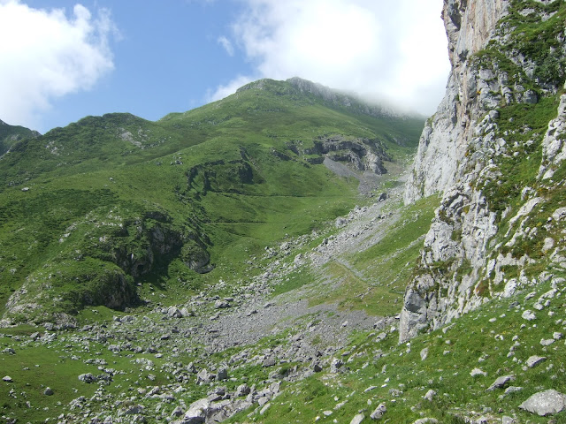
La laguna esta en la parte izquierda del collado, pero hay que subir hacia el lado derecho para arrimarse a la Paré Corvera
There is a pool is on the left, which gives the pass its name, but to continue the walk you have to go up to the right and find a path at the foot of the cliffs
Vamos en dirección a la Canal de San Carlos, bordeando la pared hasta intuir el Rendijón, que ofrece una subida a la parte de arriba de la Paré Corvera. Antes de llegar hasta allí, sin embargo giramos a la derecha por esta entrada entre las rocas. Esta es la Hendida, que nos habían recomendado coger.
We follow the cliff westwards as far as a point just after going round a large rock, where a narrow entrance appears to our right. It's easy to miss as a more obvious gap in the cliff-face seems to be just ahead. This is the Hendida, and we'd been recommended to take it rather than the Rendijón just a bit further along.
En seguida el sendero nos lleva a esta perspectiva por encima de la pared
Very soon the path brings us to this point, with views above the cliffs
Giramos hacia la izquierda y vamos hacia la canal
We bear left and go up towards the gully
Es una trepada sencilla y divertida
It's an enjoyable scramble up
Al salir de la Hendida, vemos el Samelar
On coming out we see Samelar ahead of us
y una montaña más baja que visité la última vez que estuvimos en el Samelar
and a slightly lower mountain I explored last time we were on Samelar
 |
| Canto la Concha |
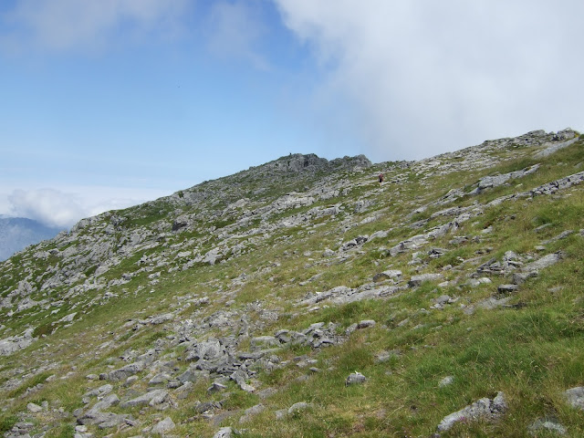
Fuimos hacia lo que suponíamos era la parte más alta de Paré Corvera (centro) pero cuando llegamos, nos dimos cuenta que habíamos dejado la cima atrás a la derecha
We walked up to what we supposed was the highest point of the clifftops (centre) but when we got there, we realised we'd left the summit behind on our right
Así que subimos un poco hacia la pila de piedras que indican el Alto las Verdianas. Tuvimos que esperar un rato hasta poder disfrutar de vistas parciales del oeste y el sur
So we made our way to pile of rocks that mark the Alto las Verdianas. We had to wait a while to be able to enjoy partial views to the west and south
 |
| Samelar |
Mi idea había sido seguir por Las Becerreras, hacia el norte, y luego bajar hacia la derecha y alcanzar la pista en el Puerto de las Brañas, pero la nube nos iba a quitar las vistas
My original idea had been to descend by heading towards the north and then going down to the right so as to get back onto the trail we came up on, but the cloud would have left us seeing nothing
así que decidimos volver por la arista donde habíamos estado hacía pocos minutos y seguir hasta un paso que nos llevaría a la Canal del Valle otra vez
so we decided to go back along the ridge to where we'd been a few minutes previously and then continue as far as a pass that would take us back down to the Canal del Valle
Aparece el collado de la llaguna
The pool comes into sight down below
 |
| Collado de la Llaguna |
 |
| Canal del Valle |
y llegamos a Treslaparé, donde arranca el Sendero del Palo. No teníamos información sobre el estado de esta senda. La primera parte baja por una zona herbosa
We got to the point where the Sendero del Palo starts. We had no idea what this path was like except that it existed. The first part runs down a grassy slope
y luego hay alguna zona un poco expuesta antes de subir por la cuesta de la foto
and then a continuation where you have to be very careful not to miss your footing before making your way up the next knoll
Nada más empezar a bajar por el otro lado hay un destrepe que precisa de buena técnica o (como en mi caso) de piernas largas.
As soon as you start the descent on the other side there is a tricky section to climb down which requires good technique or (as in my case) long legs.
Luego a bajar, entrando brevemente al campo visual de un espectador hipotético en la Canal, antes de volver a subir. Finalmente la lengua herbosa te saca a espacios más suaves y se puede bajar a la Canal del Valle tranquilamente
Thereafter, you carry on down, reappearing briefly to a hypothetical onlooker from the gorge below, before going up the next grassy bank. Finally you reach a gentler section and can follow the grassy patch down to the left and make your way to the Canal del Valle
A esta foto de octubre del '19 he dibujado por donde va la parte del sendero que sería visible desde la zona alta de la Canal del Valle
On this photo from October '19 I've marked the part of the path that would be visible from higher up the gorge
Y para acabar, la parte baja de la canal florida
A flowery conclusion, near the bottom of the gorge
Aunque el Alto las Verdianas es la cumbre más oriental de Picos de Europa que supera los 2000 metros no es especialmente vistoso. Lo más llamativo de esta ruta han sido los accesos al mismo. Y el hecho de que en otras ocasiones el no encontrar el camino, el viento o la niebla parecían haberlo convertido en ¡una montaña maldita!
Finalmente, El Sendero del Palo no es una bajada recomendable para el senderista medio.
Although Alto las Verdianas is the easternmost summit in the Picos de Europa to exceed 2000 metres, it doesn't really stand out. The most memorable part of this excursion were the points of access to and from the ridge. Added to that, after previous failed attempts, owing to not finding the gully up from the pool, the strong wind or the fog, it was satisfying to tick it off the list! N.B. The Sendero del Palo is not a path I would recommend to the average hiker.
El track de la ruta:


