martes, 28 de febrero de 2017

Pico San Vicente


Ya tocaba probar la rodilla, y como escenario escogí un pico que no subía desde hace años. Aparqué a la salida de Ramales y empecé a andar un poco antes de la gasolinera bajando a la derecha por una pista que se convierte en seguida en un sendero. A los pocos minutos encontramos el asfalto - un camino que baja de la general, y vamos a la derecha para cruzar el río Gándara. Hacía un tiempo muy soleado.
I chose a mountain walk in east Cantabria to test my knee. Leaving the town of Ramales we crossed the river Gándara and followed it upstream to the south. Another lovely sunny day in store.

Vamos a la izquierda, siguiendo el río, continuando por la izquierda en un cruce, viendo el Pico San Vicente a nuestra derecha. Se bordea por la izquierda antes de acometer la subida final.
I last went up Pico San Vicente about 20 years ago, but this time the starting point was lower down. The walk was to take us round to the left on the mountain before beginning the final ascent.

Hay que estar atentos cuando empezamos a subir por una pista, para coger un sendero a la izquierda donde está indicado Manzaneda (abajo a la izquierda aparece una piscifactoría), y bajamos para ponernos a las orillas del río.
The path starts to go up but almost at once you take a signposted path to Manzaneda to the left (below to the left there's a fish farm) and go back down to the river bank.

Entramos en un encinar y empezamos a ganar altitud
We then entered a holm oak wood and the walk was uphill from there on.

En un punto hay una cueva donde se podría imaginar perfectamente a los del Clan del Oso Cavernario. A través de una "ventana" en la roca vemos la Peña Busta hacia el este
At one point there's a cave which I could perfectly imagine the Clan of the Cave Bear inhabiting. Through a gap in the rocks you can see Peña Busta to the east


Salimos del bosque y vemos la zona entre los Tornos y La Sía en frente
We come out of the woods and enjoy the view to the south.

Ahora tenemos una perspectiva distinta del Pico que vamos a subir
The mountain looks quite different from the side.

Entramos en el barrio de Manzaneda y empezamos la última parte de la excursión, siguiendo una flecha al lado de "La casa del Lirón"
We begin the last part of the climb in Manzaneda, following an arrow that points north.

Poco a poco se hace más empinado
It gets steeper and steeper


Pero la recompensa son las vistas desde arriba. A nuestros pies está Ramales y el Buciero de Santoña más allá en la costa.
But the reward is at the top, with this view of Ramales down below and Santoña on the coast.


La Peña del Moro a la izquierda, y en el horizonte se intuyen Anboto y Gorbeia
To the left of Peña Busta is Peña del Moro and Basque mountains Anboto and Gorbeia on the horizon.


Soba - los montes nevados de la derecha serán Imunia y Peña Lusa, con Castro Valnera detrás y el Picón del Fraile a la derecha
The view to the southwest


a continuación La Sierra del Hornijo
and round to the west.


Antes de bajar de la cima saqué otra foto donde se distingue la primera parte del camino que había cogido, hasta el campo de flores amarillas y después la piscifactoría, que se ve claramente
Before going back down I took another photo where you can see the first part of the walk, with the field with yellow flowers and then the fish farm between the gap in the rocks.

tardé la mitad en bajar que subir - la verdad es que ¡noté mucho la inactividad de las últimas semanas!
It took only half as long to get back down to Manzaneda as going up had taken. I can tell you I really noticed the layoff!

Mi idea original era buscar un camino que me llevara al Humilladero de la Canal para luego volver a Ramales por la GR-74, pero no lo encontraba y además, no apetecía mucho andar por pista bajo el sol, así que volví a Manzaneda y bajé otra vez por el bosque. La foto muestra Pico San Vicente desde el SO.
I had originally planned to head west and pick up the GR-74, but couldn't find the path, and anyway, the idea of following a trail in the hot sun (I kid you not) didn't appeal especially so I turned back to the wood again. The photo shows Pico San Vicente from the SW.


Ya estamos otra vez donde el campo de flores amarillas, que puede ser canola o colza (no sé bien cómo se dice)
Back beside the river. I don't know whether this is rapeseed or not.

El sol quedaba por detrás del Pico
The sun was now behind the peak.

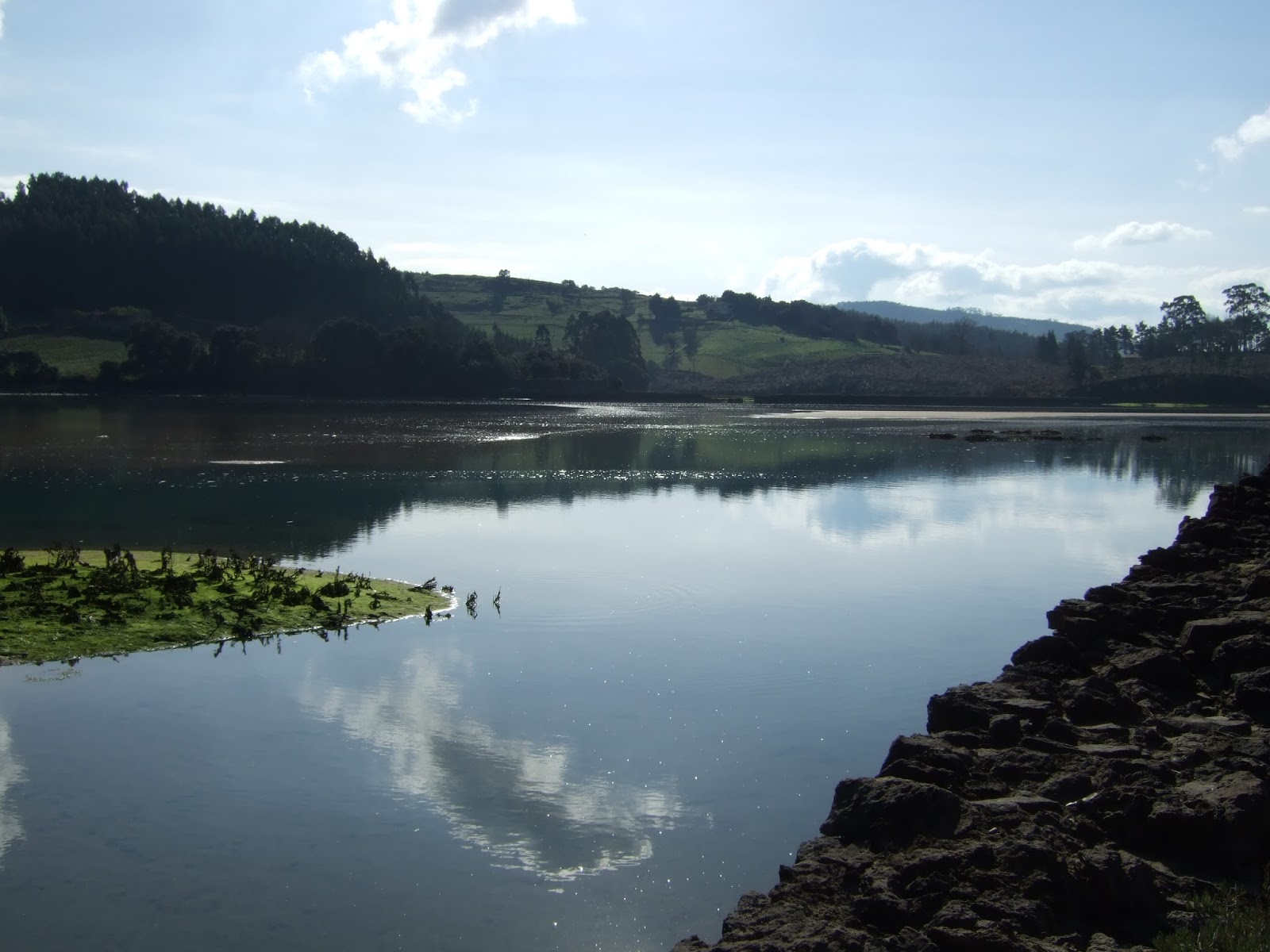
Y para acabar, cuando llegué a Ramales decidí echar un vistazo al lugar donde se juntan los ríos Gándara y Asón, ya que me ha dado por ahí últimamente. He añadido más fotos en la entrada correspondiente de enero
And to finish, when I got back to Ramales I went to have a look at the place where the river Gándara joins up with the Asón - one of the main rivers in Cantabria. I've added more photos to a recent blog entry

Y ¿la rodilla? bien gracias.
I'm pleased to report that my knee survived the ordeal OK.

miércoles, 22 de febrero de 2017

En torno a Ajo / Round about Ajo


El pueblo de Ajo. A la derecha está la iglesia, donde empecé a caminar. Al fondo, en el centro, se intuye el faro, y se ven las olas que rompen en la playa de Cuberris a la izquierda.
The village of Ajo. On the right is the church, where I started my walk. In the distance, in the centre of the photo you can just about make out the lighthouse, and the waves breaking on Cuberris beach are visible on the left.

Desde la iglesia está señalizado el paseo que bordea la ría de Ajo. Al principio sigue una carretera que va hacia el este
The walk to Ajo estuary is signposted from the church. It starts along a road heading east.

En este punto sigue siendo el río Campiazo
It's still the river Campiazo at this point

Se convierte en ría un poco más adelante
It then becomes the Ajo estuary

La carretera sube un poco hasta una barriada (Convento), donde hay que seguir de frente hasta llegar a este edificio (El Convento de San Ildefonso). Hay que ir a la derecha y justo al lado del convento se coge un sendero a mano izquierda.
It then climbs a little to a built-up area, where you carry straight on till you get to the San Ildefonso Convent. Turn right and then, next to the convent, left along a path.

Bajamos suavemente hasta la orilla de la ría. A partir de aquí empieza la parte más bonita de la ruta.
The path descends gently to the waterside. This is where the most picturesque part of the walk begins.


Muchos peces, aprovechando de la ausencia de aves.
Lots of fish in evidence - making the most of the lack of water birds.


El sendero continúa muy cerca de la ría con varios sitios donde puedes llegar hasta el agua. Finalmente se vislumbra el mar abierto.
The path runs alongside the estuary, with several spots where you can come right up to the water's edge. Eventually the open sea comes into sight.


En este punto hay que subir a una urbanización, que impide la posibilidad de seguir bordeando el agua. Perdí bastante tiempo buscando una salida de de la zona urbanizada (La Sorrozuela), pero por fin acerté en subir por la calle que estaba de frente de las escaleras que me traían de la ría, y siguiéndola hacia la izquierda subí hasta el final de las casas donde vi unas escalones a la derecha. A partir de aquí podía otra vez ir bordeando la orilla, ahora del mar, y llegar al cabo de Ajo.
The path comes to an end and you have to walk up some steps to a residential area (La Sorrozuela) where I lost a bit of time trying to find a way out. The street I should have gone up from the start (continuing on from the steps up from the waterside) curves round to the left and soon exits the estate. A stile appears on the right and once over I could get back to following the coastline round to the cape of Ajo.


Este sitio se llama la ojerada.
The name given to this formation makes reference to the eyes it resembles.


Llegué demasiado tarde para la marea alta, así que perdí los bufones que hay por la zona, salvo éstos.
I got here after the tide had turned, so missed the geyser-like jets of water that come up through cracks in the limestone. Something similar can be seen at the foot of the cliff opposite.

Detrás queda la entrada a la ría
The entrance to the estuary lies behind me

Siguiendo por la costa hacia el oeste llegas a la Punta del Rostro, que debe de ser ser el punto más septentrional de Cantabria
Continuing along the coast we reached the northernmost point of the province.

El faro de Ajo. A partir de aquí me dirigía hacia el suroeste, sin perder de vista la costa.
Ajo lighthouse - a regional landmark. Hereafter I headed southwest, staying close to the coastline.


Después de atravesar unas fincas y una zona de casas llegué a la playa de Cuberris. Costó un poco encontrar un sitio donde Monty podía baja a la arena...
After crossing a few fields and coming out near some houses, we got to Cuberris beach. I had to find a place where Monty could avoid the worst of the karst and get down to the sand...

pero una vez allí disfrutó de lo lindo.
but once there he made the most of it.

La playa con el faro a la derecha a lo lejos
The beach, with the lighthouse in the distance

Desde la playa hay que subir un poco a la izquierda y luego ir a la derecha en un cruce. La carretera dibuja una curva y sube hasta unas casas y pronto se ve la iglesia donde cerramos el círculo. Un paseo agradable que no llegó a las 5 horas. Desde luego tuvimos suerte con el tiempo - parecía un día de primavera total.
From the beach you go up the hill to the left then turn right. The road curves round and up to some houses, where the church we set out from comes into sight. A pleasant walk taking a little less than five hours. We were dead lucky with the weather too - a lovely warm springlike day.