lunes, 24 de julio de 2017

Jou de los Boches / A circular walk in the Urrieles


Mi primera excursión en los Picos de este año...
Primer regalo del día: este mar de nubes que se ve desde el mirador del cable
My first visit to the Picos de Europa this year...
From the top of the cable car we looked down on a sea of clouds


La primera parte de la ruta nos lleva por la pista hacia la Vueltona
The first part of the walk follows the trail northwards

Después vamos a la derecha por la Canalona. Mirando hacia atrás desde la mitad de la subida
We turn up right to the Canalona. A look back from halfway up

Acercándonos al collado de la Canalona
Nearing the Canalona pass

Mirando hacia Torre Blanca desde el collado
A view of Torre Blanca (the highest point in Cantabria) from the pass

Y hacia el otro lado la Morra de Lechugales y Peña Cortés
To the other side lies the eastern massif

Subimos un poco hacia la izquierda hasta el collado de Santa Ana. Bajamos por un sendero cómodo en diagonal hacia la derecha para llegar hasta el fondo: el Jou de los Boches
We go left up to the Santa Ana col (we are now in Asturias). We take a gentle path down diagonally to the right to get to the foot of the depression: the Jou de los Boches


A nuestra izquierda está la Torre de Horcados Rojos, y en la parte inferior derecha se ve la senda que subiremos después
To our left is the Torre de Horcados Rojos, and in the bottom right hand part of the photo is the path we will go up later

El jou debe su nombre a los muchos agujeros (boches) que hay en el fondo
The jou (depression) owes its name to the many holes (boches) in the crater

La niebla es constante en la zona de la Vega de Urriellu
The cloud is a constant towards the Vega de Urriellu

Llegamos abajo (un descenso de unos 350 metros) y conectamos con el sendero que viene del Urriellu
When we reach the bottom (having come down 350 metres) we take the path that comes from the Vega 

Ahora vamos hacia el oeste, y vemos el collado de Santa Ana arriba, donde empezamos a bajar
Now we're heading west, and can see Santa Ana col up above on our left, where we started our descent


Hay una subida de 200 metros hasta el collado de los Horcados Rojos
Next up is a 200-metre ascent to Horcados Rojos pass

La parte más baja del jou
The lowest part of the depression

Tiro Navarro a la izquierda, Santa Ana a la derecha del collado que se ve claramente con la nube detrás
The cloud helps focus our attention on the col we came down from, between Tiro Navarro on the left and Santa Ana on the right

Donde la subida se pone más pindia hay un cable para mayor seguridad que va hasta arriba del todo. Apenas lo tuvimos que usar, pero para los que bajan se agradecerá seguramente
Where the ascent gets steeper there is a cable that gives greater safety and which goes all the way up. We hardly needed to use it, but I'm sure I'd be grateful for it if I was coming down.

unos puntos amarillos indican el mejor camino
yellow dots show the best way to go


Una mirada hacia atrás
A look back

Hay que ir con cuidado, asegurando cada paso, pero se sube sin problemas - y lo dice alguien que sufre de acrofobia. Delante de nosotros está el collado de Horcados Rojos, con el pico Tesorero detrás
You have to take care, but it's not a scary climb - and I should know as I have acrophobia. Ahead of us is Horcados Rojos pass and behind that is Pico Tesorero, the geographical centre of the Picos


Desde el collado, disfrutamos de la vista clásica del Urriellu al fondo, y el Jou de los Boches a nuestros pies
From the Pass we enjoy the classic view of the Naranjo de Bulnes (Urriellu) in the distance, with the Jou de los Boches at our feet.

El collado de Santa Ana a la derecha. Se intuye la bajada en diagonal hacia la izquierda
Santa Ana col on the right. The path we took from there falls diagonally to the left


Para terminar, una imagen de la vuelta al cable, bordeando los Picos Santa Ana por el oeste, y con Peña Vieja visible entre las nubes
And finally, a photo taken on the way back down to the cable car; Santa Ana up to the left and Peña Vieja visible despite the clouds.

jueves, 6 de julio de 2017

El Cañón del Ebro / River Ebro Canyon


Temperaturas más bajas de las habituales para lo que es el verano me dieron la oportunidad de acercarme al norte de Burgos para conocer otro tramo del río Ebro.
Unseasonal low temperatures gave me the chance to spend a Sunday morning in the north of Burgos to discover another stretch of the Ebro river following a walk at the end of last year that did for my knee

El circuito que pretendía hacer precisaba localizar una senda supuestamente poco evidente, así que decidí empezar por ahí. No hubo problemas en encontrarla, a 4 km del cruce con la nacional N-623 en la carretera local que va a Pesquera de Ebro (ver foto). El sendero arranca en dirección suroeste.
I wanted to do a circuit rather than return the same way, and as there was a path that was potentially tricky to find, I decided to resolve any orienteering issues from the start. Happily, no time was wasted and the path I took was the right one. It heads off the road to the SW, 4km after the turnoff from the N-623 to Pesquera de Ebro (see photo).


Pronto se bifurca, y hay que escoger el ramal de la derecha. Poco después gira hacia la izquierda y empieza a bajar por un bosque de encinas. Es un paseo muy bonito. A través de los árboles se ve Quintanilla Escalada, y alrededor de media hora después de haber empezado a andar salimos a la pista que es la G-99.
The path soon comes to a fork. The branch to the right (W-NW) is the one to follow. It then changes direction and leads down through a holm oak wood to the west. A very pleasant walk. You see Quintanilla Escalada through the trees, and in about half an hour come out onto the G-99 trail.


Fuimos hacia la derecha, y en menos de 5 minutos me encontraba en el puente sobre el Ebro que recuerdo haber cruzado muchas veces años atrás cuando ésta era la carretera que se cogía para ir de Santander a Madrid.
I turned right and in fewer than 5 minutes was on the bridge over the Ebro and remembering frequent crossings when this was the main road to Madrid from Santander


Volvimos a la pista, y recorrimos un tramo que sigue el río, primero hacia el sur. La verdad es que al principio el agua que se ve es la que transporta un canal hasta una planta hidroeléctrica.
I retraced my steps and set off on the 9km flat stretch that follows the river, firstly to the south. There isn't much river to be seen at first though, as the trail runs alongside a channel taking water to a hydroelectric plant

El canal termina por pasar a nuestra izquierda y nos vemos al lado del río.
Eventually the channel crosses to our left and we get to come up to the water's edge.

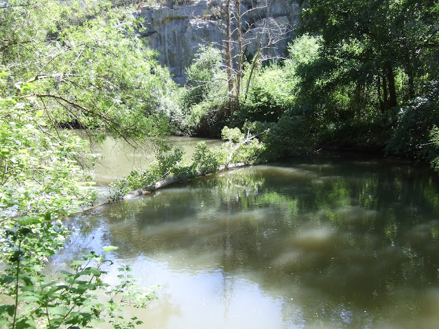
Arriba se ve el farallón que enmarca el cañón.
Up above the sheer cliffs of the gorge


Los primeros kilómetros siguen un meandro del río y la verdad es que la pista me estaba empezando a aburrir un poco. Luego llegamos a esta ermita coqueta.
As the river comes out of a long meander we reach a quaint chapel


Y después de pasar al lado de la planta eléctrica disfrutamos de la parte más bonita del paseo, ya que la pista se convierte en sendero y bordea el río
After passing behind the hydro-electic plant we enjoy the most pleasant part of the walk, following a path right by the river


Al final nos apartamos un poquito de la orilla antes de entrar en Pesquera
Eventually we approach Pesquera, and the path leaves the riverside

La vista río arriba desde el puente del pueblo
Looking upriver from the old bridge in the village.

Pesquera es uno de esos pueblos donde parece que sólo hay cobertura para móviles desde un punto - al lado de la iglesia. Así que mientras comía mi bocata era divertido ver como distintas personas se acercaban a la crucecita para hacer su comunicación
The churchyard is about the only point in the village where mobile phones can get a signal. While I ate my lunch, it was amusing to see different individuals coming to stand or sit next to the little cross to make their calls.

Pesquera se vanagloria de sus muchos escudos. Di un paseo por algunas de las calles
Apparently Pesquera is also known for its many coats-of-arms. Certainly worth a stroll through the streets
Este escudo se ve cerca de la salida del pueblo por la carretera hacia el suroeste
The last part of the walk took me up the road to the SW.

Si antes veía los farallones desde abajo, ahora están a mi nivel. El contraste me ayuda a apreciar la erosión que ha habido.
The clifftops seen previously from below are now at the same elevation as the rambler. It really brings it home how the rock has been eroded by the river down the years.

Al rato de salir de Pesquera hay un mirador donde se obtiene una buena vista del cañón. El río está a unos 100 metros por debajo de donde nos encontramos.
Soon afterwards you can leave the road and get a view of the canyon. The river is about 100 metres below at this point


Más adelante me acerqué a otro punto para apreciar el río
Another vantage point a little farther along

Ahora estamos enfrente del lugar donde empieza (o termina) el meandro
We are now opposite the point where the meander begins (or ends)

Justo abajo está la planta hidroéléctrica
The power plant is just below
y la ermita se ve hacia la derecha entre los árboles
and the chapel can be seen towards the bottom right

Llegamos al coche poco después. Menos mal - el tiempo veraniego volvía con paso firme.
We reached the car shortly afterwards. Just as well, as seasonal weather was returning fast...