jueves, 29 de noviembre de 2018

Noviembre/November


Agua y árboles en Palencia/Water and trees in Palencia

Los álamos bordean el río Pisuerga a su paso por el Cañón de la Horadada 
Poplars line the Pisuerga river near Aguilar


Los pinos cerca del embalse de Aguilar
Pines near the reservoir


la montaña palentina al atardecer
the mountains at dusk


Otoño en el bosque de Ucieda/Autumn in Ucieda woods

Los tonos inconfundibles de las hayas 
the unmistakeable hues of beech trees in November


Los acebos repletos de bayas
holly bushes stacked with berries


El valle de Iguña/Iguña valley

Los robles cobran protagonismo
Oak trees take pride of place


Montabliz

Hacia finales del mes, las hojas de la mayoría de los árboles caducifolios han caído al suelo
Towards the end of the month the ground is covered with the leaves of most of the deciduous trees


Fuera del bosque el cielo atrae mi mirada
Out of the woods the clouds in the sky demand our attention

Como también lo hacen algunas inscripciones hechas por el hombre, como en estas puertas contiguas en Pesquera
As do some man-made inscriptions, such as those above two doorways in Pesquera: the Town Hall on the right and the gaol on the left

o en esta fuente en el Camino Real a Bárcena
or on this fountain a mile south of Pesquera at the side of the 18th century thoroughfare to Bárcena

y más adelante una más reciente
and further along a more recent one 

La luz del cielo indicaba que no quedaba mucho del día 
The day was drawing to a close

 y otro bonito paseo llegaba a su fin
 as we approached the end of our walk


jueves, 22 de noviembre de 2018

Un paseo por el Valle de Iguña/ A morning walk


Esta caminata corta era una forma ideal de pasar la mañana antes de disfrutar del partido Inglaterra-Croacia a mediodía en casa
This shortish walk was an ideal way to spend the morning before getting back home for the 3pm kick-off that saw England through to the UEFA Nations finals.

Desde el pueblo de San Cristóbal, entre Las Fraguas y Los Llares, cogí el camino que sube al cementerio antes de continuar hacia arriba. Donde el camino gira hacia la izquierda lo dejé para conectar con una cambera hacia la derecha que va bordeando los praos.
From the village of San Cristóbal, in the Iguña valley, I took the narrow road that goes up past the cemetery and carries on uphill to the north. Where it turns up to the left I left it to follow a stony trail that took me most of the way up past the meadows.


San Cristóbal quedaba abajo
San Cristóbal below me


Cuando la cambera se acabe, usé la intuición para buscar una senda más pindia hacia una portilla. Después de una media hora de subida, ya me encontraba en una pista relativamente llana que viene de Pedrero. La seguimos durante una hora y media. Al principio parecía que iba a ser un paseo un tanto aburrido, ...
When the trail peters out, intuition leads you up a steep dirt path to a gate.  After about half an hour going uphill, you now get to a track that seems pretty flat in comparison, and you continue along it to the left for another hour and a half. At first it feels like it's going to be a fairly boring walk..

siendo lo más interesante las vistas a San Vicente de León al otro lado del valle.
with little more than views across the valley to San Vicente de León on the other side.

Pero este grupo de robles anuncia un cambio hacia un paisaje más bonito. Volveremos a este lugar a la vuelta, después de bajar por un camino que viene del cueto que está al SE.
But this clump of oak trees at a sharp bend heralds more picturesque countryside. We'll come back to this spot on the way back, after coming down from the hill to the SE.


luego los robles ceden el paso a los pinos
the oaks give way to pine trees

y llegamos a la braña de Rodil, donde poco después la pista conecta con la carretera que sube de Los Llares hacia la Braña de Brenes y el valle de Cieza.
and eventually we reach Rodil, just after which the track joins the road coming up from Los Llares to the Braña de Brenes.

Ya que me sobraba tiempo decidí subir a ver qué tal las vistas
 I decided to head uphill to see what the views would be like from the top

Justo antes de la última parte de la subida vi este abrevadero original con forma de pozo
Near the top an unusually-shaped round water trough for the cattle

y media hora después de haber llegado a Rodil alcancé el cordal. Descubrí de mi mapa que me encontraba en la Peña del Cuervo - un nombre que sólo asociaba con el lugar del bar La Pasarela en Santander
and half an hour after reaching Rodil I was at the top of the ridge. I discovered from my map that this was the Peña del Cuervo, which up to now I'd just known as the name of an area in Santander.

Mirando hcia Alto Campoo y Peña Sagra
Looking across to Alto Campoo and Peña Sagra

Al mirar hacia el este  mi forma de regresar quedaba evidente - seguiría el cordal hasta un poco antes del Cueto del Agua  (la colina en el centro de la foto) para bajar a la pista.
I made up mind to go back by following the ridge to the east almost as far as the Cueto del Agua (the hill in the cente of the photo) and then descending to the track again

Al principio se sigue una senda, pero al llegar a estas rocas hay que buscar otra forma de continuar - yo lo hice por la derecha, aunque el sendero no está bien marcado
Easy-going at first, but then you have to bypass the obstacles in your way on the right


Para que Monty no sufriera más con los escajos, en el siguiente obstáculo pasamos por la izquierda acercándonos a los árboles. Atrás queda la Peña del Cuervo.
and then on your left to avoid the gorse - definitely not Monty's cup of tea. Looking back at Peña del Cuervo

Luego hay que pasar por el bosque, guiándose por las estacas que indican la divisoria entre Iguña y Cieza
Then onwards through a wooded area, with wooden stakes showing the boundary between the Iguña and Cieza valleys.

En un claro empecé por seguir hacia el Cueto del Agua, pero al ver abajo el primer grupo de robles de antes, desanduve los últimos pasos y bajamos por el camino marcado por las rodadas que llegan hasta bastante arriba.
At a slight clearing I carried on a moment towards the Cueto del Agua but seeing the clump of oak trees below me, turned back to follow the ruts down the hill

Un paseo fácil para Monty y así volvimos a la pista
Monty was grateful for not having any more gorse to deal with and so we got back to the track

Una media hora más y habíamos llegado a la portilla por encima del pueblo, con Pico Jano enfrente, apenas visible a causa de las nubes.
Another half an hour and we were at the gate leading back down to the village.
Una caminata de 4 horas y media, seguida de la victoria de mi selección - ¡no se puede pedir más!
4 and a half hours' walk and a perfect result in the football to follow!

sábado, 27 de octubre de 2018

Entre Las Cuerres y el Tumbo / a red letter day

Aproveché un domingo soleado de otoño para subir desde el Valle de Bedoya al extremo norte de la Sierra de Peña Sagra, una ruta que me recordaba otra que hice con Carmen y Yuri hace años.
I chose a lovely autumn day to walk up from the Bedoya Valley to the northern end of the Peña Sagra Sierra, evoking memories of a walk Carmen and I did years ago with Yuri.

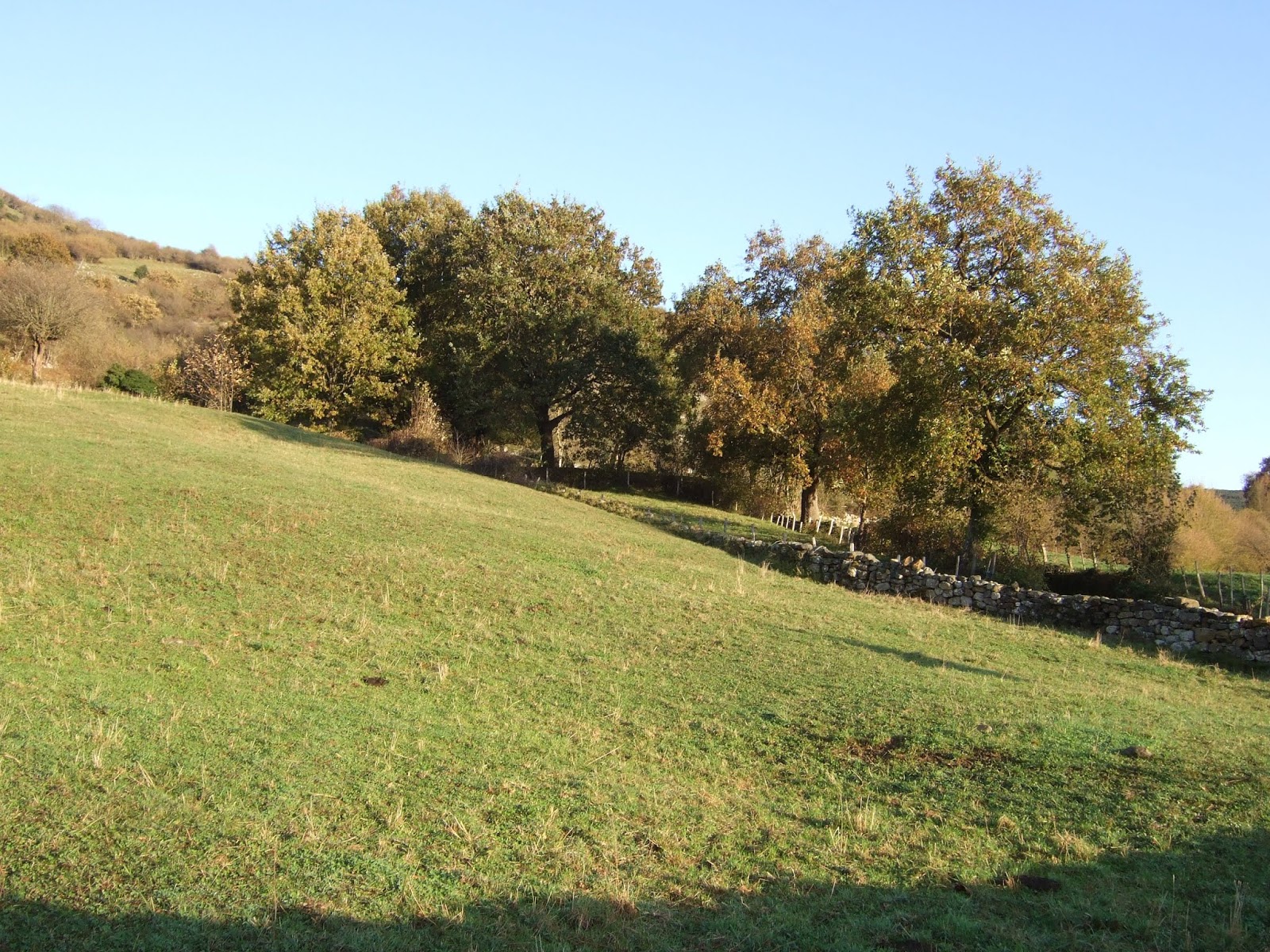
Peña Ventosa desde Salarzón, el pueblo más alto del valle.
Peña Ventosa from Salarzón - the highest village in the valley.

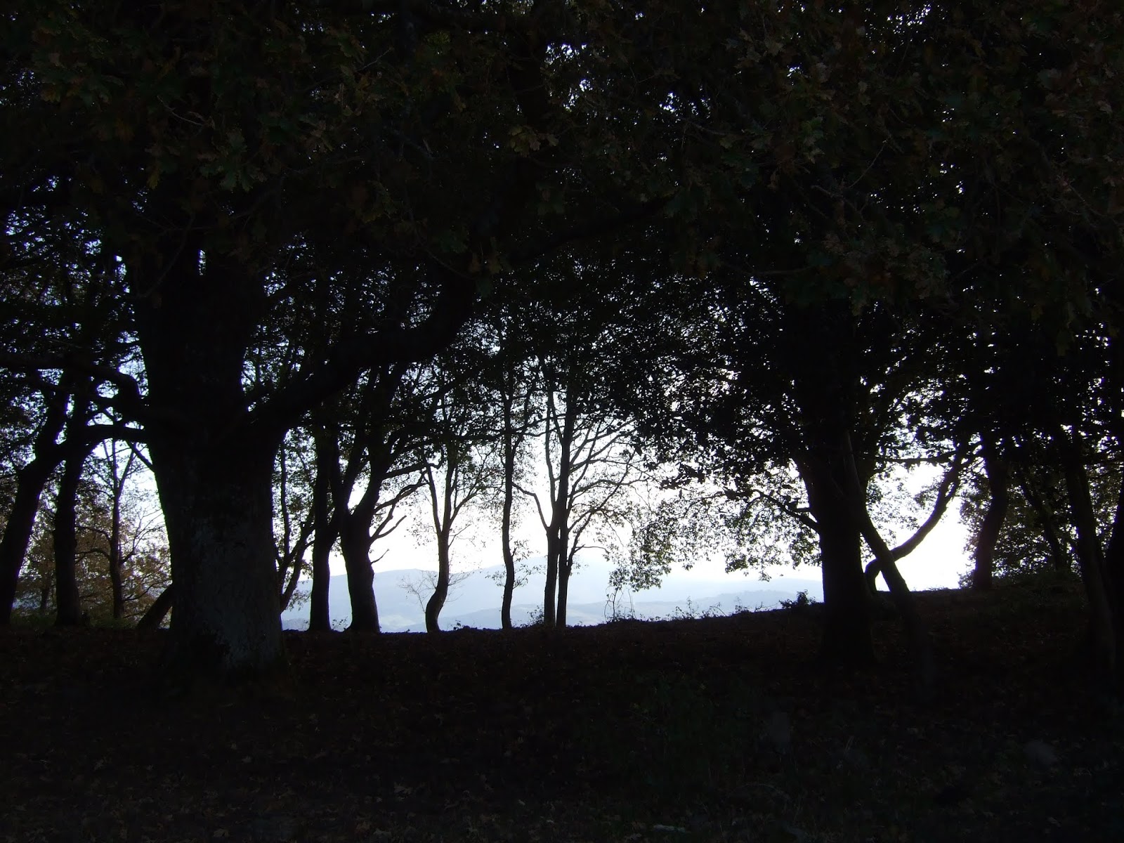
Al pasar la iglesia de Salarzón coges la cuesta a la derecha y luego la primera a la derecha para salir del pueblo. En una bifurcación cogí el ramal de la izquierda - desde donde saqué la foto anterior, pero es más sencillo coger el que sigue llano, trazando una curva a la derecha. A partir de allí el camino es una subida bastante pindia a través del bosque. Hay un momento en que se sale momentáneamente del bosque y se aprecia la Cordillera Cantábrica y los Picos (foto).
I turned right up past the church and then right again out of the village. Where the track forks, keep to the lower one and follow the bend round to the right. Thereafter it's pretty steep up through the woods. There's a break in the trees with beautiful views of the Cordillera Cantábrica and Eastern Picos (photo).

En el primer cruce sigue adelante, dirección la Braña de los Tejos, ignorando la pista que baja a la derecha. En el segundo, mantente a la izquierda y continúa con la subida.
At the first crossroads keep straight on, following the signpost to the Braña de los Tejos, ignoring the track down to the right. At the second, turn left and keep going up the steep track.


La pista sale del bosque justo antes de llegar al collado de Taruey. Paré a comer algo, y este amigo se acercó a saludar.
This eventually comes out of the woods and almost immediately takes you to the Taruey pastures. This local resident couldn't have got much closer, when he saw me stop for a bite to eat.

Luego dejé la pista y subí hacia el este. Me llamó la atención este roble todavía con las hojas verdes, delante de unas hayas ya con tonos otoñales - normalmente es al revés.
I then left the track and walked uphill to the east. I was surprised to see this oak whose leaves were yet to change colour,  in front of a stand of beech trees already looking very autumnal - usually it's the other way round.

Seguí cuesta arriba hacia la cresta al NO del Tumbo (a la derecha de la foto)
Anyway, I carried on up the hill towards the ridge to the NW of El Tumbo (on the right of the photo)

Abajo está Taruey, con Peña Ventosa detrás un poco a la derecha y los Picos al fondo.
Looking down at Taruey, with Peña Ventosa behind slightly to the right, and the Picos in the background

Una vez arriba disfruté de la perspectiva del Cornón a lo lejos y otras cimas de la Sierra como Pico Paraes y (la más cercana) El Tumbo. Continué hasta la cota de 1.634 mts que se ve en la foto.
At the top of the ridge with the Cornón in the distance and the various other summits along Peña Sagra including Pico Paraes and nearest, el Tumbo. I continued along as far as the outcrop at 1,634 mts.


Caminar no era tarea fácil, pero sí divertido
The going got rather more complicated, but it was an enjoyable clamber up the rocks

Después me di la vuelta y me dirigí hacia La Mesa con su repetidor y "los pozucos". A su izquierda se ve el Cascuerres (o Busnedo)
I turned back there and headed towards La Mesa with its antenna and a couple of pools. To the left lies Cascuerres.

Caminé hasta Cascuerres, donde hice una parada para almorzar, mirando hacia Peña Sagra
I carried straight on down the other side to Cascuerres, where I stopped for lunch, looking towards Peña Sagra

Bajé por la pista a Pasaneu,
I followed the track down to Pasaneu,


y ya que me sobraba tiempo decidí visitar la Braña de los Tejos al otro lado del collado. Una mirada atrás a la pista que acababa de bajar, con Cascuerres en primer plano, detrás La Mesa y luego el Tumbo a la derecha. Hace unos 20 años recuerdo haber desistido de subir por ella debido a la cantidad de nieve. Desde entonces siempre quería apreciar las vistas desde arriba. Ahora, además de cumplir con esa cuenta pendiente estaba conociendo la única parte de la Sierra de Peña Sagra a la que no había ido.
deciding on the way down to pay a visit to the yew trees up the hill on the other side. Here you can see the track I joined to come down, with Cascuerres on the left, La Mesa in the middle and el Tumbo on the right. I'd once started up this track about 20 years ago but had to turn back because the snow was too deep. Since then I'd always meant to see how things looked from the top. As well as getting round to it now, I was ironically visiting the only part of Peña Sagra I'd not been to before.

La conocida Braña de los Tejos
The well-known Braña de los Tejos - home to a number of yew trees 


Los colores de este tejo contrastan con los de un par de hayas
This one flanked by a couple of beech trees


Peña Ventosa vista desde el este
Peña Ventosa from the east

Más caballos, en el pozo de Pasaneu
More horses, by the pool at Pasaneu

Desde aquí bajé por la pista que atraviesa un bosque bonito, antes de llegar a Taruey
From here I walked down the track to Taruey, which traverses a pretty wood on the way


Y finalmente bajar otra vez por la pista a Salarzón, mirando atrás de vez en cuando al Tumbo, donde Monty y yo pasamos una tarde angustiosa en diciembre pasado.
And then back down the track to Salarzón, with the occasional look back at El Tumbo, where Monty and I spent a harrowing afternoon last December


Podía haber cogido una senda por el bosque a la izquierda de la pista, que vi poco después de pasar delante de la indicación "Salarzón-Braña de los Tejos", pero no tenía claro si bajaba directamente a San Pedro. Luego vi que efectivamente se junta con la pista justo antes de llegar a Salarzón.
I was undecided about taking a path I spotted to the left of the track just after the signpost  I mentioned before, as I wasn't sure if it led to San Pedro or not, and regretted not taking it, as it comes out onto the track just before you get to Salarzón.

Un día precioso tanto por las vistas y el tiempo soleado - se anuncia nieve para el domingo siguiente, pero se ve que ¡los paisanos están preparados para el frío!
No matter; it was a beautiful warm day spent admiring wonderful views - maybe the last such Sunday this year, as snow is forecast for the following weekend - the people who live here are prepared for the cold though!