lunes, 9 de noviembre de 2015

Noviembre veraniego en el Valle de Cieza / Still summer in the forest


Las setas señalan que estamos en otoño
The toadstools would seem to indicate it's autumn

pero las hojas verdes de los robles y hayas tardan en cambiar a tonos otoñales
but the green leaves on the oaks and beech trees are yet to change to their autumn hues

Así que mi plan de disfrutar un día de otoño en el Valle de Cieza se convirtió en un día veraniego tardío
So my plan to enjoy a mid-November day in the Cieza Valley turned ino a late summer outing

Además, en un día en que en Santander rozaba los 30º, cuando salí del bosque y sentía la temperatura, desistí de mi idea original de subir al Mozagro para luego pasar al Toral. Di marcha atrás para buscar algo de sombra
On a day when it got up to almost 30ºC in Santander, the moment I came out from under the trees and felt the temperature I changed my plans to head up to the ridge that encircles the woods. Back I went into the shade.


Después de explorar más de un sendero vi que seguir iba a suponer subir bajo mucho sol, y decidí coger hacia el oeste por el sendero que fuera. Por suerte me di con un par de postes balizados de los pocos que jalonan el PR 45 y seguí ese camino hacia la divisoria con Ucieda. En el punto que recoge la siguiente foto cogí el ramal de la derecha, que sube con algunos hitos para ayudar a encontrar el camino, pocos postes como el de la foto y una buena dosis de intuición. Más tarde llegaría al mismo sitio bajando por el ramal de la izquierda.
I headed up westwards, which meant I didn't have to leave the shelter of the trees until the top of the hill. I came across a marked route by chance and chose to follow the signs (few and far between though they were), here taking the right track, and later in the day coming out at the same spot down the left one.


Al salir del bosque quedaba el Alto del Toral a mi derecha.
When I came out at the top, the Toral was to my right

La foto de rigor de los Picos y Peña Sagra
In the distance, the Picos de Europa and Peña Sagra

Seguí por la divisoria hasta llegar a Brañazarza. 
I carried on to the south till I got to a familiar meadow

Paramos a comer al lado de la cabaña. Unas cuantas veces he almorzado en este lugar, pero nunca con tantas ganas de pillar sombra. A Monty le pasaba igual.
Monty and I stopped here awhile,  glad to find some shade.

Bajamos por la senda que va en dirección NE. No está balizado en ningún momento pero unos jirones de plástico blancos y amarillos atados en lugares convenientes ayudan a encontrar el sentido correcto sin problema. Estas vacas Tudancas se sorprendieron al vernos
We then headed down to the NE. The way down is pretty obvious  compared to the walk up. On the way we came across these Tudanca cows - a local breed

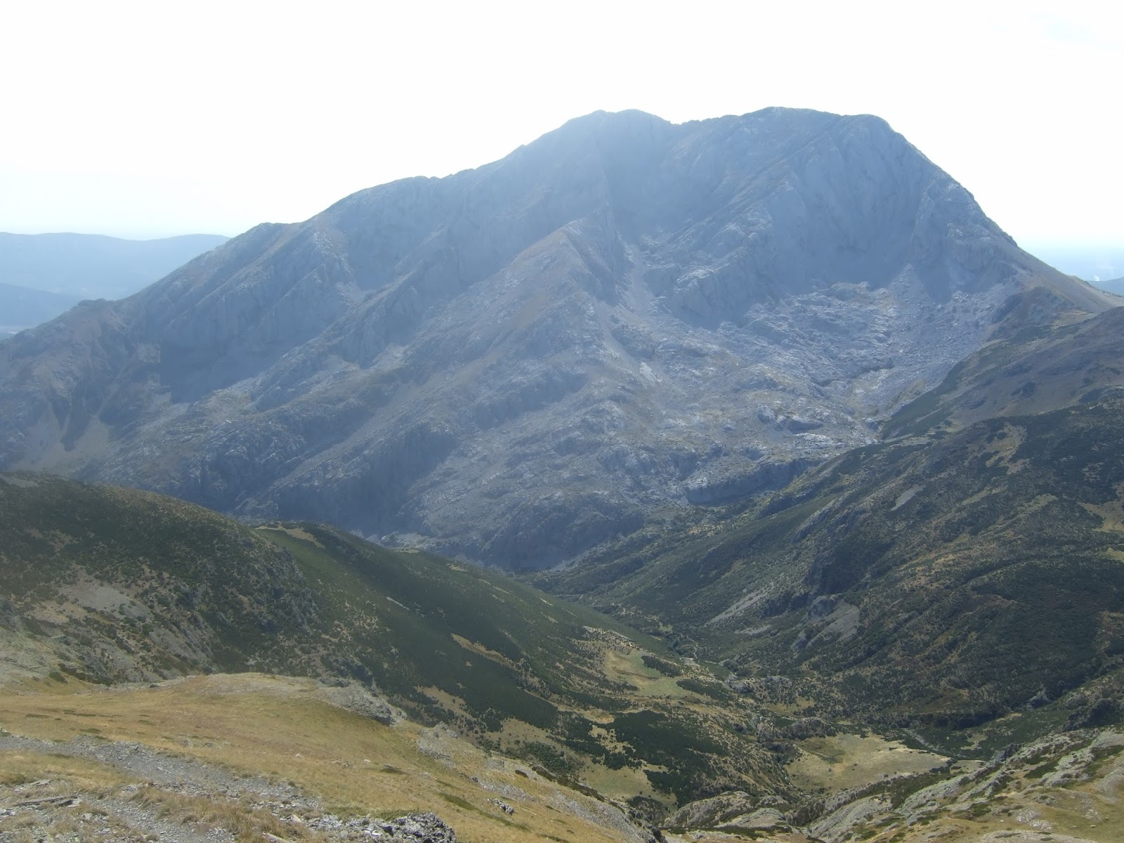
Ya hacía algo menos de calor. A lo lejos Castro Valnera
By now the temperature had dropped a little


Tardamos una hora en bajar hasta el fondo del valle. Desde allí unos 10 minutos hasta la zona recreativa, 15 más hasta el cruce con la pista que sube a Brenis y otros 20 hasta Villasuso donde tenía el coche.
It took an hour to get down to the bottom of the valley, and then another three-quarters of an hour back to the car.

martes, 3 de noviembre de 2015

Otra excursión palentina / Another walk in Palencia


Al ver este cordal desde el Parador de Cervera de Pisuerga durante el verano se me ocurrió combinarlo con una visita al Valle de Tosande y su Tejal. A la izquierda está el Pico Almonga, y luego el Pico Las Cruces. La cresta baja hacia un collado por donde se accede al Valle de Tosande. Al otro lado del valle se ve la Sierra de la Peña.
This is a photo taken during the summer from near a reservoir in Palencia. I decided to return and combine the walk along the ridge from left to right with a visit to the neighbouring valley, noted for the yew trees that grow nearby.

Así que regresé a Ruesga el 1 de noviembre y empecé a caminar cerca del embalse.
November has arrived, and with it the chance to return. I set off on my walk from the village of Ruesga.

Subí por la izquierda hacia el Almonga
I walked up the slopes of the Pico Almonga to the left

Los colores de otoño
The colours of autumn


Desde la cima se ve el embalse, con el Curavacas al fondo hacia la izq.
The view from the top, with the reservoir down below and the Curavacas mountain on the skyline.

Hacia el otro lado: la llanura.
The plains of Castile towards the other side.


Ahora continuar hacia el Pico Las Cruces (detrás se ve la Peña Oracada) para luego seguir por la cresta hacia la derecha
Next I continued along to the Pico Las Cruces, prior to heading down towards the right

Desde Las Cruces una mirada atrás hacia Pico Almonga
A look back towards Almonga

Al fondo Peña Labra y la Sierra de Peña Sagra. Debajo el embalse y el pueblo de Ruega. También se ve el Parador, donde me imaginaba esta ruta mientras tomaba un café.
In the distance, mountains of Cantabria. In the foreground, the village I set off from.


En el horizonte, el Espigüete a la izquierda y el Pico Murcia a su derecha; Curavacas más a la derecha.
The highest mountains in Palencia: Espigüete on the left, Pico Murcia to its right and Curavacas on the right of the photo


Bajando del Pico
Coming down from the Pico Las Cruces


La entrada al Valle de Tosande desde el sur
The way into the Tosande Valley from the south

Y adonde lleva. Bajé al collado donde se ve una cueva en la pared de enfrente
And this is what it leads to. We carried on down to the col on the right


Desde el collado hay una bajada cómoda pero pindia hacia el valle. Mientras bajaba no hacía más que pensar que tendría que volver a subir después...
From there, there's an easy but steepish walk down to the valley. On the way down I kept thinking I'd have to come back up later on...

Al llegar abajo hay que cruzar el camino y subir hasta el bosque de hayas que está justo enfrente
When you get down to the valley you cross the track and go straight up the other side to the beech wood

La entrada al bosque
Entering the wood

La senda al Tejal está indicada y muy cómoda para las muchas visitas que hay (por lo menos este día las había). Después de un rato las hayas ceden terreno a los tejos.
The path that leads up to the yew trees is clearly marked out for the many visitors (at least there were lots the day I was there). Eventually the beech trees give way to yews.

Muchos de los ejemplares tienen centenares de años
Many of them are several hundreds of years old

Después de subir unos doscientos metros se sale del bosque, y enfrente se ve el collado al que tendría que volver
After ascending about 200 metres the path leads out of the wood and right opposite is the col I would have to return to shortly


Hay más de 700 tejos en este bosque
There are more than 700 yews in the wood


Al llegar al valle de nuevo, una parada para disfrutar del entorno
When we got down to the valley again I stopped a while to admire the surroundings


Luego a subir la cuesta despacio y bajar por el otro lado por otro bosque, yendo hacia el NO, adivinando por donde quedaba sepultado el sendero
Then it was a case of making my way up the hill again before heading down the other side, guessing where the path might be under all the fallen leaves


Al salir del bosque nos enlazamos con un camino que se dirige hacia el embalse
When we got out of the wood we made our way to a track that leads back to the reservoir


El sol ya no estaba delante, así que poco antes de llegar al final de la excursión pude sacar una foto del Almonga. El Pico las Cruces se asoma a la derecha.
The sun was no longer straight ahead, so just before the end of the walk I was able to take a photo of Pico Almonga. Pico Las Cruces is just visible along to the right.

lunes, 28 de septiembre de 2015

Pico Murcia


The first week of autumn and back to Palencia I went - a two-hour drive took me to a little village in the N-W of the province. As kids we used to pick rose hips and then try to catch our schoolmates out in a stupid ritual but I don't remember having seen a bush with quite as many as this one at the start of my walk.
Por segunda vez en una semana en Palencia; un trayecto de dos horas me llevó a Cardaño de Arriba. Ya estamos en otoño, y estos escaramujos añadían color al comienzo de la ruta.

Anyway, after  a quarter of an hour or so, the mountain I'd come to climb came into view- Pico Murcia is the one on the left,  and is actually higher than the one emerging from the right - but I wouldn't see that for myself for another couple of hours.
Había salido del aparcamiento a la entrada del pueblo en dirección norte siguiendo el arroyo Lomas. A los pocos minutos una señalización a la izquierda indica una pista que pronto entra en el valle Valcabe. Al fondo del valle aparece el Pico Murcia. Al principio no tenía claro cuál de los dos era, porque él de la derecha parecía más alta. Pero engaña, como luego vería.

A rather beautiful mountain I think
Una montaña muy bonita, ¿verdad?

After getting to the top I planned to walk along the ridge to the left rather than coming back the same way.
Mi idea era volver por la cresta de la izq. en lugar de bajar por el mismo camino.

When I got to the grassy pasture at the fend of the valley I followed the cairns up to the right
Al llegar al final del valle una pintada en una roca (WayPoint 4) indica el sitio donde se cambia de rumbo y subes a la derecha para seguir los hitos que señalan un sendero...

and then up the slope as they guided me along a narrow path through the vegetation
... que sube la cuesta a través de la retama


The path zigzagged all the way up and I was soon well above the valley
Es una cómoda subida y rápidamente se gana altura sobre el valle

Over to the left the impressive cwm came completely into view
Hacia la izquierda un circo glaciar impresionante

meanwhile I carried on zigzagging my way up
No recuerdo un sendero con tantos zigzags 

until reaching a col just under the summit
por fin llegas a un collado al sur de la cima, que se gana con un poco más de esfuerzo

From the top there was a splendid spectacle:
To the west: Riaño and the mountains of León
Desde la cumbre unas vistas maravillosas:
Al oeste el embalse de Riaño y las montañas de León

Pico Murcia actually sits on the Palencia-León provincial limit
Pico Murcia está en el límite entre Palencia y León

The western and central massifs of the Picos de Europa
Los macizos oeste y central de los Picos

The eastern massif on the left, in the centre the mountain that from below seemed higher and on the right Peña Prieta - the highest mountain in the cordillera
A la izq. el macizo oriental, delante: el cordal que sigue hasta Peña Prieta. Ya se ve que la montaña que había visto antes desde el valle (en el centro de la foto) queda por debajo del Murcia
The Valcabe valley, which I'd come along to reach the mountain. In the foreground to the right, the end of the ridge from which I'd see the way down to the village
Debajo: el valle Valcabe. A la derecha: el final de la cresta desde donde más tarde bajaría al pueblo

Focusing more on the skyline: Curavacas, and beyond it to the left the Sierra de Cordel.
Prestando más atención a lo más lejano: Curavacas, y en el horizonte a su izq. la Sierra del Cordel. Debe de ser el Pico Lezna que impide que se vea Peña Labra

The  ridge and its highest point: El Castillo
El punto más alto de la cresta es el Pico Castillo

the majestic Espigüete
El Espigüete imponente

Another photo of the Picos
Otra de los Picos

I then walked down to Las Cerezuelas and looked back at Pico Murcia before continuing along the ridge
Después de un buen rato, bajé a Las Cerezuelas y eché un vistazo hacia atrás antes de seguir hacia el este

El Espigüete

Pico Murcia from El Castillo
Pico Murcia desde El Castillo

and from the end of the ridge
y desde el final de la cresta

while in the other direction down below, lay the village I'd set off from
Al otro lado se veía Cardaño al fondo del valle

It took me an hour to make my way down. The first part was quite enjoyable, but the last 150 metres became a bottleneck and I was lucky to find a reasonably easy way through the undergrowth. However, it could have been rather more unpleasant, and I'm not sure I'd recommend coming down this way to anyone not prepared for a bit of adventure. Anyway, I got down to the carpark at the entrance to the village and took one final look back up to El Castillo and the outcrop to the right of centre I'd started the descent from.
Tardé una hora en bajar. La primera parte era bastante divertida, pero los últimos 150 metros re convertían en un cuello de botella y costaba algo encontrar un camino entre tanta maleza. No sé si recomendaría esta bajada a alguien a quien no le apeteciese un poco de aventura. Al llegar abajo miré hacia atrás: se ve El Castillo a la izq y el punto desde donde empecé la bajada en el centro-derecha.