Una caminata de media jornada con salida en Sel del Tojo (Alceda). La nube estaba justo encima, así que esperaba que no tardara en levantarse.
Hoping to get a walk in early in the day before it got too hot, I got to Sel del Tojo (Southern Cantabria) to find low-lying cloud.
En la parte alta del pueblo giré a la izquierda, pasando delante del depósito de agua, y poco después seguía recto, ignorando una pista a la derecha.
At the top of the village, we turned left, up past the water deposit, shortly afterwards ignoring a turn-off to the right.
Mi idea era subir al monte Cildá, y cogí la pista de la izquierda para ir en dirección OSO. Volveríamos a este punto a la vuelta, por la pista de la derecha, que bordea una plantación de pinos.
The idea was to carry on to Cildá, the uppermost point of a ridge that separates the Toranzo and Iguña valleys. At this fork I took the left turn and kept going WSW. We would return to this point on the way back, coming from the right.
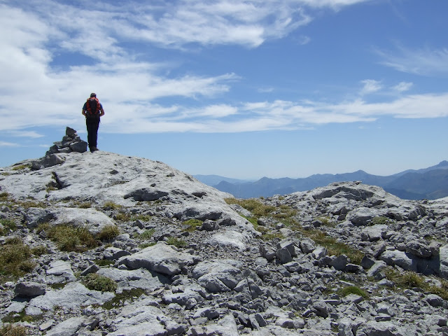
La pista seguía en la misma dirección un buen rato, pero de repente aparece un tramo pindio. La continuación más marcada va hacia la derecha, pero decidí probar suerte con una senda menos marcada que mantenía el rumbo que quería. Al llegar al Arroyo del Calabazo se extingue, por lo que tenía que retroceder un poco y subir directamente entre el tojo para rápidamente encontrar un sendero que permitía seguir la caminata. Todavía estábamos metidos en la nube, pero de golpe aparecieron los cielos azules, y el repetidor del Cildá delante de nosotros.
After a while there's a steep stretch, and the main track veers to the right. I decided to take the fainter path to the left to keep going in the same direction. At a gulley the path becomes impassable, so I had to turn back a bit and make my way up through the gorse till I came onto a decent path. We were still in the cloud, but all of a sudden blue skies appeared, as did the radio mast on Cildá right in front of us.
Nos dirigimos a la cabaña entre los árboles en búsqueda de algún camino que sorteara la maleza de la ladera de enfrente. Efectivamente, al otro lado de la cabaña hay un sendero que sube en diagonal hacia la izquierda, y así llegamos cómodamente a una zona despejada.
We headed for the stone hut surrounded by trees and found a path just behind it that goes up the slope diagonally to the left.
Una mirada atrás. La nube indica donde está el arroyo.
Looking back at the cloud rising up from the gulley
Habíamos visto la cima al alcanzar la pista que se ve en la foto desde la derecha. Cuando bajamos del monte la seguiríamos hacia la izquierda.
We'd come up onto the track in the photo from the right. When we came down later on we'd follow it to the left.
As we made our way up the hillside the cloud seemed to follow us.
A lo lejos se ve Castro Valnera
Castro Valnera in the distance
Meanwhile, the last part of the walk up
On the other side of the ridge it was also pretty cloudy. Right opposite is Navajos, which has the same elevation as Cildá (1065m)
As we walked back down another cloud started to encroach from the west
Cerca de la cabaña, las vacas disfrutaban de este sel
Near the hut the cows watched us go past
Y los caballos también
and we briefly interrupted these horses enjoying the shade of the oak trees
El repetidor del Cildá a punto de desaparecer entre las nubes
The radio mast about to be engulfed by the cloud
De hecho, no volví a ver el sol hasta el final del paseo. La pista se dirige hacia el NO antes de cambiar de dirección. Cuando empieza a perder altura vemos el Valle de Toranzo debajo.
As it happens, no more blue sky was to be seen until the end of the walk. The track heads NW before changing direction. When it starts going down we see the Toranzo valley stretch out below us.
Ahora la pista va hacia el sur en dirección a Sel del Tojo. Después de pasar delante de una casa hay que coger el ramal de la derecha sin cruzar el paso canadiense. Esta pista lleva a la plantación de pinos en ligera subida antes de conectar con nuestro camino de ida.
Now the track goes southwards towards Sel del Tojo. After going past a house you have to take a fork to the right and not cross the cattle grid. The track goes uphill a little before skirting a pine plantation and then losing ground before joining up with the path we took earlier in the morning.
Llegamos al punto de partida. Muchas casas abandonadas en el pueblo, pero los pocos vecinos, muy majos.
The end of the walk. There are a lot of abandoned houses in the village, but the few inhabitants were very friendly.

¡Sin comentarios!
No comment!


