domingo, 19 de agosto de 2018

El Río Carrión / Carrión River


Desde la cima de Curavacas se ve el pueblo de Vidrieros y el río Carrión, que atraviesa el valle de Pineda desde el oeste
From the summit of Curavacas you can make out the village of Vidrieros and River Carrión traversing the Pineda Valley from the west

Ocho años más tarde salgo de Vidrieros para seguir el río. Una pista arranca en frente de un aparcamiento y se dirige al sureste para luego mantener una dirección este
8 years later I leave Vidrieros to follow the river. The track starts opposite a large car park and heads south-east before settling on an easterly direction


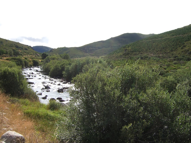
Después de un buen rato la pista gira hacia el NE antes de cruzar el río. Por primera vez en la ruta hay una ligera subida, que permite la contemplación del siguiente tramo, donde la pista cambia de dirección y va hacia el norte. La roca que se ve al fondo en el centro donde la base de la montaña marcaba el límite de mi paseo.
After a good while the track shifts to the NE before crossing over to the other side of the river. There's a slight incline in the otherwise flat route where you get a view of the next stage of the walk as it changes to head to the north. The rock that can be seen in the centre at the base of the mountain is as far as I would go.

Esta roca me recordaba la cabeza de un animal
A rock formation that looks like an animal's head


Estos árboles se llaman álamos temblones
These trees are called Quaking Aspen

Hasta aquí llegamos. El río cambia de dirección una vez más y sigue hacia el NO. Debido a la nube densa no se ve el Pico Lezna a la derecha, ni Peña Prieta al fondo. Si hubiera podido verlos la temperatura habría sido demasiado alta para hacer la excursión, sobre todo a causa de Monty, que ya a la vuelta buscaba la sombra, y eso que soplaba un viento del norte considerable.
This is as far as I planned to walk. The river changes direction again to the NW. Due to the dense cloud Pico Lezna is not visible to the right, and neither is Peña Prieta straight ahead. If they had been, then the temperature would undoubtedly have been too high to even consider doing the walk in the first place - especially as Monty was accompanying me. 

Ésta es la vega de Santa Marina, y el refugio está situada en la base de la roca. Hay que cruzar el río Arauz (hay un puente) poco antes de que se junta con el Carrión
This is the Vega de Santa Marina, and the refuge is on the left at the base of the rock. You have to cross the Arauz River (there's a footbridge) just before it joins the Carrión.


Mientras almorzaba disfrutaba de esta panorámica de la Vega delante de mi
As I had my lunch I enjoyed this view of the Vega in front of me

Habíamos tardado tres horas a paso tranquilo para llegar hasta aquí. Todavía queda una caminata larga hacia el oeste rodeando el macizo de Curavacas para quien quiere alcanzar el pozo.
We'd taken a leisurely 3 hours to get here, but from here there's still a substantial walk to the west round the Curavacas mountain range for anyone who wants to get to the lake

Así que aquí tenéis la segunda vista del río Carrión desde arriba; esta vez desde Pico Lezna un día soleado hace tres años
So here's the view of the continuation of the Carrión from Pico Lezna on a sunny day three years ago

Pero bastaba para hoy así que me di la vuelta
Anyway, it being the present, I headed back

Las nubes no se desprendían de la montaña a mi derecha
The clouds still hugged the mountain to my right

Cuando llegamos a la curva del río intenté animar a Monty a que se metiera, pero en balde
We reached the bend in the river, where I vainly tried to get Monty to have a swim


Ya vamos hacia el oeste y las nubes se han quitado del Espigüete (a lo lejos). Pico Murcia se ve a la derecha
By the time we were facing west, the clouds had cleared from the summit of Espigüete (the mountain in the distance, right of centre). Pico Murcia to the right

Curavacas se empieza a descubrir
Curavacas much more visible than it was earlier on


Una mariposa fritillaria
A fritillary


Al volver a Vidrieros la cima de Curavacas se ve entera por primera vez en el día
Curavacas with a summit clear of cloud as we return to Vidrieros



martes, 14 de agosto de 2018

Tiros Navarro

Esta ruta a los Tiros Navarro estaba pendiente desde 2015, cuando no conseguí culminarla.
This was a second crack at climbing the Tiros Navarro in the Picos de Europa, which I didn't feel up to in 2015. 
El mirador de Fuente Dé estaba metido en la nube y solo empezaba a abrirse cerca de la Vueltona
The cable car up from Fuente Dé left us in the middle of a cloud, which only started to clear from about 2000 metres

Desde el collado de la Canalona se ven los Tiros Navarro (2.600 mts. aprox.). La cima central  se ve a la derecha, con la cima norte detrás. Se intuye una brecha hacia la izquierda y luego está la cima sur.
First glimpse of Tiros Navarro, once over the top of the collado de la Canalona.

Cogimos el sendero que baja hacia el Valle de las Moñetas. En el centro de esta foto se aprecia claramente la brecha entre la cima sur y la cima central
We took a path that heads down to the Moñetas Valley. Now opposite the Tiros Navarro we can see the southern summit (left of centre) then a gap before the central summit to the right, behind which is the northern summit (more clearly visible in the previous photo)


Dejamos el sendero y subimos a la zona que está a la derecha de los dos neveros y una cavidad alargada en la roca
This is where we leave the path and walk up to the area to the right of the two patches of snow and an elongated cavity in the rockface

No todo es rocas y nieve
It's not all rocks and snow though


Hemos llegado a la cavidad, y ahora seguimos subiendo pegados a la pared, dejando la roca verrugosa a nuestra derecha. Al llegar allí vamos hacia otro afloramiento parecido pero sin llegar a él.
We've reached the cavity and now, sticking close to the rockface, we follow it round, passing between it and the warty looking outcrop. From there we carry on towards a similar outcrop but stop before we get there.


Aquí tenemos que cambiar de rumbo y trepar por la pared a nuestra izquierda. En este punto me di marcha atrás hace tres años, dudando cómo iba a bajar por aquí a la vuelta. Esta vez Pedro había traído una cuerda por si acaso, pero de todas formas, aunque la subida se puede hacer directamente en vertical, a la vuelta bajé un poco por una cornisa que se ve arriba a la derecha (marcado en azul). La bajé un poco hasta ver una zona donde se podía destrepar hacia la izquierda - la parte de la roca que se ve en esta foto.
Because this is where we change tack and climb up the rock face to our left. This is where I turned back three years ago, as I had doubts about the descent. This time round one of the crew had brought a rope to be on the safe side. In any case, although I climbed straight up ahead of me, when we came down I chose to walk down the ledge I've marked in blue before making my way across the rock face (there are lots of holds) towards the centre of this photo and then down.

Después de la trepada se trata de seguir los hitos, primero con tendencia hacia la derecha y después de un zigzag directamente hacia arriba. Arriba a la derecha se ve la cima norte y a su izquierda se asoma la cima central
After this tricky bit it's a question of following the cairns, which lead you to the right and then after zigzagging, straight up the side of the mountain

Detrás de nosotros la nube que cubría Liébana se acercaba, pero durante toda nuestra estancia en la montaña nos evitó
Behind us the cloud that still covered Liébana was threatening to approach, but fortunately came no closer

La última parte de la ascensión, hacia la cima central, en el centro de la foto. La bordeamos por la izquierda, pero también se podría subir trepando por la derecha
The final part of the walk up, towards the central summit, in the centre. We went round the left side, but going up via the right is equally viable

Desde la cima las vistas que permitían las nubes eran espectaculares:
From the summit the views were spectacular (when the clouds weren't in the way!):
Peña Vieja

La cima sur de Tiros Navarro con Santa Ana detrás
The southern summit of Tiros Navarro with Santa Ana behind

El Jou de los Boches
the depression to the west


La cima norte de Tiros Navarro, y a la derecha se ve la cima del Urriellu
The northern summit, and to the right the top of the Naranjo de Bulnes is visible


Había espacio más que suficiente en la cima para que almorzáramos tranquilamente. Luego decidí bajar para acercarme a la cima norte, que se sube fácilmente
There was more than enough room at the top for us to enjoy a leisurely snack. I then decided to pop over to the northern summit, which is easily reached

Pedro y Fernando están bajando de la cima central. Se ve Peña Vieja detrás
My two companions are climbing down from the central summit. Peña Vieja rises up behind them

La cima sur (la más alta, pero demasiado escarpada para visitar), con las cimas de Santa Ana detrás
The southern summit with the two peaks of Santa Ana behind to the right

Al fondo, el Cornión. A la derecha Torrecerredo
In the distance the western massif of the Picos. To the right the highest peak in the whole system.

 El Urriellu al fondo


La continuación de la cresta de Tiros Navarro 
The ridge curves round to the left


Entre la cima norte y el central hay una bajada en picado hacia el Jou de los Boches
Between the northern and central summits there's a pretty sheer drop down towards the depression

Al bajar de Tiros Navarro vemos que las nubes se han quitado bastante. En el centro de la foto es el Collado de la Canalona adonde regresamos ahora
By the time we get off Tiros Navarro the clouds have lessened a fair bit. We now head back to the collado de la Canalona, right in the centre of the photo

El macizo oriental aparece por primera vez
The eastern massif appears for the first time

A su izquierda hay un mar de nubes, y en primer plano el nevero que cruzamos para alcanzar el collado lo más directo posible
To the left there's a sea of clouds, and in the foreground the snow we crossed to reach the collado as directly as possible

La bonita imagen que nos depara la boca de la Canalona
The lovely view from the collado of the descent we now begin

Mirando atrás desde la mitad de la bajada
Looking back from halfway down

Y ahora hacia abajo
And now in the other direction

Interrumpimos un rebeco un poco más abajo. Mantenía su distancia pero no se inquietaba mucho. Señal de que no había mucha gente hoy en esta zona
We came upon an ibex soon afterwards. It kept its distance but was not unduly concerned by our presence. A sure sign that there weren't many people in the area that day

Pasó a una roca al lado y tan tranquilo.
Our friend hopped over to a neighbouring rock and ignored us

En el centro izquierda Los Pozos de Lloroza. Detrás de las nubes, Curavacas, Peña Prieta, El Espigüete
The Lloroza lakes are centre left. Behind the clouds are the mountains to the north of Palencia

Hacía calor por primera vez en el día y cuando llegamos a la altura de los pozos me sentía un poco como Odiseo cuando pasa cerca de la isla de las sirenas - pero ¡qué bien verlos con tanto agua a finales de julio!
We were feeling the heat of the sun for the first time that day and when we got to lakes I must admit I felt a bit like Odysseus passing close by to the Sirens' Isle - but good to see so much water in them at the end of July!