domingo, 15 de septiembre de 2013

La Canal del Valle


Dejé el coche en el aparcamiento del Collado de Hoja por encima de la aldea de Bejes con la intención de hacer una ruta circular. Aquí se ve el pueblo, con la pared del Desfiladero detrás.
The plan was to do a walk starting and finishing just above the village of Bejes, on the edge of the Picos de Europa. 

Hay que dejar la pista que sube hacia el Vau de los Lobos antes de llegar al Dobrillo y coger un camino que sale a la izquierda (dirección SE). Después de unos tornos se llega a esta fuente.
El cordal de Tresviso, con el pueblo en el centro de la imagen
Leave the track after gaining about 200 metres and take a path that leads off to the left (going SE). After a few zigzags you get to this fountain.
In the middle of the photo you can just make out the village of Tresviso

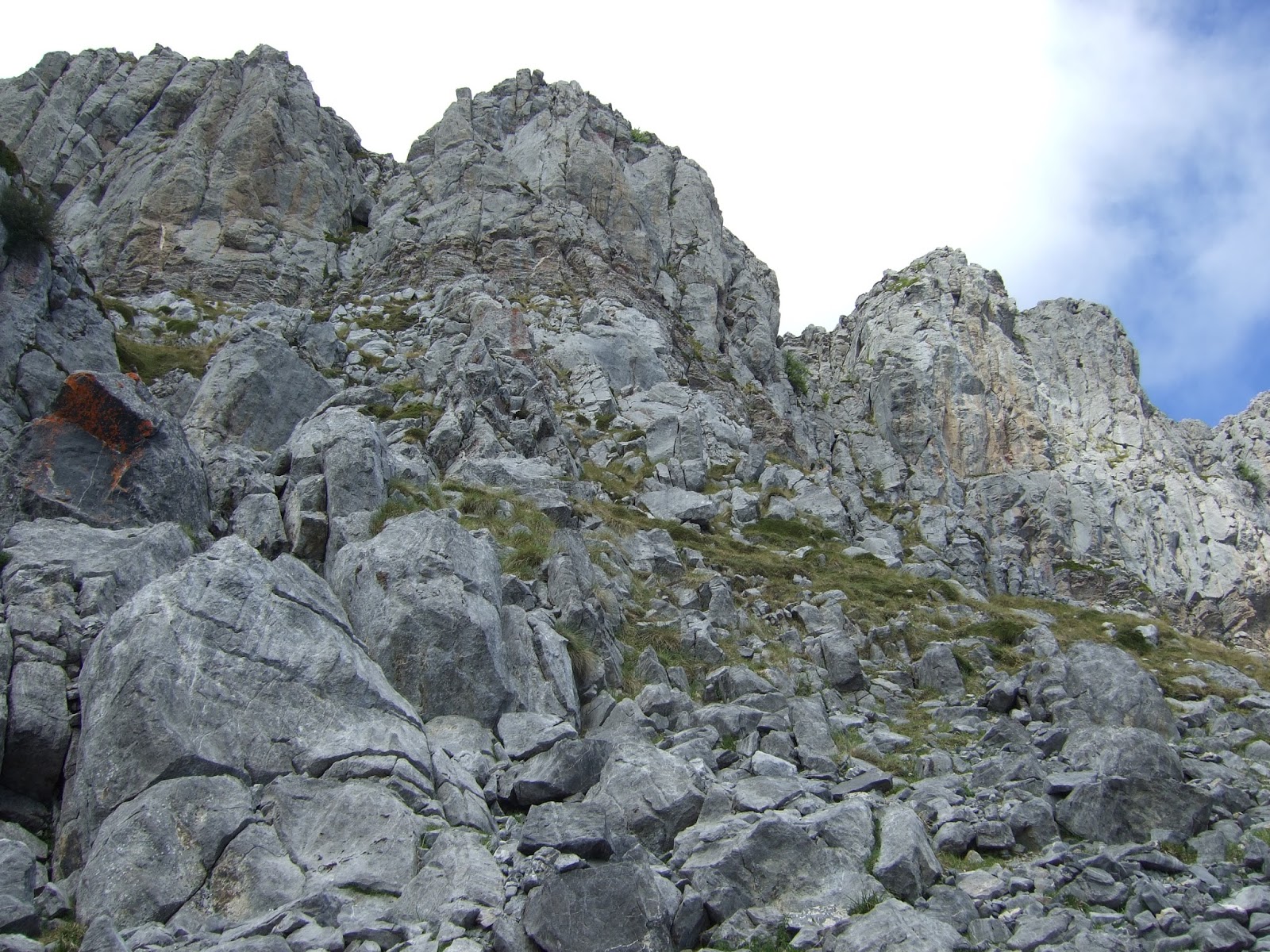
El sendero que lleva a la entrada de la Canal del Valle
The path that leads to the entrance of the Canal del Valle

Me alegré de no haber traído a Monty; no sólo por el calorcillo sino por el mastín que guardaba estas ovejas
I was glad I hadn't brought Monty; not only because of the temperature but also because of the mastiff looking after these sheep

La entrada de la canal
This is the entrance to the valley 

Mirando atrás cuando había hecho la tercera parte de la subida de la canal
Looking back from a third of the way up

Desde ese mismo punto se veía el siguiente tramo así
The next part looked like this

Y cuando llegué allí miré atrás otra vez - todavía quedaba otro tercio
And when I did that stretch I looked back again before starting on the last third 

Y por fin la vista atrás desde el collado en lo alto de la Canal. Tardé una hora en subirla
At last a look back from the top. It took me an hour to walk all the way up

Se llama el collado de la Llaúna
It's called the Lagoon Pass


A la izquierda se ve el Pico las Agudinas
To the left the Pico las Agudinas

De frente el Samelar y el San Carlos
Straight ahead San Carlos with Samelar to the right

Y a la derecha  el Alto las Verdianas, que era mi gran objetivo del día, con la idea de bajar después por La Riega de Los Lobos
And to the right Las Verdianas, which was where I'd planned to climb up to, before coming back down on the other side

Había leído en un par de blogs que no era fácil encontrar el paso para llegar a la Hendida, así que cuando vi un hito me lancé pared arriba
I'd read on a couple of blogs that it was no easy task to find the right way, so when I saw a cairn I headed in that direction

Sin embargo, llegué a un punto donde no veía claro por donde seguir. Ya no había hitos y la canal delante de mí hacia la derecha no me convencía. Pensando en lo complicado que podría ser la bajada si me equivocaba de sitio decidí bajar a la base de la pared a ver si había otra vía más evidente
However, I got to a point where it wasn't clear which way to go. There were no more cairns to be seen, and the gap that seemed to open up towards the right was by no means a certainty. Thinking how tricky a descent could be if it turned out not to be the right way, I decided to turn back to see if there was a more obvious route further along

pero no sin antes sacar una foto donde se ve la base de la Canal de San Carlos, la parte sur del valle de Liébana en el centro y El Curavacas y Peña Prieta detrás
but not before I'd taken this photo looking towards Liébana


Después de seguir la pared un poco y no encontrar otra vía, decidí volver al collado y quedar un rato en el Pico las Agudinas - aquí mirando hacia el collado
When I found no clear way up the mountainside, I decided to go back to the pass and enjoy the views from the Pico Las Agudinas 

Buenas vistas hacia el S-E -  la entrada del valle de Cabezón de Liébana se ve hacia la dcha de la foto
Looking towards Liébana

más hacia el este, delante está el Pico del Acero y detrás el final del Desfiladero (o la entrada según como se mira)
further towards the east and the entrance to the Hermida Gorge (coming from Potes)

Así se veía la Canal del Valle - me recuerda un poco La Vega del Jascal en el Cornión al ser bastante herbosa, aunque ésta es bastante más larga y empinada
The Canal del Valle from Las Agudinas

Al haber dejado el coche por encima de Bejes no me quedaba otra que volver por el mismo camino; el sol ya no estaba detrás del Peña Ventosa y Peña Sagra, lo que me permitía sacar esta última foto.
I had no option but to return the way I'd come; better views now of Peña Ventosa and Peña Sagra behind

Para acabar, rescato una foto del 2009 de Las Verdianas y Las Agudinas desde el San Carlos
And finally, a photo I took in 2009 from San Carlos of Las Verdianas (left) and Pico Las Agudinas (centre)


sábado, 31 de agosto de 2013

Silla Caballo: Superando el acrofobia / Staying in the Saddle


La última vez que andaba por Ándara me eché para atrás en la cresta que lleva a la Silla Caballo cimero  por el vértigo que me producía - aunque me encanta andar por las montañas, a veces experimento una sensación de acrofobia. Dicen que cuando te caes de un caballo lo mejor es volver a montar en seguida; otra vez a la Silla pues...
The last time I was in this part of the Picos I turned back on the narrow ridge that leads to the Silla Caballo (Saddle) when struck by a feeling of acrophobia,which I get occasionally. Well, they say that when you fall off you should get straight back into the saddle, so...


El jou del Evangelista, con la Silla envuelta en la niebla que subía desde el valle de Liébana y la cresta a su derecha
The summit of the Silla caught in the clouds that were coming up from Liébana with the ridge to the right

Los espectadores de siempre
The usual suspects

Las rocas que llevan a la Silla - pasé el primer punto aéreo cresteando de forma poco elegante y el segundo (al final) por la derecha. No son pasos difíciles técnicamente, y seguro que la mayoría de los que vienen por aquí pasan sin agobiarse en lo más mínimo
The ridge isn't difficult technically, and I'm sure most people who frequent these mountains would get across without the slightest qualm. This time I overcame my fear of the height I would fall from and got  to the base of the summit, from where things are much more straightforward

Por suerte en la cima se estaba empezando a quitar las nubes, y se veía bastante bien el valle abajo
Fortunately, at the summit the clouds were beginning to clear, and the Liébana valley was there to see 6,500 feet below


la paciencia dio sus frutos: se hizo visible La Morra de Lechugales y detrás Peña Cortés
The Morra de Lechugales is the only peak higher than the Silla in the Eastern Massif, but I had to wait a while before it came into view, with the Peña Cortés behind


A la vuelta pasé los puntos peliagudos de la cresta por la cara norte, eso sí, con muchísimo cuidado. Detrás se ven los Picos de Jierru, con La Pica del Jierru a la derecha.
On the way back I crossed the tricky parts of the ridge on the north side. Behind are the Picos del Jierru, with the Pica del Jierru to the right


Con el cielo ya más despejado, La Silla desde los Picos del Jierru, que extrañamente marcaban 10 metros más de altura en el altímetro que la Silla
With weather conditions now improved the Silla was clearly visible from the Picos del Jierru

Desde el otro lado de los Picos del Jierru se contemplaba la caída al valle del Duje
From the other side there was a spectacular view of the Duje Valley

A pesar de la bruma se ve la cima del Escamellao y la bajada que hicimos hace dos semanas por la pedrera - esta foto demuestra que desde lejos se ven las cosas mucho más acojonantes que lo que son en la realidad. También se distingue la raya vertical que separa Asturias de Cantabria
In spite of the mist I could see the Escamellao just opposite, and the scree slope we came down two weeks ago - this only goes to show that sometimes things look worse further away than close up. The vertical line denotes the boundary between Cantabria to the left and greener-looking Asturias to the right

Aspecto singular de la Morra
The Morra from behind the Picos del Jierru


El jou del Evangelista - la vuelta como la ida bordeando el lado izquierdo, sin bajar al hoyo
I now retraced my steps on the left side of the Evangelista depression

Una mirada atrás hacia la cresta que lleva a la Silla
Looking back at the ridge that leads to the Silla


Volviendo por el camino minero, saqué un par de fotos más hacia Liébana
Following an old miners' path, I took advantage of the better weather to take some shots of Liébana


Cuando subí al Grajal de Abajo ya se estaba cubriendo otra vez: la Silla a la izq y los Picos del Jierru a su derecha. Llama la atención la cantidad de topónimos parecidos: la Horcada de los Grajos del Escamellao,  la Canal de las Grajas que sube al Cortés y este camino del Grajal. Curiosamente, si vas en línea recta, ascendiendo el Grajal de Abajo y bajando por el otro lado atajas el camino que lo rodea - en inglés "en línea recta" se dice "como vuela el grajo"
By the time I reached the last peak of the day cloud was beginning to cover the mountains again: the Silla on the left and Picos del Jierru to the right

El Pico de San Carlos

La Junciana y La Rasa

lunes, 19 de agosto de 2013

El Escamellao


El Escamellao

Desde las Vegas de Sotres llama la atención El Escamellao con sus 2000 metros y forma tan bonita. A la derecha vas hacia Peña Castil o Las Moñetas, y la izquierda entras en el Valle del Duje. Para subirlo hicimos una aproximación bastante larga pero sin pendientes fuertes, yendo al Lago de las Moñetas para luego cambiar de dirección en subida suave hasta la Horcada de los Grajos. Bajamos por el otro lado de la horcada para completar una ruta circular. Para ver detalles de la 1ª parte del camino hasta el lago os remito a la entrada de julio de 2010.

The Escamellao rises up more than 3000 feet above the valley below near Sotres in the Picos de Europa. To get to the top we headed up the valley to the right to the Moñetas lake before changing direction and making our way up to a pass near the summit. We came down the other side and so completed a circular walk. For details of the first part of the walk up to the lake, check out the entry from July 2010.


El lago de Moñetas

Se dibuja una curva alrededor del lago para seguir un sendero que asciende cómodamente
We encircled the lake following a path that took us up gently towards our destination


La última vista del lago antes de seguir un buen trecho casi llano hasta la parte alta del Vallellón
The last view of the lake before we began a longish stretch that connects up with the top of a slope that plunges steeply down from the side of the Escamellao


Aparte de roca y agua también había fauna
As well as  rocks and water there was also fauna


y flora
and flora


acercándonos a la Horcada de los Grajos
The pass came into view

Desde allí no se tarda ni 15 minutos en subir al Escamellao. En algún reportaje he visto que se habla de un tramo algo aéreo al principio, pero no creo que merezca el comentario.
The scramble up to the top of the Escamellao takes just two shakes of a chamois' tail

Desde la cima se ven El Paredón del Albo, el Cueto la Cuadra y detrás Peña Vieja
The view from the summit towards Peña Vieja

la vista hacia el oeste
towards the west

Peña Castil

hacia Sotres
looking towards Sotres and the first part of the walk

La Morra de Lechugales y Peña Cortés
the main peaks of the Eastern massif

los Puertos de Áliva con El Curavacas y Peña Prieta al fondo
Áliva in the foreground


De vuelta a la Horcada, delante está la entrada al pindio Vallellón y enfrente el camino que habíamos hecho antes desde la Majada del Fresnedal (se ve una cabaña a la dcha de la foto) hacia el lago
Back down from the summit, this photo gives some idea of the route we took; down on the right is a stone hut we went past on our way towards the lake - out of shot further to the left.


Se ve claramente cómo es el Vallellón en esta foto sacada el año pasado desde la Vega de los Tortorios; el Escamellao está a la izquierda.
This photo taken on the way up to Peña Castil last year shows the steep scree slope leading up to the pass; the Escamellao is on the left


Quedaba un largo descenso hacia el otro lado por la pedrera hasta el Valle del Duje
We were left with a long descent down the other side towards the Duje Valley

mirando atrás:
a look back:

Ya desde el Valle del Duje; la Horcada está en el centro y el Escamellao a la derecha
This is the view from the valley below: the way down is in the middle of the photo, with the Escamellao on the right

un juego de luz bonito
the sun was going down as we made our way back


y una mirada final al objetivo del día
one last look back
Llegamos al coche casi 11 horas después de haber empezado la marcha. ¡Tiempo bien aprovechado!
We got back to the car almost 11 hours after we set off. Time well spent!