jueves, 26 de octubre de 2017

2 Peñas de Rucandio


Una ruta corta (3 horas y media) realizada un domingo por la mañana.
A short walk (3.5 hours). 

Cruzo el puente de Rubalcaba y sigo la carretera hacia la derecha. A los pocos minutos hay un prado a la derecha cuyo dueño lo ha "sembrado" de pancartas anunciando que es propiedad privada, que no se puede acampar, que es particular... una exageración, vamos. Justo enfrente vi una senda que ascendía por el bosque, así que no lo dudé e intenté buscar un atajo hacia la zona de Extremera, 200 metros más arriba.
Crossing the bridge in Rubalcaba (near Liérganes), follow the road round to the right. Shortly afterwards there's a field on the right with an incredible number of "Private Property" signs. Really OTT. Just opposite I saw a path leading up into the wood and decided to look for a short cut up to the road 200 metres higher up.

Siguiendo las sendas, la intuición, y bordeando un par de prados más (ambas a mi izquierda), llegué a una carretera, justo debajo del Pico Levante. Seguí la carretera un poco hacia la izquierda, buscando un camino para alcanzar otro tramo de la carretera que se intuía más arriba.
Following the paths, using my intuition, and coming across a couple more fields on the way (on the left), I came out onto a road just below Pico Levante. I walked along to the left, on the look-out for a way up to another stretch of the road that I could make out a bit higher up.


No había ningún sendero que no fuera propiedad privada (¡como no!) así que retrocedí un poco, atravesé una valla y fui monte a través hacia arriba. Alcancé el tramo de la carretera ya a la izquierda del pico. Bajé un poco para acercarme a la base del mismo.
Nothing that wasn't private property though, so I retraced my steps a bit, ducked under a fence and made my way through the scrub. I came out onto the road to the left of and higher up from the peak, so turned down to the right to get to the base.


La subida es por el lado norte y desde la cima se ve Peña Pelada en frente, con la carretera que sube a San Roque debajo.
The way up is via the north side, and from the top you can see Peña Pelada just over the way, with the main road to San Roque down below.

Hacia el noreste queda la continuación de este macizo, cuya cima más alta es Peña Coba: a la derecha en la foto. El camino hacia esta peña parece evidente, buscando la franja verde entre las rocas.
Looking northeastwards: the highest peak in this area is Peña Coba, on the right. The way to get there looked pretty clear, to head for the grassy stretch between the rocks.

Más hacia el noroeste están las Tetas de Liérganes, delante de Peña Cabarga
To the northwest are the so-called "Liérganes Tits", with Peña Cabarga behind them

El camino a seguir para llegar a Peña Coba no tiene complicaciones, a través de un paisaje típicamente kárstico
In effect, the walk to Peña Coba was straightforward, through typically karst country

A medio camino (desde lo alto de la franja verde) se veía así
Halfway there

Tardé una media hora en llegar al collado a la derecha de la peña antes de ir en zigzags hacia arriba
I took half an hour to get to the point where the grassy hill gives way to the rocks, and then zigzagged my way up

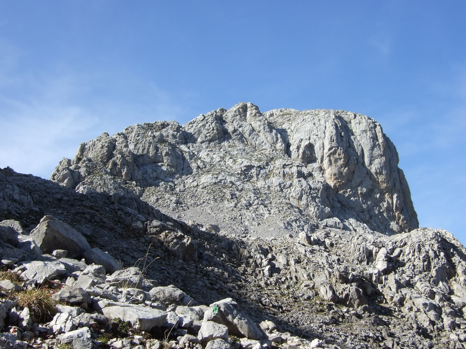
Fui hacia la izquierda para subir la parte final
I went to the left to ascend the final part

Desde la cima, Pico Levante (en el centro de la foto) parecía ser más bajo que lo que es en comparación (50 metros solamente). A la izquierda está Peña Pelada
From the summit Pico Levante (centre of photo) seemed a lot lower in comparison than it really is (50 metres). To the left is Peña Pelada


No parecía hacer buen día en la costa
Not a good day on the coast

El Mullir hacia el este
Mullir to the east

Peña Lavalle y el Mosquiteru se ven, pero una nube cubre Porracolina
To the left are Peña Lavalle and el Mosquiteru, but the top of Porracolina is covered by cloud

Al otro lado del Miera: las Enguinzas detrás de Peña Pelada
On the other side of the Miera river: Las Enguinzas behind Peña Pelada


Volví sobre mis pasos, pero acortando camino para alcanzar la carretera a la izquierda del Pico Levante. Reunión de la familia Quercus: roble y encina bordean el camino.
I walked back down, but took a short cut to get to the road to the left of Pico Levante. This oak and holm-oak growing side by side caught my eye.


En un cruce fui a la derecha y me encontré en la misma carretera que antes, debajo del Pico Levante
At a crossroads I went right and found myself on the same road as earlier that morning, beneath Pico Levante


Ya que apremiaba el tiempo decidí bajar directamente por la ladera como había subido
I went back down through the woods the same way I'd come up

Y así llegué a Rubalcaba
And so returned to Rubalcaba and the bridge over the Miera.


miércoles, 27 de septiembre de 2017

Valdominguero (2)


Uno de los caminos hechos por los mineros de otros tiempos nos lleva hacia el Pico Valdominguero
Using one of the tracks built by miners long ago we make our way to Pico Valdominguero

Es ese que se ve al fondo en el centro. En primer plano las ruinas de una caseta de las minas de Mazarrasa
It's the peak in the centre of the photo. In the foreground the ruins of a hut at the Mazarrasa mines

Detrás del Mancondíu se veía el mar y la playa de Merón, cerca de San Vicente
We came up past this mountain. Behind it the sea and the beaches near San Vicente can be seen 


Al llegar al collado de Valdominguero avistamos la canal de Fresnedal enfrente, culminando en Peña Castil (izq.), y a nuestros pies la canal de Jidiellu (derecha)
When we got to the Valdominguero pass we found ourselves right opposite the Fresnedal valley, leading up to Peña Castil (left), while at our feet is the Jidiellu valley, coming up to this point


A nuestra derecha el Pico
On our right is Pico Valdominguero

Lo rodeamos para subir hasta la cima desde el este por una grieta en la roca que se sube bien usando a la pared a la derecha como apoyo. Yo temía que en la bajada iba a pasarlo mal debido a mi acrofobia, pero felizmente no fue así
We walked round the base a little to make our way up to the top from the east via this cleft in the rock. I was a bit worried I'd suffer on the way down, but in the end it was pretty straightforward.

Mirando hacia atrás desde el mismo lugar
Looking back down from the same spot


Casi en la cima, se ve la parte recién ascendida hacia la derecha, y abajo el collado
Near the summit, you can see the part of the climb just covered to the right, with the pass down below


Ya en la cima se ve el camino que seguimos bordeando los hoyos para llegar hasta aquí. Detrás están varias cumbres del macizo oriental: el Samelar, San Carlos (se asoma un poquito), la Junciana y más cerca la Rasa, con su cima herbosa
From the summit you can make out the path we took along the side of the depressions. Behind are various mountains in this eastern massif of the Picos de Europa


Hacia el sur está la Pica del Jierru y a su derecha los Campos de Valdominguero, que visitaríamos más tarde. Detrás de éstas se alza el Pico Cortés
To the south is Pica del Jierru, and Pico Cortés behind to the right. In front of this mountain are the Campos de Valdominguero, which we would explore later


Espectacular la vista al macizo central; los picos del horizonte desde Peña Vieja a la izquierda, pasando entre otros por Santa Ana, Tiros Navarro, Horcados Rojos, y más adelante el Urriellu y Peña Castil con los Picos de Albo a la derecha de la foto.
This spectacular view is of the Central Massif.

Hacia el norte la Sierra de Cuera
To the north lies the Sierra de Cuera

Después de almorzar en el collado subimos enfrente a los Campos de Valdominguero. Así se ve el Pico recién ascendido desde allí, con Mancondíu atrás en el centro-derecha
After having something to eat at the pass we walked up to the Campos de Valdominguero opposite. From there we looked back at the Pico Valdominguero. Mancondíu is behind  (centre-right)

Mirando en dirección opuesta:
En el centro de la imagen el Escamellau, con Áliva debajo y la pista que recorre la Llomba del Toro
Meanwhile, in the opposite direction:
In the foreground is Escamellau, with Áliva at its feet


Hacia el sur: el Pico Cortés
To the south Pico Cortés

Pica del Jierru a la izq. y Morra de Lechugales atrás a la derecha
More mountains: Pica del Jierru (left) and Morra de Lechugales (behind on the right)


Otra imagen de la Pica del Jierru, donde se ve la brecha en la roca por donde se accede a la subida a la cima desde la pedrera que cae hacia el lado izquierdo
Another view of Pica del Jierru. To get to the top you walk up the scree slope towards the right, then go left up a short steep gulley that can be seen to the right of the photo, then the rest of the walk up to the summit is straightforward


Bajando al collado de Valdominguero estos dos rebecos se vieron obligados a apartarse de nuestro camino
Coming down to the pass we watched these two ibex calmly amble out of our way

Emprendimos la vuelta. El lado del Pico Valdominguero por donde subimos en diagonal
We went back the way we'd come. The side of Pico Valdominguero we walked up diagonally to the left

Ya acercándonos al Jito de Escarandi disfrutamos de una nota de color distinto: las hayas que que empiezan a cambiar de color con la bajada de temperatura otoñal
Nearing Jito de Escarandi we were treated to the first signs of autumn: the beech trees starting to change colour now the temperatures are dropping


Para más fotos y explicación del camino a Valdominguero ir a otra entrada de hace tres años:
For more photos and description of the walk to Valdominguero go to another entry from three years ago:

viernes, 15 de septiembre de 2017

Castro Valnera en famille


Perfect weather but not enough time for a long walk. Destination: Lunada Pass, the provincial limit between (South East) Cantabria and Burgos. From there a path runs to the SW, giving views of the Picones de Sopeña, as well as the road we'd driven up to get here.
Un día perfecto para andar por el monte, pero no disponíamos de mucho tiempo, así que decidí ir al Portillo de Lunada para que mis familiares ingleses hicieran una excursión clásica. Desde Lunada una senda se dirige hacia el suroeste, y en seguida tenemos vistas sobre los Picones de Sopeña.

A little to the left. Beech trees contrast with the emptiness of the rest of the hillside, which was shorn of its trees in the 18th century.
Hacia la izquierda un hayedo contrasta con el resto del monte alrededor, que estaba cubierto de árboles hasta que  empezaron a talarlos en el siglo 18

The first climb was up to Pico la Miel
La primera subida es al Pico la Miel


Castro Valnera from Pico la Miel
Desde allí vemos Castro Valnera

Porracolina and La Colina in the distance
A lo lejos Porracolina y la Colina

Descending the steep slope to the south of Pico la Miel
Descendiendo la cuesta empinada al sur de Pico la Miel

Last time I was here I approached from El Bernacho, on the Burgos side, following the track through the valley below us.
La última vez que andaba por aquí, me acerqué desde el Bernacho en el lado burgalesa, siguiendo la pista por el valle que vemos abajo.


After descending to the collado de la Pirula, we went up again to the SW. The last few yards up to the summit of Castro Valnera
Después de descender al collado de la Pirula, volvimos a subir hacia el suroeste. Aquí se ven los últimos metros para llegar a la cima de Castro Valnera.

Nephews and Sister at the summit
Sobrinos y hermana en la cima

Looking down into the valley to the west
Mirando el valle hacia el oeste

Matthew and I continued to the Alto Los Dojos, from where we looked back at Sarah and James
Matthew y yo seguimos hasta el Alto los Dojos, desde donde veíamos a Sarah y a James

The steep walk up I intend to take next time I come up here
El "kilómetro vertical", que será por donde pretendo subir la próxima vez que vengo por aquí

La Cubada Grande to the SE
Hacia el SE, La Cubada Grande

Pico La Capía with Peña del Cuervo just behind with a sheer drop to the right
Pico la Capía, con Peña del Cuervo justo detrás.

 Castro Valnera from the foot of Los Dojos
 Volviendo de Los Dojos así se ve Castro Valnera

Just as we set off on our way back a cloud appeared from the valley below and changed the temperature and visibility completely
Nada más empezar la vuelta una nube apareció del valle y se cambiaron tanto la temperatura como la visibilidad


But all bad things come to an end, and we made our way back up from the collado la Pirula. Pico la Miel just ahead along the ridge to the left.
Pero ya se había difuminado para cuando llegamos a la cresta de enfrente. Pico la Miel está a la izquierda.

Looking back, the summit of Castro Valnera can be seen behind and just to the left of the mountain ridge.
Hacia atrás, la cima de Castro Valnera se ve detrás y justo a la izquierda de la espina dorsal de la montaña.